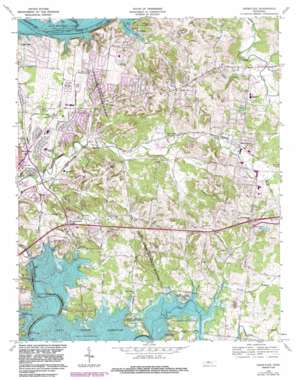
Hermitage Topo Map Tennessee
To zoom in, hover over the map of Hermitage
USGS Topo Quad 36086b5 - 1:24,000 scale
| Topo Map Name: | Hermitage |
| USGS Topo Quad ID: | 36086b5 |
| Print Size: | ca. 21 1/4" wide x 27" high |
| Southeast Coordinates: | 36.125° N latitude / 86.5° W longitude |
| Map Center Coordinates: | 36.1875° N latitude / 86.5625° W longitude |
| U.S. State: | TN |
| Filename: | o36086b5.jpg |
| Download Map JPG Image: | Hermitage topo map 1:24,000 scale |
| Map Type: | Topographic |
| Topo Series: | 7.5´ |
| Map Scale: | 1:24,000 |
| Source of Map Images: | United States Geological Survey (USGS) |
| Alternate Map Versions: |
Hermitage TN 1952, updated 1954 Download PDF Buy paper map Hermitage TN 1957, updated 1959 Download PDF Buy paper map Hermitage TN 1968, updated 1970 Download PDF Buy paper map Hermitage TN 1968, updated 1971 Download PDF Buy paper map Hermitage TN 1968, updated 1983 Download PDF Buy paper map Hermitage TN 1997, updated 2001 Download PDF Buy paper map Hermitage TN 2010 Download PDF Buy paper map Hermitage TN 2013 Download PDF Buy paper map Hermitage TN 2016 Download PDF Buy paper map |
1:24,000 Topo Quads surrounding Hermitage
> Back to 36086a1 at 1:100,000 scale
> Back to 36086a1 at 1:250,000 scale
> Back to U.S. Topo Maps home
Hermitage topo map: Gazetteer
Hermitage: Bays
Langford Cove elevation 136m 446′Hermitage: Crossings
Interchange 221 elevation 151m 495′Interchange 226 elevation 197m 646′
Williams Ford (historical) elevation 149m 488′
Hermitage: Dams
Hidden Cove Lake Dam elevation 193m 633′J Percy Priest Dam elevation 149m 488′
Hermitage: Islands
Burnt Island (historical) elevation 149m 488′Jones Island (historical) elevation 136m 446′
Hermitage: Lakes
Duncan Lake (historical) elevation 149m 488′Hermitage: Parks
Cook Public Use Area elevation 168m 551′Hermitage Lands State Wildlife Management Area elevation 171m 561′
J Percy Priest Wildlife Management Area elevation 152m 498′
Mount Juliet Little League Park elevation 143m 469′
Seven Points Public Use Area elevation 156m 511′
Shutes Branch Access Area elevation 137m 449′
Shutes Branch Recreation Area elevation 149m 488′
Suggs Creek Public Use Area elevation 154m 505′
Vivrett Creek Public Use Area elevation 155m 508′
Hermitage: Populated Places
Berryville elevation 148m 485′Caravelle elevation 153m 501′
Centralville (historical) elevation 199m 652′
Clearview elevation 192m 629′
Creekmont elevation 151m 495′
Denny Hills elevation 180m 590′
Dodoburg (historical) elevation 178m 583′
East Point elevation 160m 524′
Georgemere elevation 201m 659′
Gertrude (historical) elevation 149m 488′
Green Hill elevation 197m 646′
Greenlawn elevation 143m 469′
Harbor View elevation 163m 534′
Hermitage elevation 148m 485′
Hermitage Woods elevation 143m 469′
Highland Heights elevation 189m 620′
Hillview elevation 178m 583′
Hunters Store elevation 161m 528′
Indian Lake Farms elevation 148m 485′
Jackson Hollow elevation 152m 498′
Langford Cove elevation 147m 482′
Lankford Farms elevation 172m 564′
Lynn Christie elevation 174m 570′
Monticello elevation 153m 501′
Moreland Farms elevation 182m 597′
Mount Juliet elevation 168m 551′
Oakmont elevation 178m 583′
Pleasant Grove elevation 192m 629′
Settlers Knob elevation 172m 564′
Sherwood Forest elevation 167m 547′
Springmont elevation 180m 590′
Tate (historical) elevation 159m 521′
Travis elevation 133m 436′
Tulip Grove elevation 143m 469′
Woodlake elevation 171m 561′
Hermitage: Post Offices
Hermitage Post Office elevation 148m 485′Mount Juliet Post Office elevation 167m 547′
Hermitage: Reservoirs
Hidder Cove Lake elevation 193m 633′J Percy Priest Reservoir elevation 149m 488′
Twin Lakes elevation 169m 554′
Hermitage: Streams
Drakes Creek elevation 136m 446′Dry Fork elevation 125m 410′
North Creek elevation 149m 488′
Schutes Branch elevation 137m 449′
Schutes Branch elevation 136m 446′
Scotts Creek elevation 135m 442′
Silver Springs Branch elevation 143m 469′
Vivrett Creek elevation 149m 488′
Wright Branch elevation 153m 501′
Hermitage: Valleys
Scotts Hollow elevation 146m 479′Hermitage digital topo map on disk
Buy this Hermitage topo map showing relief, roads, GPS coordinates and other geographical features, as a high-resolution digital map file on DVD:


