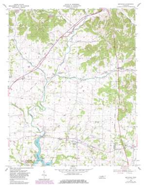
Bethpage Topo Map Tennessee
To zoom in, hover over the map of Bethpage
USGS Topo Quad 36086d3 - 1:24,000 scale
| Topo Map Name: | Bethpage |
| USGS Topo Quad ID: | 36086d3 |
| Print Size: | ca. 21 1/4" wide x 27" high |
| Southeast Coordinates: | 36.375° N latitude / 86.25° W longitude |
| Map Center Coordinates: | 36.4375° N latitude / 86.3125° W longitude |
| U.S. State: | TN |
| Filename: | o36086d3.jpg |
| Download Map JPG Image: | Bethpage topo map 1:24,000 scale |
| Map Type: | Topographic |
| Topo Series: | 7.5´ |
| Map Scale: | 1:24,000 |
| Source of Map Images: | United States Geological Survey (USGS) |
| Alternate Map Versions: |
Bethpage TN 1955, updated 1956 Download PDF Buy paper map Bethpage TN 1955, updated 1981 Download PDF Buy paper map Bethpage TN 1994, updated 1997 Download PDF Buy paper map Bethpage TN 2010 Download PDF Buy paper map Bethpage TN 2013 Download PDF Buy paper map Bethpage TN 2016 Download PDF Buy paper map |
1:24,000 Topo Quads surrounding Bethpage
> Back to 36086a1 at 1:100,000 scale
> Back to 36086a1 at 1:250,000 scale
> Back to U.S. Topo Maps home
Bethpage topo map: Gazetteer
Bethpage: Parks
Bledsoe Creek Camping State Park elevation 147m 482′Bethpage: Populated Places
Bethpage elevation 166m 544′Castalian Springs elevation 151m 495′
Chipman elevation 181m 593′
Desha elevation 168m 551′
Hartsville Junction elevation 153m 501′
Hickory Grove elevation 173m 567′
Oakland elevation 155m 508′
Old Bethpage elevation 167m 547′
Paynes Store elevation 182m 597′
Rocky Creek Subdivision elevation 163m 534′
Rogana elevation 153m 501′
Sideview (historical) elevation 178m 583′
Bethpage: Post Offices
Bethpage Post Office elevation 197m 646′Castalian Springs Post Office elevation 148m 485′
Bethpage: Streams
Bates Branch elevation 136m 446′Brush Fork elevation 161m 528′
Brushy Fork Creek elevation 161m 528′
Deshea Creek elevation 140m 459′
Dry Fork elevation 146m 479′
Dry Fork elevation 146m 479′
East Fork Bledsoe Creek elevation 148m 485′
Lick Creek elevation 136m 446′
Mutton Branch elevation 160m 524′
Pryor Branch elevation 168m 551′
Rogues Fork Creek elevation 208m 682′
Bethpage: Valleys
Campbell Hollow elevation 180m 590′Hog Hollow elevation 201m 659′
Mutton Hollow elevation 162m 531′
Bethpage digital topo map on disk
Buy this Bethpage topo map showing relief, roads, GPS coordinates and other geographical features, as a high-resolution digital map file on DVD:


