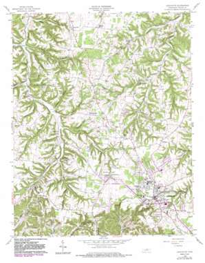
Lafayette Topo Map Tennessee
To zoom in, hover over the map of Lafayette
USGS Topo Quad 36086e1 - 1:24,000 scale
| Topo Map Name: | Lafayette |
| USGS Topo Quad ID: | 36086e1 |
| Print Size: | ca. 21 1/4" wide x 27" high |
| Southeast Coordinates: | 36.5° N latitude / 86° W longitude |
| Map Center Coordinates: | 36.5625° N latitude / 86.0625° W longitude |
| U.S. State: | TN |
| Filename: | o36086e1.jpg |
| Download Map JPG Image: | Lafayette topo map 1:24,000 scale |
| Map Type: | Topographic |
| Topo Series: | 7.5´ |
| Map Scale: | 1:24,000 |
| Source of Map Images: | United States Geological Survey (USGS) |
| Alternate Map Versions: |
Lafayette TN 1958, updated 1959 Download PDF Buy paper map Lafayette TN 1958, updated 1979 Download PDF Buy paper map Lafayette TN 1958, updated 1983 Download PDF Buy paper map Lafayette TN 2010 Download PDF Buy paper map Lafayette TN 2013 Download PDF Buy paper map Lafayette TN 2016 Download PDF Buy paper map |
1:24,000 Topo Quads surrounding Lafayette
> Back to 36086e1 at 1:100,000 scale
> Back to 36086a1 at 1:250,000 scale
> Back to U.S. Topo Maps home
Lafayette topo map: Gazetteer
Lafayette: Airports
Lafayette Municipal Airport elevation 294m 964′Lafayette: Parks
Macon County Park elevation 294m 964′Lafayette: Populated Places
Brattontown elevation 275m 902′Gap of the Ridge elevation 283m 928′
Green Valley elevation 225m 738′
Haysville elevation 258m 846′
Lafayette elevation 292m 958′
Long Creek elevation 220m 721′
Maple Grove elevation 282m 925′
Oakdale elevation 275m 902′
Pleasant Hill elevation 275m 902′
Williams elevation 289m 948′
Lafayette: Post Offices
Lafayette Post Office elevation 292m 958′Lafayette: Springs
Cold Spring elevation 243m 797′Wheeler Spring elevation 254m 833′
Lafayette: Streams
Clifty Creek elevation 211m 692′Johns Creek elevation 218m 715′
Lick Branch elevation 213m 698′
Little Puncheon Creek elevation 194m 636′
Malden Branch elevation 204m 669′
Mooningham Branch elevation 250m 820′
Spring Creek elevation 212m 695′
Stratton Branch elevation 214m 702′
West Fork Long Creek elevation 204m 669′
Lafayette: Valleys
Cold Spring Hollow elevation 211m 692′Copeland Hollow elevation 211m 692′
Dick Hollow elevation 232m 761′
Doctor Hollow elevation 221m 725′
Doss Hollow elevation 224m 734′
Fishburn Hollow elevation 228m 748′
Meetinghouse Hollow elevation 223m 731′
Negro Hollow elevation 201m 659′
Nunley Hollow elevation 207m 679′
Shoemake Hollow elevation 206m 675′
Speakman Hollow elevation 210m 688′
Sulphur Spring Hollow elevation 223m 731′
Threefork Hollow elevation 216m 708′
Wildcat Hollow elevation 209m 685′
Wiseman Hollow elevation 237m 777′
Lafayette digital topo map on disk
Buy this Lafayette topo map showing relief, roads, GPS coordinates and other geographical features, as a high-resolution digital map file on DVD:


