Turners Station Topo Map Tennessee
To zoom in, hover over the map of Turners Station
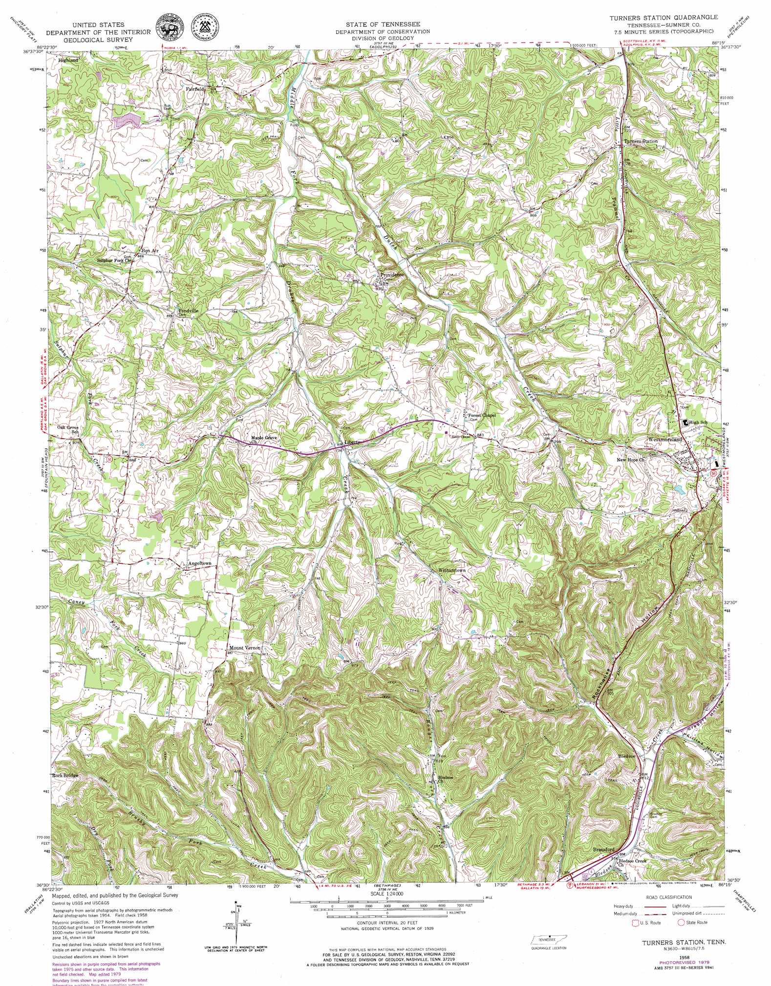
USGS Topo Quad 36086e3 - 1:24,000 scale
| Topo Map Name: | Turners Station |
| USGS Topo Quad ID: | 36086e3 |
| Print Size: | ca. 21 1/4" wide x 27" high |
| Southeast Coordinates: | 36.5° N latitude / 86.25° W longitude |
| Map Center Coordinates: | 36.5625° N latitude / 86.3125° W longitude |
| U.S. State: | TN |
| Filename: | o36086e3.jpg |
| Download Map JPG Image: | Turners Station topo map 1:24,000 scale |
| Map Type: | Topographic |
| Topo Series: | 7.5´ |
| Map Scale: | 1:24,000 |
| Source of Map Images: | United States Geological Survey (USGS) |
| Alternate Map Versions: |
Turners Station TN 1958, updated 1959 Download PDF Buy paper map Turners Station TN 2010 Download PDF Buy paper map Turners Station TN 2013 Download PDF Buy paper map Turners Station TN 2016 Download PDF Buy paper map |
1:24,000 Topo Quads surrounding Turners Station
Woodburn |
Drake |
Allen Springs |
Scottsville |
Austin |
Franklin |
Hickory Flat |
Adolphus |
Petroleum |
Holland |
Portland |
Fountain Head |
Turners Station |
Westmoreland |
Lafayette |
Cottontown |
Gallatin |
Bethpage |
Hartsville |
Hillsdale |
Hendersonville |
Laguardo |
Hunters Point |
Bellwood |
Dixon Springs |
> Back to 36086e1 at 1:100,000 scale
> Back to 36086a1 at 1:250,000 scale
> Back to U.S. Topo Maps home
Turners Station topo map: Gazetteer
Turners Station: Dams
Meadowbrook Game Farm Dam elevation 233m 764′Pine Lake Dam elevation 257m 843′
Turners Station: Populated Places
Angeltown elevation 273m 895′Bledsoe elevation 183m 600′
Bon Air elevation 263m 862′
Bransford elevation 174m 570′
Fairfield elevation 247m 810′
Highland elevation 250m 820′
Liberty elevation 221m 725′
Mount Vernon elevation 292m 958′
Pondville elevation 272m 892′
Providence elevation 250m 820′
Turners Station elevation 217m 711′
Withamtown elevation 250m 820′
Turners Station: Reservoirs
Meadowbrook Game Farm Lake elevation 233m 764′Pine Lake elevation 257m 843′
Turners Station: Streams
Dutch Creek elevation 201m 659′Otter Fork elevation 170m 557′
Turners Station: Valleys
Duffer Hollow elevation 177m 580′Gregory Hollow elevation 182m 597′
Keen Hollow elevation 209m 685′
Phillips Hollow elevation 180m 590′
Rockhouse Hollow elevation 187m 613′
Turners Station digital topo map on disk
Buy this Turners Station topo map showing relief, roads, GPS coordinates and other geographical features, as a high-resolution digital map file on DVD: