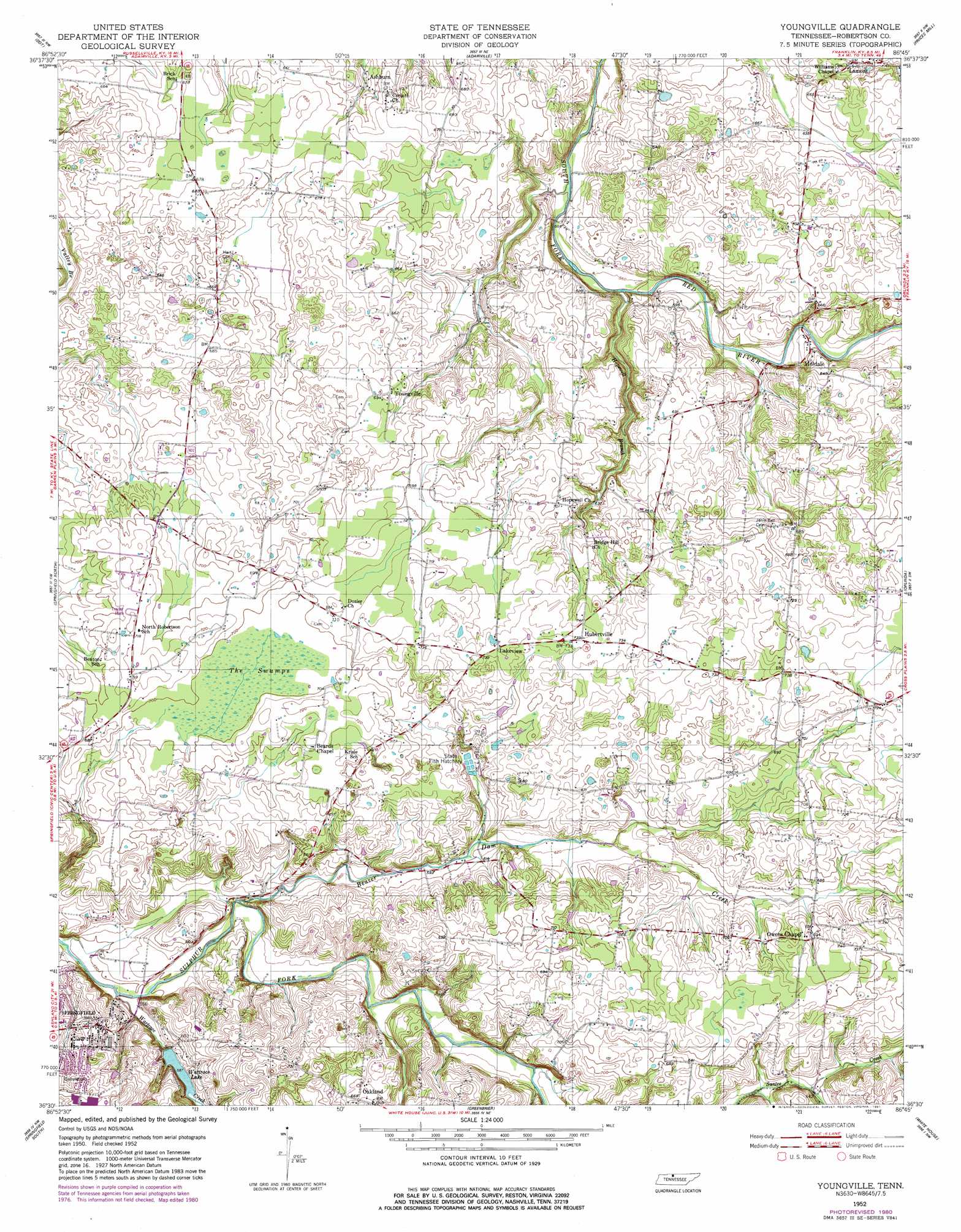
Youngville Topo Map Tennessee
To zoom in, hover over the map of Youngville
USGS Topo Quad 36086e7 - 1:24,000 scale
| Topo Map Name: | Youngville |
| USGS Topo Quad ID: | 36086e7 |
| Print Size: | ca. 21 1/4" wide x 27" high |
| Southeast Coordinates: | 36.5° N latitude / 86.75° W longitude |
| Map Center Coordinates: | 36.5625° N latitude / 86.8125° W longitude |
| U.S. State: | TN |
| Filename: | o36086e7.jpg |
| Download Map JPG Image: | Youngville topo map 1:24,000 scale |
| Map Type: | Topographic |
| Topo Series: | 7.5´ |
| Map Scale: | 1:24,000 |
| Source of Map Images: | United States Geological Survey (USGS) |
| Alternate Map Versions: |
Youngville TN 1952, updated 1953 Download PDF Buy paper map Youngville TN 1952, updated 1981 Download PDF Buy paper map Youngville TN 2010 Download PDF Buy paper map Youngville TN 2013 Download PDF Buy paper map Youngville TN 2016 Download PDF Buy paper map |
1:24,000 Topo Quads surrounding Youngville
Olmstead |
Russellville |
Dennis |
Auburn |
Woodburn |
Allensville |
Dot |
Adairville |
Prices Mill |
Franklin |
Adams |
Springfield North |
Youngville |
Orlinda |
Portland |
Pleasant View |
Springfield South |
Greenbrier |
White House |
Cottontown |
Ashland City |
Forest Grove |
Whites Creek |
Goodlettsville |
Hendersonville |
> Back to 36086e1 at 1:100,000 scale
> Back to 36086a1 at 1:250,000 scale
> Back to U.S. Topo Maps home
Youngville topo map: Gazetteer
Youngville: Airports
Reid Farm Airport elevation 220m 721′Youngville: Dams
Wartrace Lake Dam elevation 176m 577′Youngville: Lakes
Wartrace Lake elevation 176m 577′Youngville: Populated Places
Ashburn elevation 194m 636′Bobwhite (historical) elevation 213m 698′
Green Valley elevation 213m 698′
Hubertville elevation 224m 734′
Lakeview elevation 225m 738′
Lamont elevation 206m 675′
Milldale elevation 184m 603′
Oakland elevation 204m 669′
Youngville elevation 211m 692′
Youngville: Reservoirs
Wartrace Lake elevation 176m 577′Youngville: Streams
Beaver Dam Creek elevation 167m 547′Hopewell Branch elevation 167m 547′
Wartrace Creek elevation 164m 538′
Youngville: Swamps
The Swamps elevation 211m 692′Youngville digital topo map on disk
Buy this Youngville topo map showing relief, roads, GPS coordinates and other geographical features, as a high-resolution digital map file on DVD: