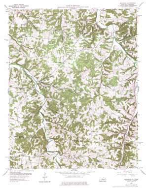
Adolphus Topo Map Kentucky
To zoom in, hover over the map of Adolphus
USGS Topo Quad 36086f3 - 1:24,000 scale
| Topo Map Name: | Adolphus |
| USGS Topo Quad ID: | 36086f3 |
| Print Size: | ca. 21 1/4" wide x 27" high |
| Southeast Coordinates: | 36.625° N latitude / 86.25° W longitude |
| Map Center Coordinates: | 36.6875° N latitude / 86.3125° W longitude |
| U.S. States: | KY, TN |
| Filename: | o36086f3.jpg |
| Download Map JPG Image: | Adolphus topo map 1:24,000 scale |
| Map Type: | Topographic |
| Topo Series: | 7.5´ |
| Map Scale: | 1:24,000 |
| Source of Map Images: | United States Geological Survey (USGS) |
| Alternate Map Versions: |
Adolphus KY 1954, updated 1956 Download PDF Buy paper map Adolphus KY 1954, updated 1976 Download PDF Buy paper map Adolphus KY 2010 Download PDF Buy paper map Adolphus KY 2013 Download PDF Buy paper map Adolphus KY 2016 Download PDF Buy paper map |
1:24,000 Topo Quads surrounding Adolphus
> Back to 36086e1 at 1:100,000 scale
> Back to 36086a1 at 1:250,000 scale
> Back to U.S. Topo Maps home
Adolphus topo map: Gazetteer
Adolphus: Populated Places
Adolphus elevation 195m 639′Alonzo elevation 181m 593′
Chapel Hill elevation 226m 741′
Fleet elevation 255m 836′
Nubia elevation 259m 849′
Red Hill elevation 216m 708′
Sugar Grove elevation 212m 695′
Adolphus: Streams
Buck Creek elevation 173m 567′Dutch Branch elevation 183m 600′
Hinton Branch elevation 200m 656′
Ramble Creek elevation 177m 580′
Rock Quarry Branch elevation 200m 656′
Snyder Branch elevation 191m 626′
Wolf Branch elevation 199m 652′
Adolphus: Valleys
Long Hollow elevation 176m 577′Adolphus digital topo map on disk
Buy this Adolphus topo map showing relief, roads, GPS coordinates and other geographical features, as a high-resolution digital map file on DVD:


