Prices Mill Topo Map Kentucky
To zoom in, hover over the map of Prices Mill
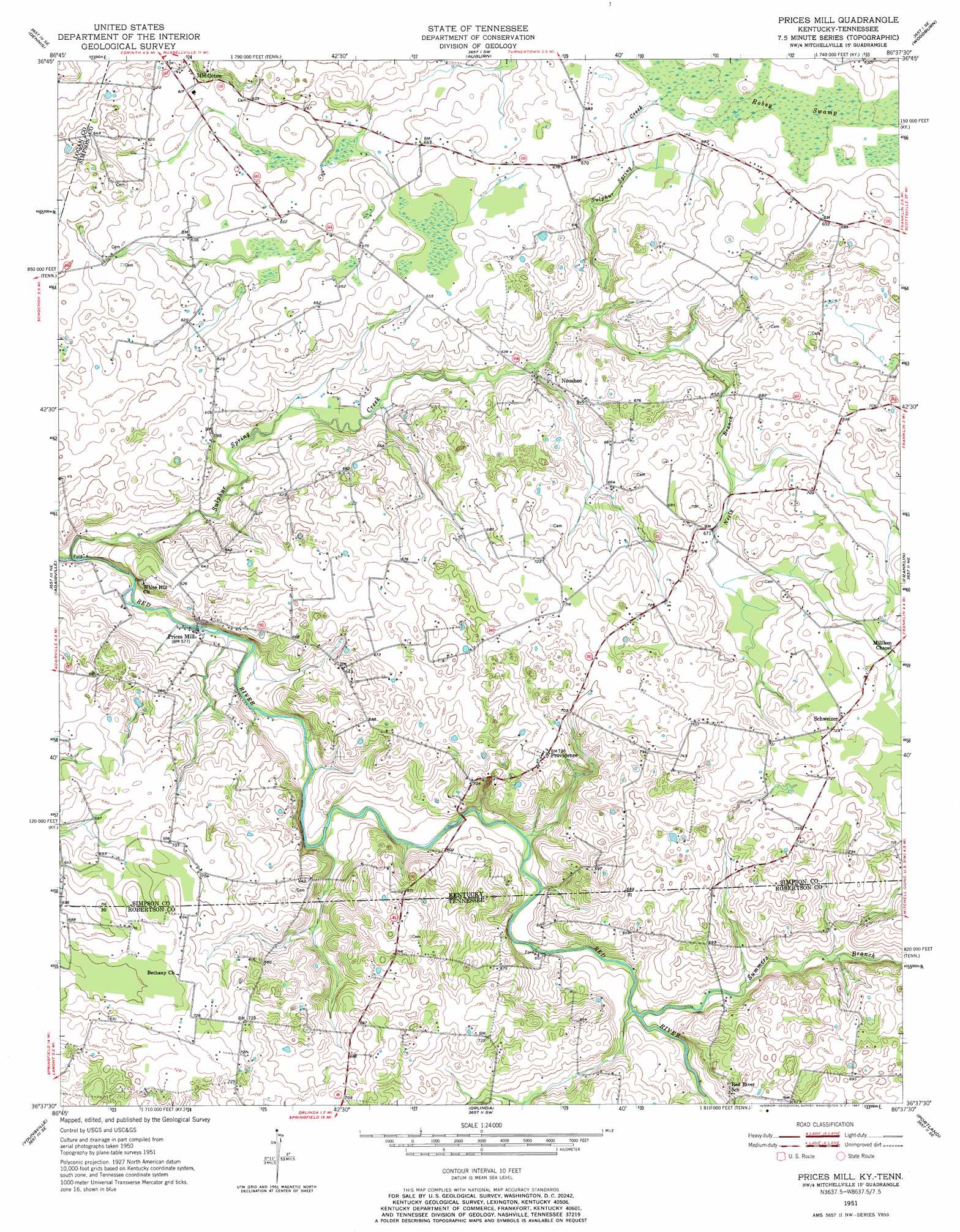
USGS Topo Quad 36086f6 - 1:24,000 scale
| Topo Map Name: | Prices Mill |
| USGS Topo Quad ID: | 36086f6 |
| Print Size: | ca. 21 1/4" wide x 27" high |
| Southeast Coordinates: | 36.625° N latitude / 86.625° W longitude |
| Map Center Coordinates: | 36.6875° N latitude / 86.6875° W longitude |
| U.S. States: | KY, TN |
| Filename: | o36086f6.jpg |
| Download Map JPG Image: | Prices Mill topo map 1:24,000 scale |
| Map Type: | Topographic |
| Topo Series: | 7.5´ |
| Map Scale: | 1:24,000 |
| Source of Map Images: | United States Geological Survey (USGS) |
| Alternate Map Versions: |
Prices Mill KY 1951, updated 1952 Download PDF Buy paper map Prices Mill KY 1951, updated 1967 Download PDF Buy paper map Prices Mill KY 2010 Download PDF Buy paper map Prices Mill KY 2013 Download PDF Buy paper map Prices Mill KY 2016 Download PDF Buy paper map |
1:24,000 Topo Quads surrounding Prices Mill
Lewisburg |
Homer |
South Union |
Rockfield |
Bowling Green South |
Russellville |
Dennis |
Auburn |
Woodburn |
Drake |
Dot |
Adairville |
Prices Mill |
Franklin |
Hickory Flat |
Springfield North |
Youngville |
Orlinda |
Portland |
Fountain Head |
Springfield South |
Greenbrier |
White House |
Cottontown |
Gallatin |
> Back to 36086e1 at 1:100,000 scale
> Back to 36086a1 at 1:250,000 scale
> Back to U.S. Topo Maps home
Prices Mill topo map: Gazetteer
Prices Mill: Airports
Welcome Field elevation 211m 692′Prices Mill: Populated Places
Neosheo elevation 187m 613′Prices Mill elevation 175m 574′
Providence elevation 224m 734′
Schweizer elevation 223m 731′
Prices Mill: Streams
Neely Branch elevation 184m 603′Sulphur Spring Creek elevation 167m 547′
Summers Branch elevation 181m 593′
Prices Mill: Swamps
Robey Swamp elevation 205m 672′Prices Mill digital topo map on disk
Buy this Prices Mill topo map showing relief, roads, GPS coordinates and other geographical features, as a high-resolution digital map file on DVD: