Russellville Topo Map Kentucky
To zoom in, hover over the map of Russellville
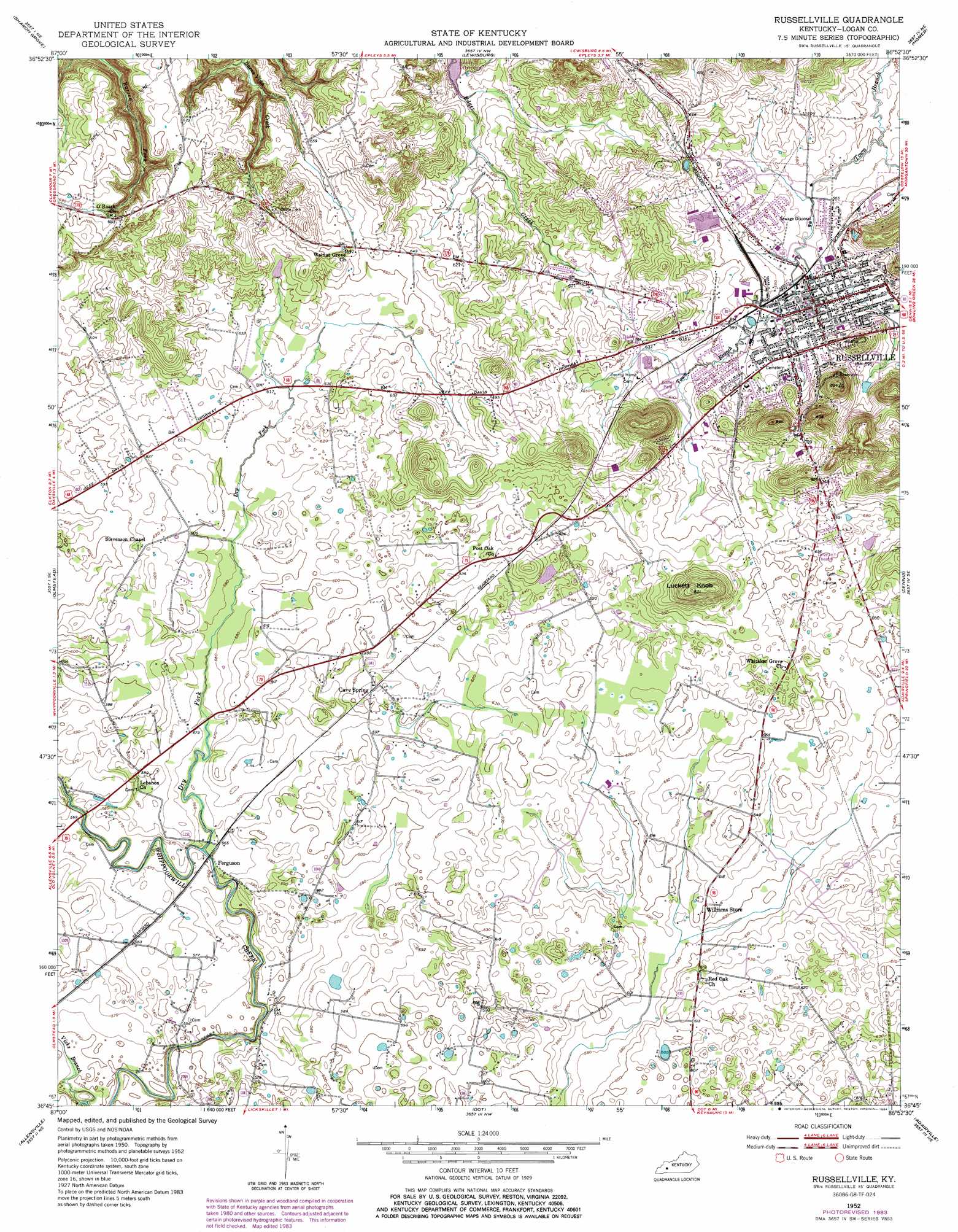
USGS Topo Quad 36086g8 - 1:24,000 scale
| Topo Map Name: | Russellville |
| USGS Topo Quad ID: | 36086g8 |
| Print Size: | ca. 21 1/4" wide x 27" high |
| Southeast Coordinates: | 36.75° N latitude / 86.875° W longitude |
| Map Center Coordinates: | 36.8125° N latitude / 86.9375° W longitude |
| U.S. State: | KY |
| Filename: | o36086g8.jpg |
| Download Map JPG Image: | Russellville topo map 1:24,000 scale |
| Map Type: | Topographic |
| Topo Series: | 7.5´ |
| Map Scale: | 1:24,000 |
| Source of Map Images: | United States Geological Survey (USGS) |
| Alternate Map Versions: |
Russellville KY 1952, updated 1953 Download PDF Buy paper map Russellville KY 1952, updated 1974 Download PDF Buy paper map Russellville KY 1952, updated 1984 Download PDF Buy paper map Russellville KY 2010 Download PDF Buy paper map Russellville KY 2013 Download PDF Buy paper map Russellville KY 2016 Download PDF Buy paper map |
1:24,000 Topo Quads surrounding Russellville
Kirkmansville |
Rosewood |
Dunmor |
Quality |
Sugar Grove |
Allegre |
Sharon Grove |
Lewisburg |
Homer |
South Union |
Elkton |
Olmstead |
Russellville |
Dennis |
Auburn |
Guthrie |
Allensville |
Dot |
Adairville |
Prices Mill |
Sango |
Adams |
Springfield North |
Youngville |
Orlinda |
> Back to 36086e1 at 1:100,000 scale
> Back to 36086a1 at 1:250,000 scale
> Back to U.S. Topo Maps home
Russellville topo map: Gazetteer
Russellville: Populated Places
Cave Springs elevation 187m 613′Ferguson elevation 168m 551′
Russellville elevation 181m 593′
Russellville: Streams
Dry Fork elevation 167m 547′Vicks Branch elevation 162m 531′
Russellville: Summits
Luckett Knob elevation 250m 820′Russellville digital topo map on disk
Buy this Russellville topo map showing relief, roads, GPS coordinates and other geographical features, as a high-resolution digital map file on DVD: