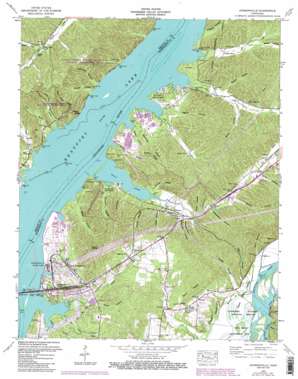
Johnsonville Topo Map Tennessee
To zoom in, hover over the map of Johnsonville
USGS Topo Quad 36087a8 - 1:24,000 scale
| Topo Map Name: | Johnsonville |
| USGS Topo Quad ID: | 36087a8 |
| Print Size: | ca. 21 1/4" wide x 27" high |
| Southeast Coordinates: | 36° N latitude / 87.875° W longitude |
| Map Center Coordinates: | 36.0625° N latitude / 87.9375° W longitude |
| U.S. State: | TN |
| Filename: | o36087a8.jpg |
| Download Map JPG Image: | Johnsonville topo map 1:24,000 scale |
| Map Type: | Topographic |
| Topo Series: | 7.5´ |
| Map Scale: | 1:24,000 |
| Source of Map Images: | United States Geological Survey (USGS) |
| Alternate Map Versions: |
Johnsonville TN 1936 Download PDF Buy paper map Johnsonville TN 1950, updated 1952 Download PDF Buy paper map Johnsonville TN 1950, updated 1970 Download PDF Buy paper map Johnsonville TN 1950, updated 1988 Download PDF Buy paper map Johnsonville TN 1950, updated 1988 Download PDF Buy paper map Johnsonville TN 2010 Download PDF Buy paper map Johnsonville TN 2013 Download PDF Buy paper map Johnsonville TN 2016 Download PDF Buy paper map |
1:24,000 Topo Quads surrounding Johnsonville
> Back to 36087a1 at 1:100,000 scale
> Back to 36086a1 at 1:250,000 scale
> Back to U.S. Topo Maps home
Johnsonville topo map: Gazetteer
Johnsonville: Areas
Flat Woods elevation 148m 485′Johnsonville: Bridges
Hickman-Lockhart Bridge elevation 116m 380′Johnsonville: Cliffs
Hurricane Bluff elevation 118m 387′Johnsonville: Crossings
Brevards Ferry (historical) elevation 109m 357′Johnsonville: Guts
Threemile Slough (historical) elevation 109m 357′Johnsonville: Islands
Plant Island (historical) elevation 109m 357′Reynoldsburg Island (historical) elevation 109m 357′
Johnsonville: Lakes
Clark Lake (historical) elevation 109m 357′Johnsonville: Parks
C L Edwards Memorial Park elevation 118m 387′Nathan Bedford Forrest State Historic Area elevation 173m 567′
Nathan Bedford Forrest State Park elevation 137m 449′
New Johnsonville State Historic Area elevation 147m 482′
Johnsonville: Populated Places
Cherry Grove elevation 144m 472′Denver elevation 119m 390′
Dry Creek Subdivision elevation 117m 383′
Johnsonville elevation 110m 360′
New Johnsonville elevation 133m 436′
Plant elevation 129m 423′
Pursley elevation 130m 426′
Reynoldsburg (historical) elevation 121m 396′
Johnsonville: Post Offices
Denver Post Office elevation 115m 377′Johnsonville: Reservoirs
Melton Pond elevation 143m 469′Johnsonville: Ridges
Nubbin Ridge elevation 171m 561′Pilot Knob Ridge elevation 175m 574′
Johnsonville: Springs
Crystal Spring elevation 116m 380′Hurricane Rock Spring elevation 110m 360′
Johnsonville: Streams
Bear Creek elevation 109m 357′Beech Creek elevation 109m 357′
Cypress Creek elevation 109m 357′
Dry Creek elevation 109m 357′
Fowlkes Branch elevation 109m 357′
Happy Hollow Branch elevation 109m 357′
Indian Creek elevation 109m 357′
Lick Branch elevation 109m 357′
Little Dry Creek elevation 109m 357′
Little Indian Creek elevation 109m 357′
Middle Fork Harmon Creek elevation 140m 459′
Oilwell Branch elevation 109m 357′
Polk Branch elevation 109m 357′
Primm Branch elevation 109m 357′
Stribling Branch elevation 110m 360′
Trace Creek elevation 109m 357′
Johnsonville: Summits
Pilot Knob elevation 200m 656′Seven Points elevation 193m 633′
Johnsonville: Valleys
Andy Hollow elevation 119m 390′Barn Hollow elevation 109m 357′
Batson Hollow elevation 120m 393′
Bone Hollow elevation 122m 400′
Boneyard Hollow elevation 123m 403′
Box Hollow elevation 115m 377′
Brake Hollow elevation 128m 419′
Brushy Hollow elevation 126m 413′
Chester Hollow elevation 110m 360′
Goodwin Hollow elevation 110m 360′
Gould Hollow elevation 111m 364′
Graveyard Hollow elevation 121m 396′
Hallmark Hollow elevation 113m 370′
Harris Hollow elevation 122m 400′
Leach Hollow elevation 109m 357′
McFall Hollow elevation 110m 360′
Meredith Hollow elevation 110m 360′
Nichols Hollow elevation 111m 364′
Pickett Hollow elevation 116m 380′
Plant Hollow elevation 119m 390′
Racetrack Hollow elevation 115m 377′
Sayre Hollow elevation 114m 374′
Sheepskin Hollow elevation 122m 400′
Spain Hollow elevation 116m 380′
Stave Hollow elevation 114m 374′
Storey Hollow elevation 127m 416′
Water Hollow elevation 117m 383′
Johnsonville digital topo map on disk
Buy this Johnsonville topo map showing relief, roads, GPS coordinates and other geographical features, as a high-resolution digital map file on DVD:


