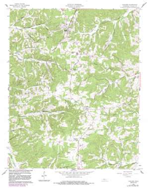
Vanleer Topo Map Tennessee
To zoom in, hover over the map of Vanleer
USGS Topo Quad 36087b4 - 1:24,000 scale
| Topo Map Name: | Vanleer |
| USGS Topo Quad ID: | 36087b4 |
| Print Size: | ca. 21 1/4" wide x 27" high |
| Southeast Coordinates: | 36.125° N latitude / 87.375° W longitude |
| Map Center Coordinates: | 36.1875° N latitude / 87.4375° W longitude |
| U.S. State: | TN |
| Filename: | o36087b4.jpg |
| Download Map JPG Image: | Vanleer topo map 1:24,000 scale |
| Map Type: | Topographic |
| Topo Series: | 7.5´ |
| Map Scale: | 1:24,000 |
| Source of Map Images: | United States Geological Survey (USGS) |
| Alternate Map Versions: |
Vanleer TN 1958, updated 1959 Download PDF Buy paper map Vanleer TN 1958, updated 1981 Download PDF Buy paper map Vanleer TN 1958, updated 1983 Download PDF Buy paper map Vanleer TN 2010 Download PDF Buy paper map Vanleer TN 2013 Download PDF Buy paper map Vanleer TN 2016 Download PDF Buy paper map |
1:24,000 Topo Quads surrounding Vanleer
> Back to 36087a1 at 1:100,000 scale
> Back to 36086a1 at 1:250,000 scale
> Back to U.S. Topo Maps home
Vanleer topo map: Gazetteer
Vanleer: Airports
Dickson Municipal Airport elevation 262m 859′Vanleer: Lakes
Stewarts Lake elevation 229m 751′Vanleer: Mines
Bell Mine elevation 230m 754′Hortense Mines elevation 268m 879′
Vanleer: Populated Places
Antioch (historical) elevation 245m 803′Bell Hollow (historical) elevation 186m 610′
Berry elevation 246m 807′
Fleetvile (historical) elevation 254m 833′
Hortense elevation 266m 872′
Sylvia elevation 264m 866′
Taylor Crossroads elevation 255m 836′
Vanleer elevation 257m 843′
Woodhaven (historical) elevation 259m 849′
Vanleer: Streams
Bell Branch elevation 176m 577′Dry Branch elevation 201m 659′
Jenkins Creek elevation 186m 610′
Martin Branch elevation 203m 666′
Rocky Branch elevation 188m 616′
Vanleer: Valleys
Browns Hollow elevation 182m 597′Logans Hollow elevation 202m 662′
Vanleer digital topo map on disk
Buy this Vanleer topo map showing relief, roads, GPS coordinates and other geographical features, as a high-resolution digital map file on DVD:


