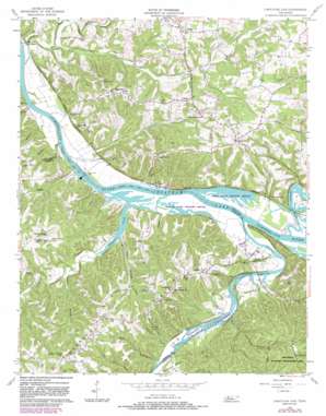
Cheatham Dam Topo Map Tennessee
To zoom in, hover over the map of Cheatham Dam
USGS Topo Quad 36087c2 - 1:24,000 scale
| Topo Map Name: | Cheatham Dam |
| USGS Topo Quad ID: | 36087c2 |
| Print Size: | ca. 21 1/4" wide x 27" high |
| Southeast Coordinates: | 36.25° N latitude / 87.125° W longitude |
| Map Center Coordinates: | 36.3125° N latitude / 87.1875° W longitude |
| U.S. State: | TN |
| Filename: | o36087c2.jpg |
| Download Map JPG Image: | Cheatham Dam topo map 1:24,000 scale |
| Map Type: | Topographic |
| Topo Series: | 7.5´ |
| Map Scale: | 1:24,000 |
| Source of Map Images: | United States Geological Survey (USGS) |
| Alternate Map Versions: |
Cheatham Dam TN 1957, updated 1958 Download PDF Buy paper map Cheatham Dam TN 1957, updated 1973 Download PDF Buy paper map Cheatham Dam TN 1957, updated 1983 Download PDF Buy paper map Cheatham Dam TN 2010 Download PDF Buy paper map Cheatham Dam TN 2013 Download PDF Buy paper map Cheatham Dam TN 2016 Download PDF Buy paper map |
1:24,000 Topo Quads surrounding Cheatham Dam
> Back to 36087a1 at 1:100,000 scale
> Back to 36086a1 at 1:250,000 scale
> Back to U.S. Topo Maps home
Cheatham Dam topo map: Gazetteer
Cheatham Dam: Bars
Harpeth Shoals elevation 117m 383′Reids Reef elevation 117m 383′
Cheatham Dam: Bridges
Montgomery Bell Bridge elevation 117m 383′Cheatham Dam: Crossings
Harpeth Ferry (historical) elevation 117m 383′Indian Ford (historical) elevation 117m 383′
Cheatham Dam: Dams
Cheatham Dam elevation 109m 357′Lock A (historical) elevation 117m 383′
Cheatham Dam: Islands
Pack Island elevation 118m 387′Cheatham Dam: Parks
Cheatham Damsite Access Area elevation 117m 383′Cheatham Damsite Tailwater Access Point elevation 109m 357′
Dyson Ditch Wildlife Refuge elevation 117m 383′
Harpeth River Bridge Access Point elevation 119m 390′
Lock A Recreation Area elevation 121m 396′
Mayberry Branch Access Park elevation 110m 360′
Pardue Pond Wildlife Refuge elevation 118m 387′
Cheatham Dam: Populated Places
Beech Grove elevation 203m 666′Bellsburg elevation 216m 708′
Bethel elevation 183m 600′
Betsystown (historical) elevation 126m 413′
Chapmansboro elevation 122m 400′
Cheap Hill elevation 222m 728′
Doddsville elevation 123m 403′
Dozier elevation 130m 426′
Fox Bluff elevation 123m 403′
Hinton Crossing elevation 124m 406′
Jackson Chapel elevation 224m 734′
Neptune elevation 187m 613′
Pardue (historical) elevation 121m 396′
Cheatham Dam: Post Offices
Chapmansboro Post Office elevation 193m 633′Cheatham Dam: Reservoirs
Cheatham Lake elevation 109m 357′Cheatham Dam: Ridges
Harpeth Ridge elevation 218m 715′Cheatham Dam: Streams
Bear Branch elevation 117m 383′Big Bethany Creek elevation 117m 383′
Buck Branch elevation 117m 383′
Cave Spring Branch elevation 113m 370′
Dry Fork Creek elevation 113m 370′
Fall Creek elevation 110m 360′
Half Pone Creek elevation 110m 360′
Hands Branch elevation 110m 360′
Harpeth River elevation 117m 383′
Jackie Branch elevation 118m 387′
Johnson Branch elevation 118m 387′
Johnson Creek elevation 117m 383′
Jones Branch elevation 110m 360′
Little Bethany Creek elevation 120m 393′
Locust Branch elevation 122m 400′
Mayberry Branch elevation 110m 360′
Sycamore Creek elevation 117m 383′
Cheatham Dam: Valleys
Doe Hollow elevation 121m 396′Cheatham Dam digital topo map on disk
Buy this Cheatham Dam topo map showing relief, roads, GPS coordinates and other geographical features, as a high-resolution digital map file on DVD:


