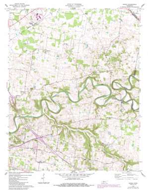
Sango Topo Map Tennessee
To zoom in, hover over the map of Sango
USGS Topo Quad 36087e2 - 1:24,000 scale
| Topo Map Name: | Sango |
| USGS Topo Quad ID: | 36087e2 |
| Print Size: | ca. 21 1/4" wide x 27" high |
| Southeast Coordinates: | 36.5° N latitude / 87.125° W longitude |
| Map Center Coordinates: | 36.5625° N latitude / 87.1875° W longitude |
| U.S. State: | TN |
| Filename: | o36087e2.jpg |
| Download Map JPG Image: | Sango topo map 1:24,000 scale |
| Map Type: | Topographic |
| Topo Series: | 7.5´ |
| Map Scale: | 1:24,000 |
| Source of Map Images: | United States Geological Survey (USGS) |
| Alternate Map Versions: |
Sango TN 1957, updated 1958 Download PDF Buy paper map Sango TN 1957, updated 1958 Download PDF Buy paper map Sango TN 1957, updated 1977 Download PDF Buy paper map Sango TN 1957, updated 1984 Download PDF Buy paper map Sango TN 1957, updated 1984 Download PDF Buy paper map Sango TN 2010 Download PDF Buy paper map Sango TN 2013 Download PDF Buy paper map Sango TN 2016 Download PDF Buy paper map |
1:24,000 Topo Quads surrounding Sango
> Back to 36087e1 at 1:100,000 scale
> Back to 36086a1 at 1:250,000 scale
> Back to U.S. Topo Maps home
Sango topo map: Gazetteer
Sango: Crossings
Interchange 11 elevation 169m 554′Interchange 8 elevation 183m 600′
Sango: Parks
Port Royal State Park elevation 122m 400′Sango: Populated Places
Countryside Estates elevation 168m 551′Hampton Station elevation 163m 534′
Kirkwood elevation 171m 561′
Paula Heights elevation 156m 511′
Port Royal elevation 129m 423′
Red River Estates elevation 160m 524′
Rossview elevation 168m 551′
Royalty Acres elevation 171m 561′
Sango elevation 196m 643′
Windermere elevation 156m 511′
Sango: Streams
Coon Creek elevation 127m 416′Passenger Creek elevation 111m 364′
Sulphur Fork Red River elevation 116m 380′
Sango digital topo map on disk
Buy this Sango topo map showing relief, roads, GPS coordinates and other geographical features, as a high-resolution digital map file on DVD:


