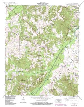
Manleyville Topo Map Tennessee
To zoom in, hover over the map of Manleyville
USGS Topo Quad 36088b2 - 1:24,000 scale
| Topo Map Name: | Manleyville |
| USGS Topo Quad ID: | 36088b2 |
| Print Size: | ca. 21 1/4" wide x 27" high |
| Southeast Coordinates: | 36.125° N latitude / 88.125° W longitude |
| Map Center Coordinates: | 36.1875° N latitude / 88.1875° W longitude |
| U.S. State: | TN |
| Filename: | o36088b2.jpg |
| Download Map JPG Image: | Manleyville topo map 1:24,000 scale |
| Map Type: | Topographic |
| Topo Series: | 7.5´ |
| Map Scale: | 1:24,000 |
| Source of Map Images: | United States Geological Survey (USGS) |
| Alternate Map Versions: |
Manleyville TN 1936 Download PDF Buy paper map Manleyville TN 1940 Download PDF Buy paper map Manleyville TN 1941 Download PDF Buy paper map Manleyville TN 1965, updated 1967 Download PDF Buy paper map Manleyville TN 1965, updated 1987 Download PDF Buy paper map Manleyville TN 2010 Download PDF Buy paper map Manleyville TN 2013 Download PDF Buy paper map Manleyville TN 2016 Download PDF Buy paper map |
1:24,000 Topo Quads surrounding Manleyville
> Back to 36088a1 at 1:100,000 scale
> Back to 36088a1 at 1:250,000 scale
> Back to U.S. Topo Maps home
Manleyville topo map: Gazetteer
Manleyville: Guts
Gum Slough elevation 109m 357′Swift Slough elevation 111m 364′
Manleyville: Populated Places
Bain elevation 122m 400′Halls elevation 134m 439′
Manleyville elevation 148m 485′
Pleasant Hill elevation 129m 423′
Pleasant Hill elevation 141m 462′
Spring Creek elevation 131m 429′
Springville elevation 147m 482′
Manleyville: Streams
Bear Creek elevation 110m 360′Buck Branch elevation 116m 380′
Camp Branch elevation 115m 377′
Chapel Branch elevation 110m 360′
Cherry Branch elevation 111m 364′
Clifty Creek elevation 110m 360′
Collins Branch elevation 112m 367′
Collins Branch elevation 119m 390′
Comer Branch elevation 110m 360′
Crossnoe Slough elevation 110m 360′
Dry Creek elevation 113m 370′
Gin Creek elevation 110m 360′
Greenbrier Branch elevation 110m 360′
Lockhart Branch elevation 116m 380′
Marberry Branch elevation 113m 370′
McDavid Branch elevation 115m 377′
Raccoon Branch elevation 110m 360′
Ramble Creek elevation 109m 357′
Rushing Creek elevation 109m 357′
Snake Branch elevation 112m 367′
Woodson Branch elevation 113m 370′
Manleyville: Swamps
Beaverdam Lake elevation 127m 416′Manleyville digital topo map on disk
Buy this Manleyville topo map showing relief, roads, GPS coordinates and other geographical features, as a high-resolution digital map file on DVD:


