Pillowville Topo Map Tennessee
To zoom in, hover over the map of Pillowville
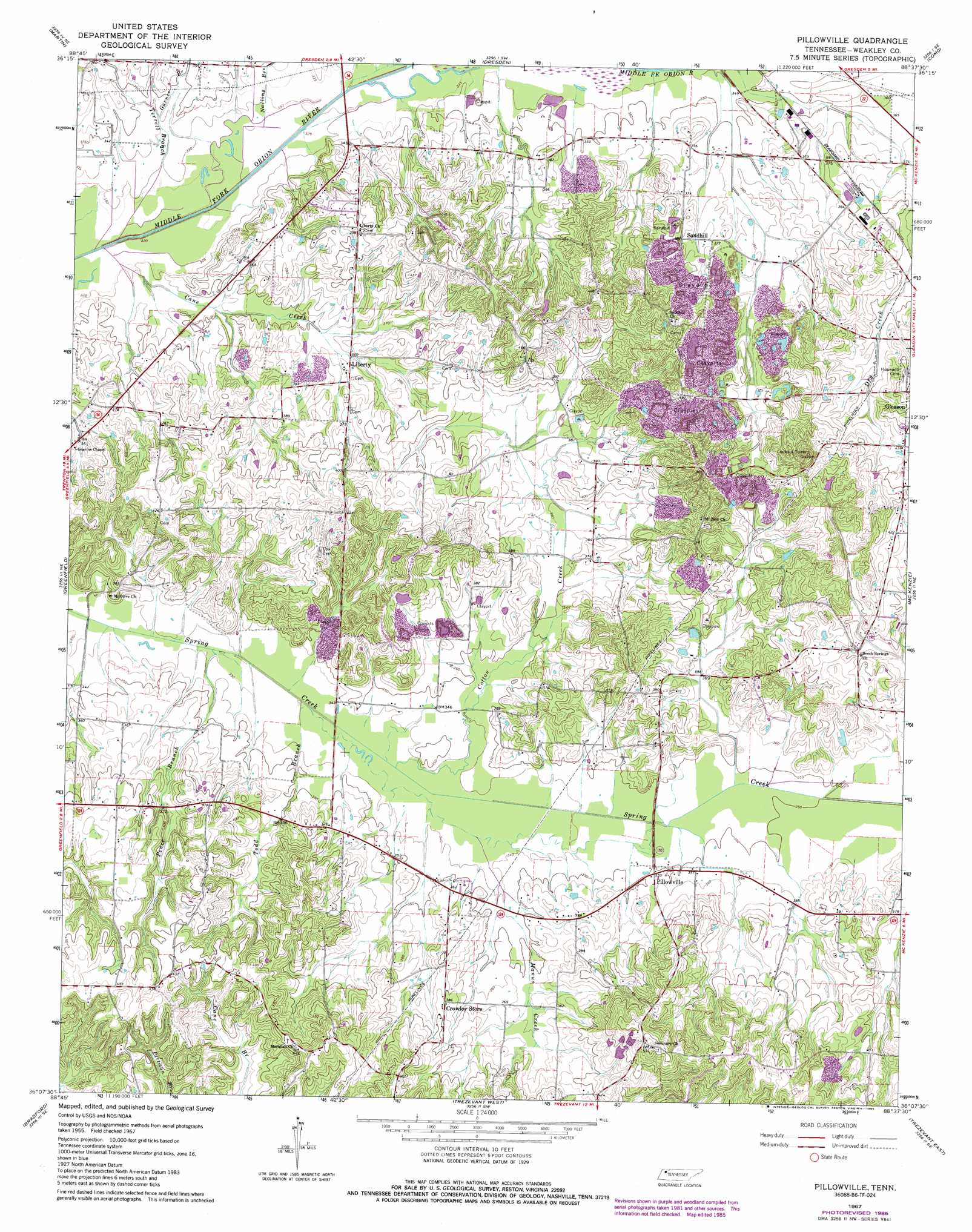
USGS Topo Quad 36088b6 - 1:24,000 scale
| Topo Map Name: | Pillowville |
| USGS Topo Quad ID: | 36088b6 |
| Print Size: | ca. 21 1/4" wide x 27" high |
| Southeast Coordinates: | 36.125° N latitude / 88.625° W longitude |
| Map Center Coordinates: | 36.1875° N latitude / 88.6875° W longitude |
| U.S. State: | TN |
| Filename: | o36088b6.jpg |
| Download Map JPG Image: | Pillowville topo map 1:24,000 scale |
| Map Type: | Topographic |
| Topo Series: | 7.5´ |
| Map Scale: | 1:24,000 |
| Source of Map Images: | United States Geological Survey (USGS) |
| Alternate Map Versions: |
Pillowville TN 1967, updated 1968 Download PDF Buy paper map Pillowville TN 1967, updated 1981 Download PDF Buy paper map Pillowville TN 1967, updated 1985 Download PDF Buy paper map Pillowville TN 2010 Download PDF Buy paper map Pillowville TN 2013 Download PDF Buy paper map Pillowville TN 2016 Download PDF Buy paper map |
1:24,000 Topo Quads surrounding Pillowville
Harris |
Mcconnell |
Latham |
Palmersville |
Cottage Grove |
Gardner |
Martin |
Dresden |
Como |
Osage |
Rutherford |
Greenfield |
Pillowville |
Mckenzie |
Henry |
Dyer |
Bradford |
Trezevant West |
Trezevant East |
Huntingdon |
Trenton |
Milan |
Atwood |
Mclemoresville |
Palmer Shelter |
> Back to 36088a1 at 1:100,000 scale
> Back to 36088a1 at 1:250,000 scale
> Back to U.S. Topo Maps home
Pillowville topo map: Gazetteer
Pillowville: Populated Places
Crowley Store elevation 119m 390′Liberty elevation 113m 370′
Pillowville elevation 107m 351′
Sandhill elevation 117m 383′
Pillowville: Streams
Cane Creek elevation 99m 324′Cotton Creek elevation 101m 331′
Garner Branch elevation 104m 341′
Manus Creek elevation 103m 337′
Nailing Branch elevation 98m 321′
Pence Branch elevation 101m 331′
Todd Branch elevation 101m 331′
Pillowville digital topo map on disk
Buy this Pillowville topo map showing relief, roads, GPS coordinates and other geographical features, as a high-resolution digital map file on DVD: