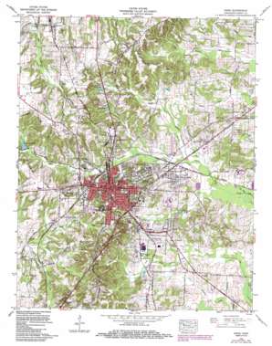
Paris Topo Map Tennessee
To zoom in, hover over the map of Paris
USGS Topo Quad 36088c3 - 1:24,000 scale
| Topo Map Name: | Paris |
| USGS Topo Quad ID: | 36088c3 |
| Print Size: | ca. 21 1/4" wide x 27" high |
| Southeast Coordinates: | 36.25° N latitude / 88.25° W longitude |
| Map Center Coordinates: | 36.3125° N latitude / 88.3125° W longitude |
| U.S. State: | TN |
| Filename: | o36088c3.jpg |
| Download Map JPG Image: | Paris topo map 1:24,000 scale |
| Map Type: | Topographic |
| Topo Series: | 7.5´ |
| Map Scale: | 1:24,000 |
| Source of Map Images: | United States Geological Survey (USGS) |
| Alternate Map Versions: |
Paris TN 1936 Download PDF Buy paper map Paris TN 1950 Download PDF Buy paper map Paris TN 1965, updated 1967 Download PDF Buy paper map Paris TN 1965, updated 1986 Download PDF Buy paper map Paris TN 2010 Download PDF Buy paper map Paris TN 2013 Download PDF Buy paper map Paris TN 2016 Download PDF Buy paper map |
1:24,000 Topo Quads surrounding Paris
> Back to 36088a1 at 1:100,000 scale
> Back to 36088a1 at 1:250,000 scale
> Back to U.S. Topo Maps home
Paris topo map: Gazetteer
Paris: Airports
Henry County Hospital Airport elevation 156m 511′Paris: Dams
Smith Lake Dam elevation 144m 472′Taylor Lake Dam elevation 128m 419′
Paris: Parks
Barton Field elevation 165m 541′Johnson Park elevation 129m 423′
Ogburn Park elevation 154m 505′
Paris: Populated Places
Chickasaw Heights elevation 131m 429′Hancock elevation 145m 475′
Hilltop elevation 180m 590′
India elevation 130m 426′
Meadow Mead elevation 125m 410′
Paris elevation 157m 515′
Porter Court elevation 152m 498′
Whitlock elevation 162m 531′
Woodland Acres elevation 124m 406′
Paris: Post Offices
Paris Post Office elevation 158m 518′Paris: Reservoirs
Green Acres Lake elevation 134m 439′Jones Bend Lake elevation 142m 465′
Smith Lake elevation 146m 479′
Smith Lake elevation 144m 472′
Taylor Lake elevation 128m 419′
Paris: Streams
Hawley Branch elevation 121m 396′Hill Creek elevation 130m 426′
Jones Bend Creek elevation 125m 410′
Lawrence Creek elevation 130m 426′
McFadden Branch elevation 126m 413′
McGowan Branch elevation 118m 387′
Smallwood Branch elevation 117m 383′
Threemile Branch elevation 128m 419′
Town Creek elevation 118m 387′
Twomile Branch elevation 126m 413′
Paris digital topo map on disk
Buy this Paris topo map showing relief, roads, GPS coordinates and other geographical features, as a high-resolution digital map file on DVD:


