Gardner Topo Map Tennessee
To zoom in, hover over the map of Gardner
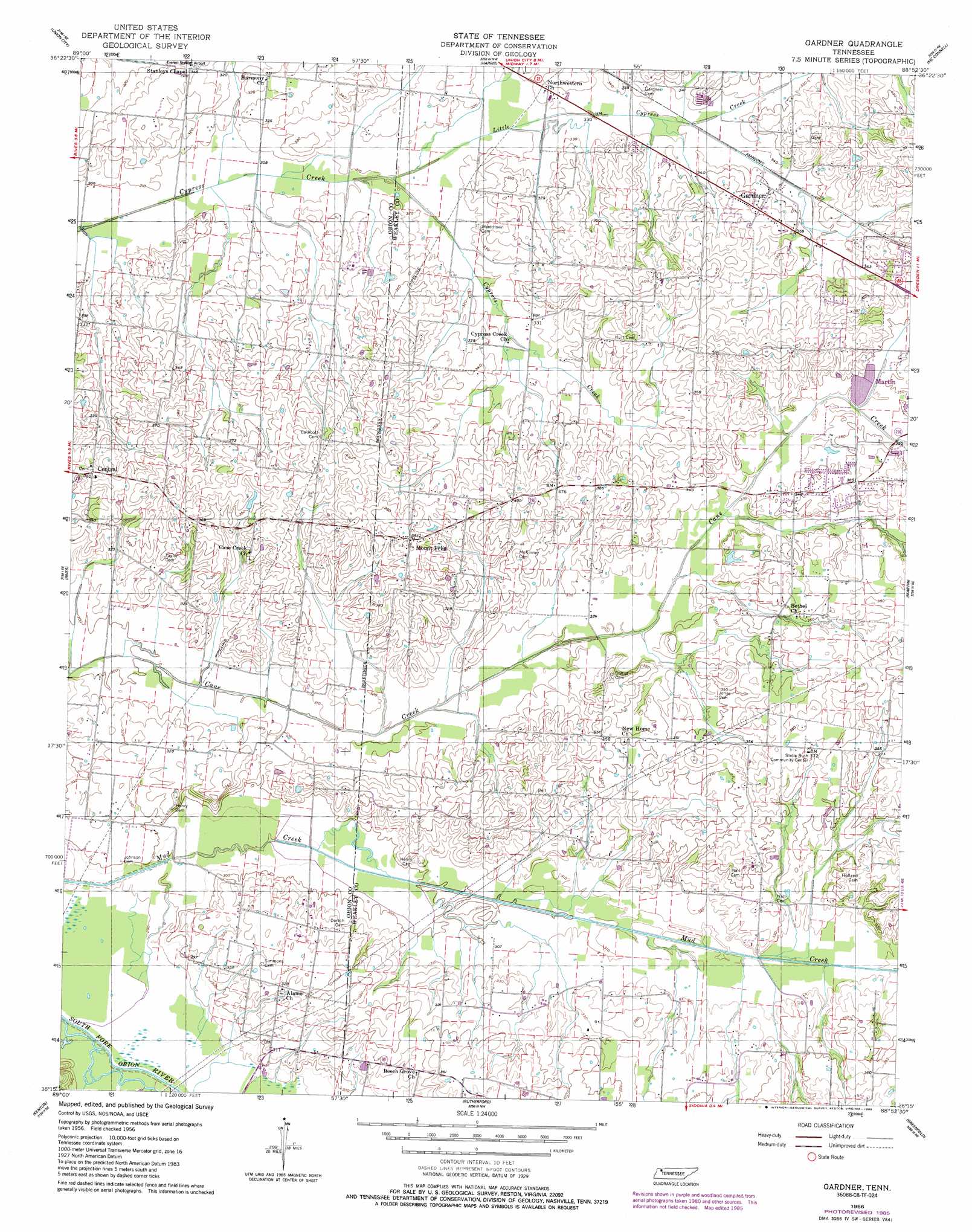
USGS Topo Quad 36088c8 - 1:24,000 scale
| Topo Map Name: | Gardner |
| USGS Topo Quad ID: | 36088c8 |
| Print Size: | ca. 21 1/4" wide x 27" high |
| Southeast Coordinates: | 36.25° N latitude / 88.875° W longitude |
| Map Center Coordinates: | 36.3125° N latitude / 88.9375° W longitude |
| U.S. State: | TN |
| Filename: | o36088c8.jpg |
| Download Map JPG Image: | Gardner topo map 1:24,000 scale |
| Map Type: | Topographic |
| Topo Series: | 7.5´ |
| Map Scale: | 1:24,000 |
| Source of Map Images: | United States Geological Survey (USGS) |
| Alternate Map Versions: |
Gardner TN 1956 Download PDF Buy paper map Gardner TN 1956, updated 1958 Download PDF Buy paper map Gardner TN 1956, updated 1985 Download PDF Buy paper map Gardner TN 2010 Download PDF Buy paper map Gardner TN 2013 Download PDF Buy paper map Gardner TN 2016 Download PDF Buy paper map |
1:24,000 Topo Quads surrounding Gardner
Hickman |
Cayce |
Crutchfield |
Water Valley |
Cuba |
Clayton |
Union City |
Harris |
Mcconnell |
Latham |
Obion |
Rives |
Gardner |
Martin |
Dresden |
Trimble |
Kenton |
Rutherford |
Greenfield |
Pillowville |
Tatumville |
Yorkville |
Dyer |
Bradford |
Trezevant West |
> Back to 36088a1 at 1:100,000 scale
> Back to 36088a1 at 1:250,000 scale
> Back to U.S. Topo Maps home
Gardner topo map: Gazetteer
Gardner: Flats
Cypress Creek Bottom elevation 96m 314′Gardner: Populated Places
Gardner elevation 111m 364′Mount Pelia elevation 118m 387′
Gardner: Reservoirs
OFDBA Little Cypress Creek Lake Number elevation 108m 354′Gardner digital topo map on disk
Buy this Gardner topo map showing relief, roads, GPS coordinates and other geographical features, as a high-resolution digital map file on DVD: