Buchanan Topo Map Tennessee
To zoom in, hover over the map of Buchanan
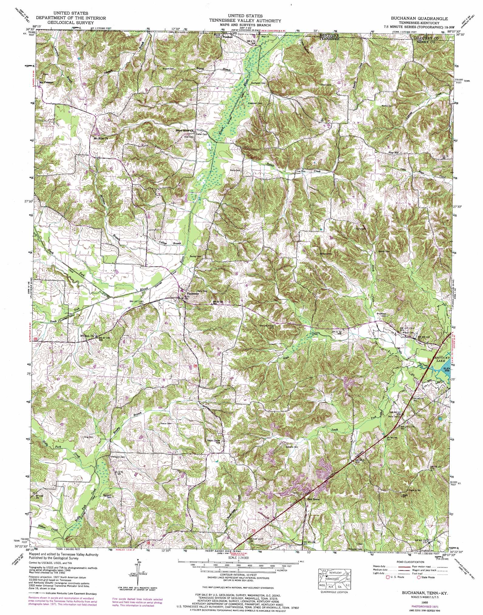
USGS Topo Quad 36088d2 - 1:24,000 scale
| Topo Map Name: | Buchanan |
| USGS Topo Quad ID: | 36088d2 |
| Print Size: | ca. 21 1/4" wide x 27" high |
| Southeast Coordinates: | 36.375° N latitude / 88.125° W longitude |
| Map Center Coordinates: | 36.4375° N latitude / 88.1875° W longitude |
| U.S. States: | TN, KY |
| Filename: | o36088d2.jpg |
| Download Map JPG Image: | Buchanan topo map 1:24,000 scale |
| Map Type: | Topographic |
| Topo Series: | 7.5´ |
| Map Scale: | 1:24,000 |
| Source of Map Images: | United States Geological Survey (USGS) |
| Alternate Map Versions: |
Buchanan TN 1936 Download PDF Buy paper map Buchanan TN 1950, updated 1953 Download PDF Buy paper map Buchanan TN 1950, updated 1972 Download PDF Buy paper map Buchanan TN 2010 Download PDF Buy paper map Buchanan TN 2013 Download PDF Buy paper map Buchanan TN 2016 Download PDF Buy paper map |
1:24,000 Topo Quads surrounding Buchanan
Kirksey |
Dexter |
Hico |
Rushing Creek |
Linton |
Lynn Grove |
Murray |
New Concord |
Hamlin |
Tharpe |
Cottage Grove |
Puryear |
Buchanan |
Paris Landing |
Standing Rock |
Osage |
Paris |
West Sandy Dike |
Poplar Creek |
Mckinnon |
Henry |
Mansfield |
Manleyville |
Big Sandy |
Harmon Creek |
> Back to 36088a1 at 1:100,000 scale
> Back to 36088a1 at 1:250,000 scale
> Back to U.S. Topo Maps home
Buchanan topo map: Gazetteer
Buchanan: Canals
Blood River Drainage Ditch elevation 125m 410′North Fork Blood River Drainage Ditch elevation 131m 429′
South Fork Blood River Drainage Ditch elevation 131m 429′
Buchanan: Populated Places
Buchanan elevation 135m 442′Freeland elevation 140m 459′
Mount Pleasant elevation 172m 564′
Mount Vista (historical) elevation 140m 459′
Oak Grove elevation 158m 518′
Pine Hill elevation 173m 567′
Buchanan: Post Offices
Buchanan Post Office elevation 146m 479′Buchanan: Streams
Brushy Branch elevation 119m 390′Bryant Branch elevation 120m 393′
Clayton Branch elevation 123m 403′
Cullage Branch elevation 126m 413′
Dale Branch elevation 123m 403′
Ferguson Branch elevation 120m 393′
McGehee Branch elevation 126m 413′
Merrill Branch elevation 125m 410′
Nelson Creek elevation 116m 380′
North Fork Blood River elevation 127m 416′
North Fork Eagle Creek elevation 113m 370′
Rabbit Creek elevation 123m 403′
Rocky Branch elevation 130m 426′
South Fork Blood River elevation 128m 419′
South Fork Eagle Creek elevation 110m 360′
Buchanan: Summits
Owens Hill elevation 169m 554′Buchanan: Valleys
Clayton Hollow elevation 131m 429′Crass Hollow elevation 122m 400′
Morgan Hollow elevation 137m 449′
Buchanan digital topo map on disk
Buy this Buchanan topo map showing relief, roads, GPS coordinates and other geographical features, as a high-resolution digital map file on DVD: