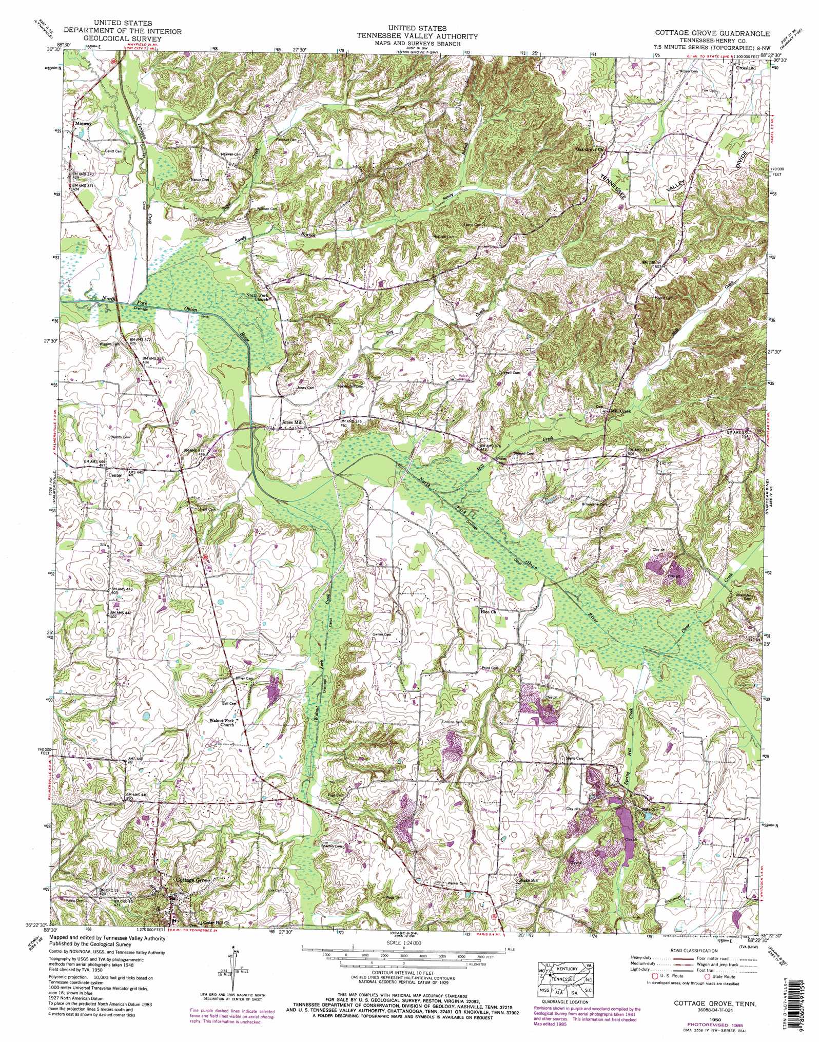
Cottage Grove Topo Map Tennessee
To zoom in, hover over the map of Cottage Grove
USGS Topo Quad 36088d4 - 1:24,000 scale
| Topo Map Name: | Cottage Grove |
| USGS Topo Quad ID: | 36088d4 |
| Print Size: | ca. 21 1/4" wide x 27" high |
| Southeast Coordinates: | 36.375° N latitude / 88.375° W longitude |
| Map Center Coordinates: | 36.4375° N latitude / 88.4375° W longitude |
| U.S. State: | TN |
| Filename: | o36088d4.jpg |
| Download Map JPG Image: | Cottage Grove topo map 1:24,000 scale |
| Map Type: | Topographic |
| Topo Series: | 7.5´ |
| Map Scale: | 1:24,000 |
| Source of Map Images: | United States Geological Survey (USGS) |
| Alternate Map Versions: |
Crossland TN 1936 Download PDF Buy paper map Cottage Grove TN 1950, updated 1954 Download PDF Buy paper map Cottage Grove TN 1950, updated 1972 Download PDF Buy paper map Cottage Grove TN 1950, updated 1985 Download PDF Buy paper map Cottage Grove TN 2010 Download PDF Buy paper map Cottage Grove TN 2013 Download PDF Buy paper map Cottage Grove TN 2016 Download PDF Buy paper map |
1:24,000 Topo Quads surrounding Cottage Grove
Mayfield |
Farmington |
Kirksey |
Dexter |
Hico |
Cuba |
Lynnville |
Lynn Grove |
Murray |
New Concord |
Latham |
Palmersville |
Cottage Grove |
Puryear |
Buchanan |
Dresden |
Como |
Osage |
Paris |
West Sandy Dike |
Pillowville |
Mckenzie |
Henry |
Mansfield |
Manleyville |
> Back to 36088a1 at 1:100,000 scale
> Back to 36088a1 at 1:250,000 scale
> Back to U.S. Topo Maps home
Cottage Grove topo map: Gazetteer
Cottage Grove: Populated Places
Cottage Grove elevation 175m 574′Jones Mill elevation 129m 423′
Midway elevation 134m 439′
Mill Creek elevation 150m 492′
Cottage Grove: Streams
Clear Creek elevation 131m 429′Dry Creek elevation 121m 396′
Mill Creek elevation 156m 511′
Sandy Branch elevation 120m 393′
Spring Hill Creek elevation 130m 426′
Sugar Creek elevation 120m 393′
Terrapin Creek elevation 119m 390′
Walnut Fork Creek elevation 122m 400′
Cottage Grove digital topo map on disk
Buy this Cottage Grove topo map showing relief, roads, GPS coordinates and other geographical features, as a high-resolution digital map file on DVD: