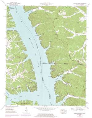
Rushing Creek Topo Map Kentucky
To zoom in, hover over the map of Rushing Creek
USGS Topo Quad 36088f1 - 1:24,000 scale
| Topo Map Name: | Rushing Creek |
| USGS Topo Quad ID: | 36088f1 |
| Print Size: | ca. 21 1/4" wide x 27" high |
| Southeast Coordinates: | 36.625° N latitude / 88° W longitude |
| Map Center Coordinates: | 36.6875° N latitude / 88.0625° W longitude |
| U.S. States: | KY, TN |
| Filename: | o36088f1.jpg |
| Download Map JPG Image: | Rushing Creek topo map 1:24,000 scale |
| Map Type: | Topographic |
| Topo Series: | 7.5´ |
| Map Scale: | 1:24,000 |
| Source of Map Images: | United States Geological Survey (USGS) |
| Alternate Map Versions: |
Rushing TN 1936 Download PDF Buy paper map Rushing Creek TN 1950, updated 1953 Download PDF Buy paper map Rushing Creek TN 1950, updated 1965 Download PDF Buy paper map Rushing Creek TN 1950, updated 1972 Download PDF Buy paper map Rushing Creek TN 1950, updated 1977 Download PDF Buy paper map Rushing Creek TN 1950, updated 1983 Download PDF Buy paper map Rushing Bay TN 2011 Download PDF Buy paper map Rushing Bay TN 2013 Download PDF Buy paper map Rushing Bay TN 2016 Download PDF Buy paper map |
| FStopo: | US Forest Service topo Rushing Bay is available: Download FStopo PDF Download FStopo TIF |
1:24,000 Topo Quads surrounding Rushing Creek
> Back to 36088e1 at 1:100,000 scale
> Back to 36088a1 at 1:250,000 scale
> Back to U.S. Topo Maps home
Rushing Creek topo map: Gazetteer
Rushing Creek: Bars
Blood River Bar elevation 107m 351′Rushing Creek: Bays
Ginger Bay elevation 107m 351′Rushing Bay elevation 107m 351′
Turkey Bay elevation 107m 351′
Rushing Creek: Cliffs
Cedar Bluff elevation 112m 367′Rushing Creek: Lakes
Vinson Pond (historical) elevation 107m 351′Rushing Creek: Populated Places
Boatwright elevation 115m 377′Rushing (historical) elevation 109m 357′
Rushing Creek: Ridges
Kirk Ridge elevation 155m 508′Sheep Ridge elevation 119m 390′
Rushing Creek: Springs
Arlt Spring elevation 138m 452′Cedar Springs elevation 112m 367′
Rushing Creek: Streams
Anderson Creek elevation 107m 351′Blockhouse Creek elevation 107m 351′
Blood River elevation 107m 351′
Blood River elevation 107m 351′
Boatyard Creek elevation 107m 351′
Colson Creek elevation 107m 351′
Ginger Creek elevation 108m 354′
Jones Creek elevation 107m 351′
Lick Branch elevation 107m 351′
Middle Rushing Creek elevation 107m 351′
North Fork Turkey Creek elevation 114m 374′
North Rushing Creek elevation 107m 351′
Rushing Creek (historical) elevation 107m 351′
Snipe Creek elevation 107m 351′
South Rushing Creek elevation 107m 351′
Sugar Creek elevation 107m 351′
Turkey Creek elevation 108m 354′
Rushing Creek: Valleys
Hicks Hollow elevation 113m 370′Hooper Hollow elevation 107m 351′
Mays Hollow elevation 109m 357′
Redd Hollow elevation 112m 367′
Wienger Hollow elevation 141m 462′
Rushing Creek digital topo map on disk
Buy this Rushing Creek topo map showing relief, roads, GPS coordinates and other geographical features, as a high-resolution digital map file on DVD:


