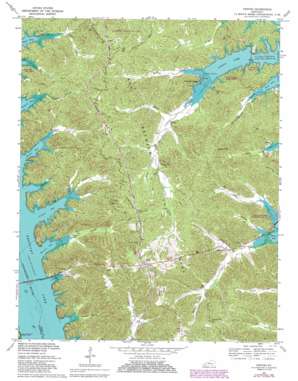
Fenton Topo Map Kentucky
To zoom in, hover over the map of Fenton
USGS Topo Quad 36088g1 - 1:24,000 scale
| Topo Map Name: | Fenton |
| USGS Topo Quad ID: | 36088g1 |
| Print Size: | ca. 21 1/4" wide x 27" high |
| Southeast Coordinates: | 36.75° N latitude / 88° W longitude |
| Map Center Coordinates: | 36.8125° N latitude / 88.0625° W longitude |
| U.S. State: | KY |
| Filename: | o36088g1.jpg |
| Download Map JPG Image: | Fenton topo map 1:24,000 scale |
| Map Type: | Topographic |
| Topo Series: | 7.5´ |
| Map Scale: | 1:24,000 |
| Source of Map Images: | United States Geological Survey (USGS) |
| Alternate Map Versions: |
Fenton KY 1936 Download PDF Buy paper map Fenton KY 1950, updated 1953 Download PDF Buy paper map Fenton KY 1967, updated 1968 Download PDF Buy paper map Fenton KY 1967, updated 1979 Download PDF Buy paper map Fenton KY 1967, updated 1987 Download PDF Buy paper map Fenton KY 2010 Download PDF Buy paper map Fenton KY 2013 Download PDF Buy paper map Fenton KY 2016 Download PDF Buy paper map |
| FStopo: | US Forest Service topo Fenton is available: Download FStopo PDF Download FStopo TIF |
1:24,000 Topo Quads surrounding Fenton
> Back to 36088e1 at 1:100,000 scale
> Back to 36088a1 at 1:250,000 scale
> Back to U.S. Topo Maps home
Fenton topo map: Gazetteer
Fenton: Bays
Barnett Bay elevation 107m 351′Crooked Creek Bay elevation 107m 351′
Rhodes Bay elevation 107m 351′
Vickers Bay elevation 107m 351′
Fenton: Bridges
Eggner Ferry Bridge elevation 107m 351′Fenton: Lakes
Energy Lake elevation 107m 351′Golden Pond elevation 194m 636′
Fenton: Parks
Kentucky Woodlands National Wildlife Refuge elevation 137m 449′Land Between the Lakes elevation 156m 511′
Fenton: Populated Places
Fenton elevation 120m 393′Ferguson Spring elevation 121m 396′
Golden Pond elevation 124m 406′
Fenton: Reservoirs
Kentucky Lake elevation 107m 351′Fenton: Streams
Barnett Creek elevation 107m 351′Crooked Creek elevation 107m 351′
Elbow Creek elevation 108m 354′
Franklin Creek elevation 116m 380′
Grace Creek elevation 124m 406′
Higgins Branch elevation 112m 367′
Little Creek elevation 107m 351′
Long Creek elevation 110m 360′
North Fork Sugar Creek elevation 107m 351′
Rhodes Creek elevation 107m 351′
Savells Branch elevation 109m 357′
Shaw Branch elevation 109m 357′
South Fork Sugar Creek elevation 107m 351′
Vickers Creek elevation 107m 351′
Fenton: Summits
Bald Knob elevation 167m 547′Gordon Hill elevation 185m 606′
Fenton: Trails
Scout Trail elevation 120m 393′Fenton: Valleys
Boardinghouse Hollow elevation 111m 364′Gordon Hollow elevation 139m 456′
Oakley Hollow elevation 112m 367′
Turner Hollow elevation 107m 351′
Fenton digital topo map on disk
Buy this Fenton topo map showing relief, roads, GPS coordinates and other geographical features, as a high-resolution digital map file on DVD:


