Mont Topo Map Kentucky
To zoom in, hover over the map of Mont
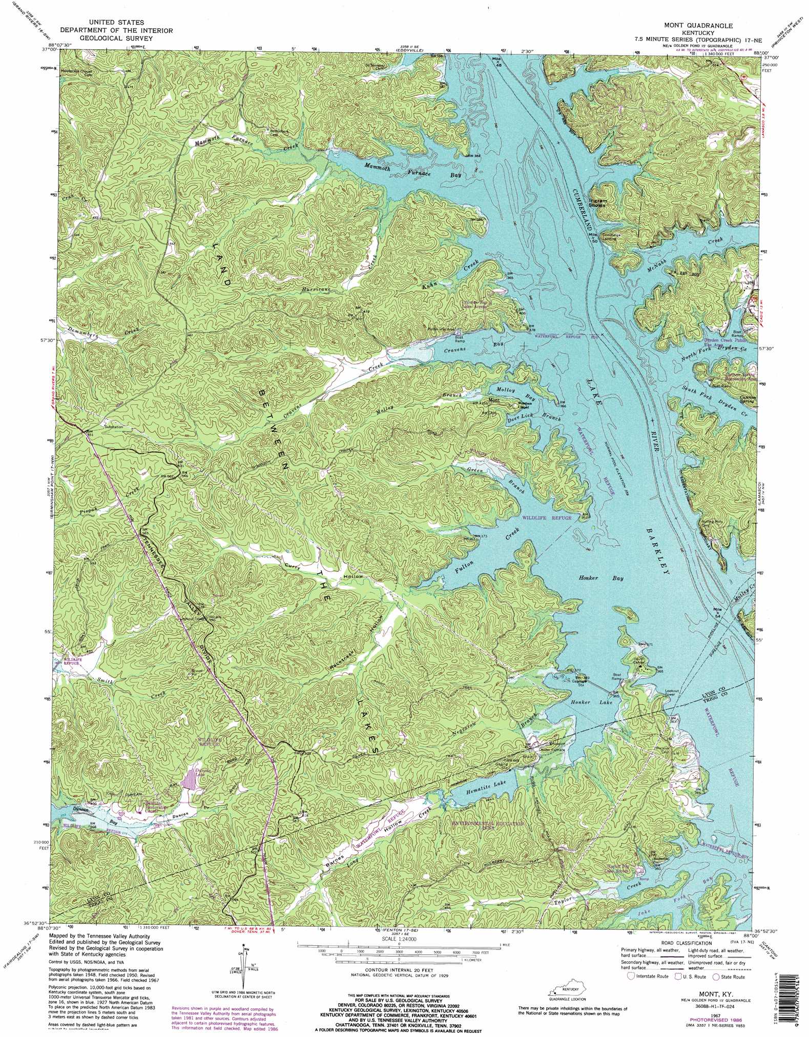
USGS Topo Quad 36088h1 - 1:24,000 scale
| Topo Map Name: | Mont |
| USGS Topo Quad ID: | 36088h1 |
| Print Size: | ca. 21 1/4" wide x 27" high |
| Southeast Coordinates: | 36.875° N latitude / 88° W longitude |
| Map Center Coordinates: | 36.9375° N latitude / 88.0625° W longitude |
| U.S. State: | KY |
| Filename: | o36088h1.jpg |
| Download Map JPG Image: | Mont topo map 1:24,000 scale |
| Map Type: | Topographic |
| Topo Series: | 7.5´ |
| Map Scale: | 1:24,000 |
| Source of Map Images: | United States Geological Survey (USGS) |
| Alternate Map Versions: |
Mont KY 1936 Download PDF Buy paper map Mont KY 1950, updated 1953 Download PDF Buy paper map Mont KY 1950, updated 1954 Download PDF Buy paper map Mont KY 1967, updated 1970 Download PDF Buy paper map Mont KY 1967, updated 1987 Download PDF Buy paper map Mont KY 2010 Download PDF Buy paper map Mont KY 2013 Download PDF Buy paper map Mont KY 2016 Download PDF Buy paper map |
| FStopo: | US Forest Service topo Mont is available: Download FStopo PDF Download FStopo TIF |
1:24,000 Topo Quads surrounding Mont
Burna |
Dycusburg |
Fredonia |
Crider |
Olney |
Calvert City |
Grand Rivers |
Eddyville |
Princeton West |
Princeton East |
Briensburg |
Birmingham Point |
Mont |
Lamasco |
Cobb |
Hardin |
Fairdealing |
Fenton |
Canton |
Cadiz |
Dexter |
Hico |
Rushing Creek |
Linton |
Johnson Hollow |
> Back to 36088e1 at 1:100,000 scale
> Back to 36088a1 at 1:250,000 scale
> Back to U.S. Topo Maps home
Mont topo map: Gazetteer
Mont: Bars
Ingram Shoals elevation 107m 351′Mont: Bays
Cravens Bay elevation 107m 351′Fulton Creek elevation 107m 351′
Honker Bay elevation 107m 351′
Jake Fork Bay elevation 107m 351′
Mammoth Furnace Bay elevation 107m 351′
Molloy Bay elevation 107m 351′
Mont: Populated Places
Commerce Landing elevation 121m 396′Mont: Reservoirs
Hematite Lake elevation 114m 374′Honker Lake elevation 107m 351′
Mont: Springs
Cannon Spring elevation 107m 351′Mont: Streams
Cravens Creek elevation 107m 351′Deer Lick Branch elevation 107m 351′
Duncan Creek elevation 116m 380′
Green Branch elevation 107m 351′
Hurricane Creek elevation 108m 354′
Jake Fork elevation 107m 351′
Kuhn Creek elevation 107m 351′
Long Creek elevation 114m 374′
Mammoth Furnace Creek elevation 108m 354′
McNabb Creek elevation 107m 351′
Molloy Branch elevation 108m 354′
Motley Creek elevation 107m 351′
Negrorow Branch elevation 110m 360′
North Fork Dryden Creek elevation 107m 351′
South Fork Dryden Creek elevation 107m 351′
Taylor Creek elevation 107m 351′
Mont: Trails
Hematite Trail elevation 116m 380′Mont: Valleys
Barnes Hollow elevation 114m 374′Curry Hollow elevation 113m 370′
Racetrack Hollow elevation 111m 364′
Mont digital topo map on disk
Buy this Mont topo map showing relief, roads, GPS coordinates and other geographical features, as a high-resolution digital map file on DVD: