Hayti Heights Topo Map Missouri
To zoom in, hover over the map of Hayti Heights
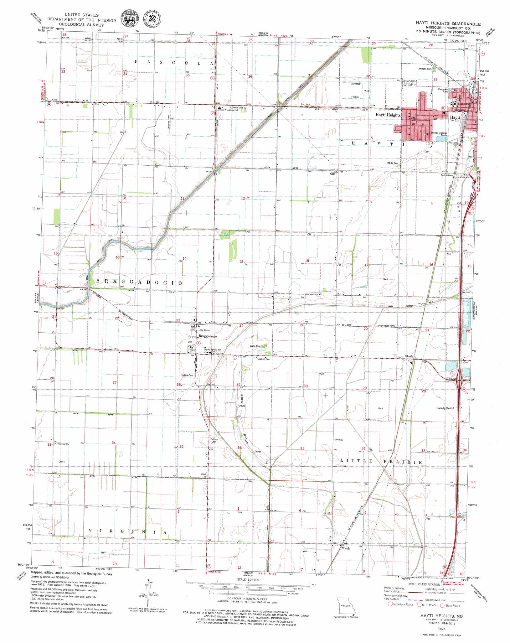
USGS Topo Quad 36089b7 - 1:24,000 scale
| Topo Map Name: | Hayti Heights |
| USGS Topo Quad ID: | 36089b7 |
| Print Size: | ca. 21 1/4" wide x 27" high |
| Southeast Coordinates: | 36.125° N latitude / 89.75° W longitude |
| Map Center Coordinates: | 36.1875° N latitude / 89.8125° W longitude |
| U.S. State: | MO |
| Filename: | o36089b7.jpg |
| Download Map JPG Image: | Hayti Heights topo map 1:24,000 scale |
| Map Type: | Topographic |
| Topo Series: | 7.5´ |
| Map Scale: | 1:24,000 |
| Source of Map Images: | United States Geological Survey (USGS) |
| Alternate Map Versions: |
Hayti Heights MO 1978, updated 1979 Download PDF Buy paper map Hayti Heights MO 2012 Download PDF Buy paper map Hayti Heights MO 2015 Download PDF Buy paper map |
1:24,000 Topo Quads surrounding Hayti Heights
Campbell |
Gideon |
Boekerton |
Portageville |
Point Pleasant |
Kennett North |
Bragg City |
Wardell |
Stanley |
Mooring |
Kennett South |
Deering |
Hayti Heights |
Caruthersville |
Tennemo |
Hornersville |
Denton |
Steele |
Cottonwood Point |
Caruthersville Se |
Half Moon |
Blytheville |
Armorel |
Chic |
Knob Creek |
> Back to 36089a1 at 1:100,000 scale
> Back to 36088a1 at 1:250,000 scale
> Back to U.S. Topo Maps home
Hayti Heights topo map: Gazetteer
Hayti Heights: Canals
Ditch Number 12 elevation 78m 255′Ditch Number 15 elevation 79m 259′
Ditch Number 18 elevation 79m 259′
Ditch Number 20 elevation 79m 259′
Ditch Number 21 elevation 81m 265′
Ditch Number 4 elevation 78m 255′
Elk Chute (historical) elevation 79m 259′
Main Ditch Number 6 elevation 78m 255′
Main Ditch Number 8 elevation 77m 252′
Hayti Heights: Populated Places
Blazer elevation 81m 265′Braggadocio elevation 81m 265′
Faris elevation 79m 259′
Gill elevation 81m 265′
Hayti Heights elevation 81m 265′
Micola elevation 81m 265′
Shade elevation 81m 265′
Vicksburg elevation 80m 262′
Hayti Heights: Ridges
Blow Ridge elevation 81m 265′Hayti Heights digital topo map on disk
Buy this Hayti Heights topo map showing relief, roads, GPS coordinates and other geographical features, as a high-resolution digital map file on DVD: