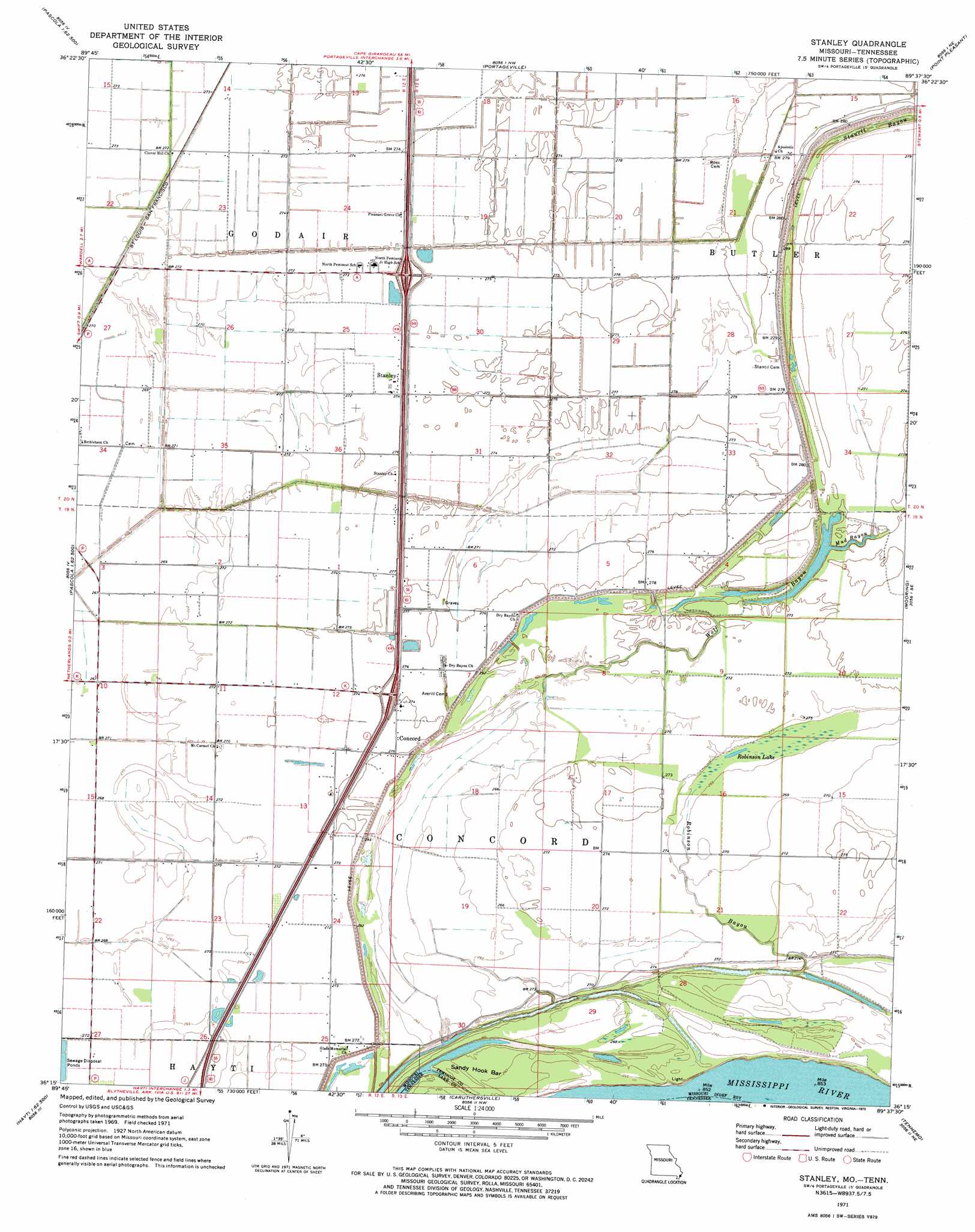
Stanley Topo Map Missouri
To zoom in, hover over the map of Stanley
USGS Topo Quad 36089c6 - 1:24,000 scale
| Topo Map Name: | Stanley |
| USGS Topo Quad ID: | 36089c6 |
| Print Size: | ca. 21 1/4" wide x 27" high |
| Southeast Coordinates: | 36.25° N latitude / 89.625° W longitude |
| Map Center Coordinates: | 36.3125° N latitude / 89.6875° W longitude |
| U.S. States: | MO, TN |
| Filename: | o36089c6.jpg |
| Download Map JPG Image: | Stanley topo map 1:24,000 scale |
| Map Type: | Topographic |
| Topo Series: | 7.5´ |
| Map Scale: | 1:24,000 |
| Source of Map Images: | United States Geological Survey (USGS) |
| Alternate Map Versions: |
Stanley MO 1971, updated 1973 Download PDF Buy paper map Stanley MO 1971, updated 1973 Download PDF Buy paper map Stanley MO 2010 Download PDF Buy paper map Stanley MO 2012 Download PDF Buy paper map Stanley MO 2015 Download PDF Buy paper map |
1:24,000 Topo Quads surrounding Stanley
Malden |
Parma |
Catron |
New Madrid |
Hubbard Lake |
Gideon |
Boekerton |
Portageville |
Point Pleasant |
Tiptonville |
Bragg City |
Wardell |
Stanley |
Mooring |
Ridgely |
Deering |
Hayti Heights |
Caruthersville |
Tennemo |
Miston |
Denton |
Steele |
Cottonwood Point |
Caruthersville Se |
Dyersburg |
> Back to 36089a1 at 1:100,000 scale
> Back to 36088a1 at 1:250,000 scale
> Back to U.S. Topo Maps home
Stanley topo map: Gazetteer
Stanley: Bars
Sandy Hook Bar elevation 80m 262′Stanley: Canals
Ditch Number 23 elevation 81m 265′Ditch Number 24 elevation 81m 265′
Ditch Number 25 elevation 81m 265′
Stanley: Guts
Stancil Bayou elevation 84m 275′Stanley: Lakes
Big Lake (historical) elevation 78m 255′Robinson Lake elevation 80m 262′
Stanley: Populated Places
Brent elevation 83m 272′Brinkerhoff (historical) elevation 82m 269′
Concord elevation 84m 275′
Gayoso elevation 84m 275′
Stancil elevation 87m 285′
Stanley elevation 85m 278′
Stanley: Streams
Dry Bayou (historical) elevation 85m 278′Mud Bayou elevation 82m 269′
Robinson Bayou elevation 79m 259′
Wolf Bayou elevation 78m 255′
Stanley digital topo map on disk
Buy this Stanley topo map showing relief, roads, GPS coordinates and other geographical features, as a high-resolution digital map file on DVD: