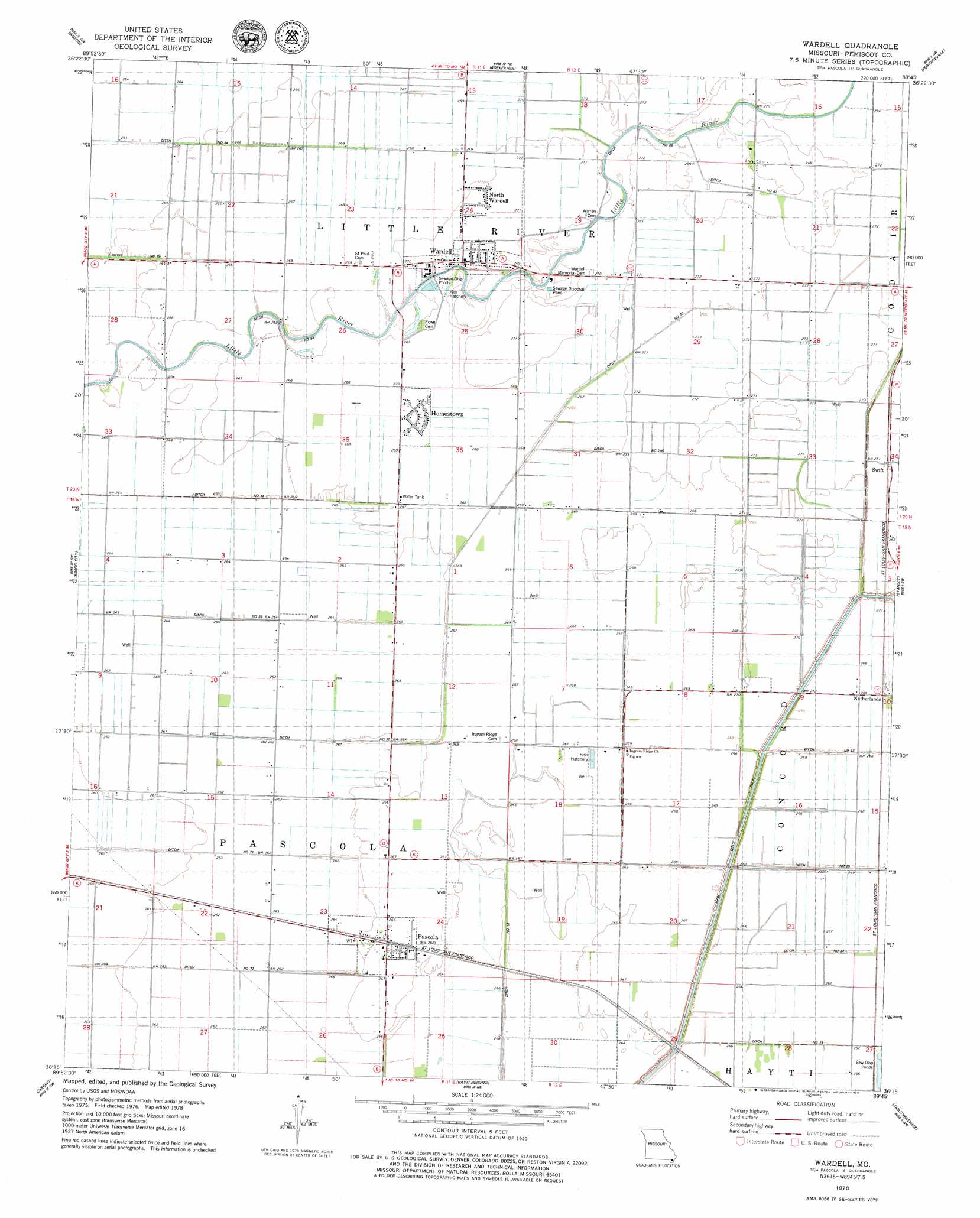
Wardell Topo Map Missouri
To zoom in, hover over the map of Wardell
USGS Topo Quad 36089c7 - 1:24,000 scale
| Topo Map Name: | Wardell |
| USGS Topo Quad ID: | 36089c7 |
| Print Size: | ca. 21 1/4" wide x 27" high |
| Southeast Coordinates: | 36.25° N latitude / 89.75° W longitude |
| Map Center Coordinates: | 36.3125° N latitude / 89.8125° W longitude |
| U.S. State: | MO |
| Filename: | o36089c7.jpg |
| Download Map JPG Image: | Wardell topo map 1:24,000 scale |
| Map Type: | Topographic |
| Topo Series: | 7.5´ |
| Map Scale: | 1:24,000 |
| Source of Map Images: | United States Geological Survey (USGS) |
| Alternate Map Versions: |
Wardell MO 1978, updated 1979 Download PDF Buy paper map Wardell MO 2012 Download PDF Buy paper map Wardell MO 2015 Download PDF Buy paper map |
1:24,000 Topo Quads surrounding Wardell
Valley Ridge |
Malden |
Parma |
Catron |
New Madrid |
Campbell |
Gideon |
Boekerton |
Portageville |
Point Pleasant |
Kennett North |
Bragg City |
Wardell |
Stanley |
Mooring |
Kennett South |
Deering |
Hayti Heights |
Caruthersville |
Tennemo |
Hornersville |
Denton |
Steele |
Cottonwood Point |
Caruthersville Se |
> Back to 36089a1 at 1:100,000 scale
> Back to 36088a1 at 1:250,000 scale
> Back to U.S. Topo Maps home
Wardell topo map: Gazetteer
Wardell: Canals
Ditch Number 22 elevation 81m 265′Ditch Number 25 elevation 81m 265′
Ditch Number 295 elevation 82m 269′
Ditch Number 64 elevation 81m 265′
Ditch Number 67 elevation 81m 265′
Ditch Number 68 elevation 79m 259′
Ditch Number 69 elevation 79m 259′
Ditch Number 70 elevation 81m 265′
Wardell: Populated Places
Homestown elevation 82m 269′Ingram Ridge elevation 81m 265′
Keokuk (historical) elevation 81m 265′
Netherlands elevation 82m 269′
North Wardell elevation 83m 272′
Pascola elevation 81m 265′
Swift elevation 83m 272′
Terry elevation 82m 269′
Wardell elevation 84m 275′
Wilbur (historical) elevation 81m 265′
Wardell digital topo map on disk
Buy this Wardell topo map showing relief, roads, GPS coordinates and other geographical features, as a high-resolution digital map file on DVD: