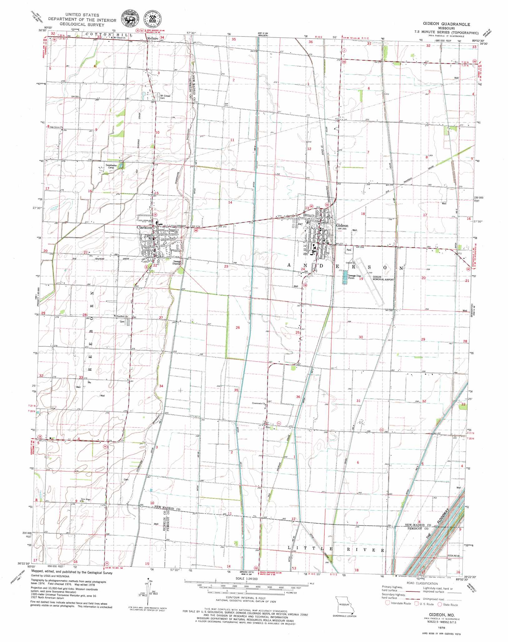
Gideon Topo Map Missouri
To zoom in, hover over the map of Gideon
USGS Topo Quad 36089d8 - 1:24,000 scale
| Topo Map Name: | Gideon |
| USGS Topo Quad ID: | 36089d8 |
| Print Size: | ca. 21 1/4" wide x 27" high |
| Southeast Coordinates: | 36.375° N latitude / 89.875° W longitude |
| Map Center Coordinates: | 36.4375° N latitude / 89.9375° W longitude |
| U.S. State: | MO |
| Filename: | o36089d8.jpg |
| Download Map JPG Image: | Gideon topo map 1:24,000 scale |
| Map Type: | Topographic |
| Topo Series: | 7.5´ |
| Map Scale: | 1:24,000 |
| Source of Map Images: | United States Geological Survey (USGS) |
| Alternate Map Versions: |
Gideon MO 1978, updated 1979 Download PDF Buy paper map Gideon MO 2012 Download PDF Buy paper map Gideon MO 2015 Download PDF Buy paper map |
1:24,000 Topo Quads surrounding Gideon
Broseley |
Powe |
Bernie |
Hills Store |
Charter Oak |
Glennonville |
Valley Ridge |
Malden |
Parma |
Catron |
Peggott |
Campbell |
Gideon |
Boekerton |
Portageville |
Greenway |
Kennett North |
Bragg City |
Wardell |
Stanley |
Senath |
Kennett South |
Deering |
Hayti Heights |
Caruthersville |
> Back to 36089a1 at 1:100,000 scale
> Back to 36088a1 at 1:250,000 scale
> Back to U.S. Topo Maps home
Gideon topo map: Gazetteer
Gideon: Airports
Gideon Memorial Airport elevation 82m 269′Gideon: Canals
Ditch Number 1 elevation 82m 269′Ditch Number 258 elevation 81m 265′
Ditch Number 293 elevation 80m 262′
Ditch Number 4 elevation 82m 269′
Main Ditch elevation 84m 275′
Main Ditch District Number 17 elevation 86m 282′
Gideon: Populated Places
Clarkton elevation 86m 282′Dunn elevation 81m 265′
Gideon elevation 82m 269′
Glendale elevation 82m 269′
Marlow elevation 84m 275′
McGuire elevation 87m 285′
Moark elevation 85m 278′
Page elevation 85m 278′
Wrightsville elevation 87m 285′
Gideon: Post Offices
Wrightsville Post Office (historical) elevation 87m 285′Gideon digital topo map on disk
Buy this Gideon topo map showing relief, roads, GPS coordinates and other geographical features, as a high-resolution digital map file on DVD: