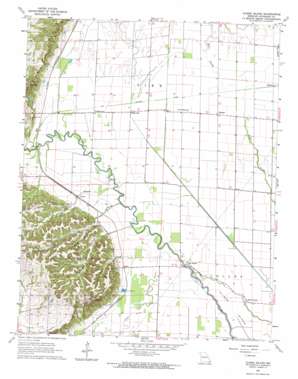
Clines Island Topo Map Missouri
To zoom in, hover over the map of Clines Island
USGS Topo Quad 36089h7 - 1:24,000 scale
| Topo Map Name: | Clines Island |
| USGS Topo Quad ID: | 36089h7 |
| Print Size: | ca. 21 1/4" wide x 27" high |
| Southeast Coordinates: | 36.875° N latitude / 89.75° W longitude |
| Map Center Coordinates: | 36.9375° N latitude / 89.8125° W longitude |
| U.S. State: | MO |
| Filename: | o36089h7.jpg |
| Download Map JPG Image: | Clines Island topo map 1:24,000 scale |
| Map Type: | Topographic |
| Topo Series: | 7.5´ |
| Map Scale: | 1:24,000 |
| Source of Map Images: | United States Geological Survey (USGS) |
| Alternate Map Versions: |
Clines Island MO 1963, updated 1964 Download PDF Buy paper map Clines Island MO 2012 Download PDF Buy paper map Clines Island MO 2015 Download PDF Buy paper map |
1:24,000 Topo Quads surrounding Clines Island
> Back to 36089e1 at 1:100,000 scale
> Back to 36088a1 at 1:250,000 scale
> Back to U.S. Topo Maps home
Clines Island topo map: Gazetteer
Clines Island: Canals
Ditch Number 24 elevation 91m 298′Ditch Number 30 elevation 93m 305′
Ditch Number 33 elevation 93m 305′
Ditch Number 34 elevation 93m 305′
Clines Island: Dams
Lewis Lake Dam elevation 113m 370′Montgomery Lake Lower Dam elevation 131m 429′
Montgomery Lake Upper Dam elevation 129m 423′
Rice Lake Dam East elevation 152m 498′
Rice Lake West Dam elevation 147m 482′
Clines Island: Islands
Clines Island elevation 92m 301′Clines Island: Populated Places
Avert elevation 101m 331′Birds Corner elevation 91m 298′
Clines Island elevation 94m 308′
Durnell elevation 95m 311′
Guam elevation 97m 318′
Himmel elevation 93m 305′
Shady Dell elevation 94m 308′
Shawan elevation 94m 308′
Toppertown elevation 96m 314′
Zeta (historical) elevation 98m 321′
Clines Island: Post Offices
Bridges Post Office elevation 98m 321′Clines Island: Reservoirs
Rice Lake elevation 152m 498′Clines Island: Streams
Beech Grove Branch elevation 93m 305′Mill Slough elevation 94m 308′
Poplar Branch elevation 93m 305′
Williams Creek elevation 93m 305′
Wilson Creek elevation 93m 305′
Clines Island: Wells
Artesian Well (historical) elevation 93m 305′Clines Island digital topo map on disk
Buy this Clines Island topo map showing relief, roads, GPS coordinates and other geographical features, as a high-resolution digital map file on DVD:


