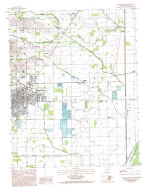
Paragould East Topo Map Arkansas
To zoom in, hover over the map of Paragould East
USGS Topo Quad 36090a4 - 1:24,000 scale
| Topo Map Name: | Paragould East |
| USGS Topo Quad ID: | 36090a4 |
| Print Size: | ca. 21 1/4" wide x 27" high |
| Southeast Coordinates: | 36° N latitude / 90.375° W longitude |
| Map Center Coordinates: | 36.0625° N latitude / 90.4375° W longitude |
| U.S. State: | AR |
| Filename: | o36090a4.jpg |
| Download Map JPG Image: | Paragould East topo map 1:24,000 scale |
| Map Type: | Topographic |
| Topo Series: | 7.5´ |
| Map Scale: | 1:24,000 |
| Source of Map Images: | United States Geological Survey (USGS) |
| Alternate Map Versions: |
Paragould East AR 1983, updated 1984 Download PDF Buy paper map Paragould East AR 1983, updated 1993 Download PDF Buy paper map Paragould East AR 2011 Download PDF Buy paper map Paragould East AR 2014 Download PDF Buy paper map |
1:24,000 Topo Quads surrounding Paragould East
> Back to 36090a1 at 1:100,000 scale
> Back to 36090a1 at 1:250,000 scale
> Back to U.S. Topo Maps home
Paragould East topo map: Gazetteer
Paragould East: Bridges
Eight Mile Creek Bridge elevation 83m 272′Paragould East: Canals
Eightmile Ditch elevation 76m 249′Johnson Creek Ditch elevation 74m 242′
Locust Creek Ditch elevation 73m 239′
Village Creek Ditch elevation 77m 252′
Paragould East: Islands
Giles Island elevation 71m 232′Paragould East: Parks
Centennial Station Park elevation 85m 278′Harmon Park elevation 83m 272′
Labor Park elevation 79m 259′
Paragould East: Populated Places
Bard elevation 71m 232′Coffman elevation 73m 239′
Cotton Belt elevation 83m 272′
Halliday elevation 81m 265′
Lake Side elevation 75m 246′
Morning Star elevation 76m 249′
Noxburn elevation 86m 282′
Paragould elevation 93m 305′
Twin Oaks elevation 77m 252′
Unity elevation 86m 282′
Paragould East: Post Offices
Paragould Post Office elevation 89m 291′Paragould East: Streams
Eightmile Creek elevation 80m 262′Henderson Creek elevation 74m 242′
Hurricane Creek elevation 74m 242′
Jacks Creek elevation 78m 255′
Johnson Creek elevation 82m 269′
Locust Creek elevation 80m 262′
Paragould East digital topo map on disk
Buy this Paragould East topo map showing relief, roads, GPS coordinates and other geographical features, as a high-resolution digital map file on DVD:


