Marmaduke Topo Map Arkansas
To zoom in, hover over the map of Marmaduke
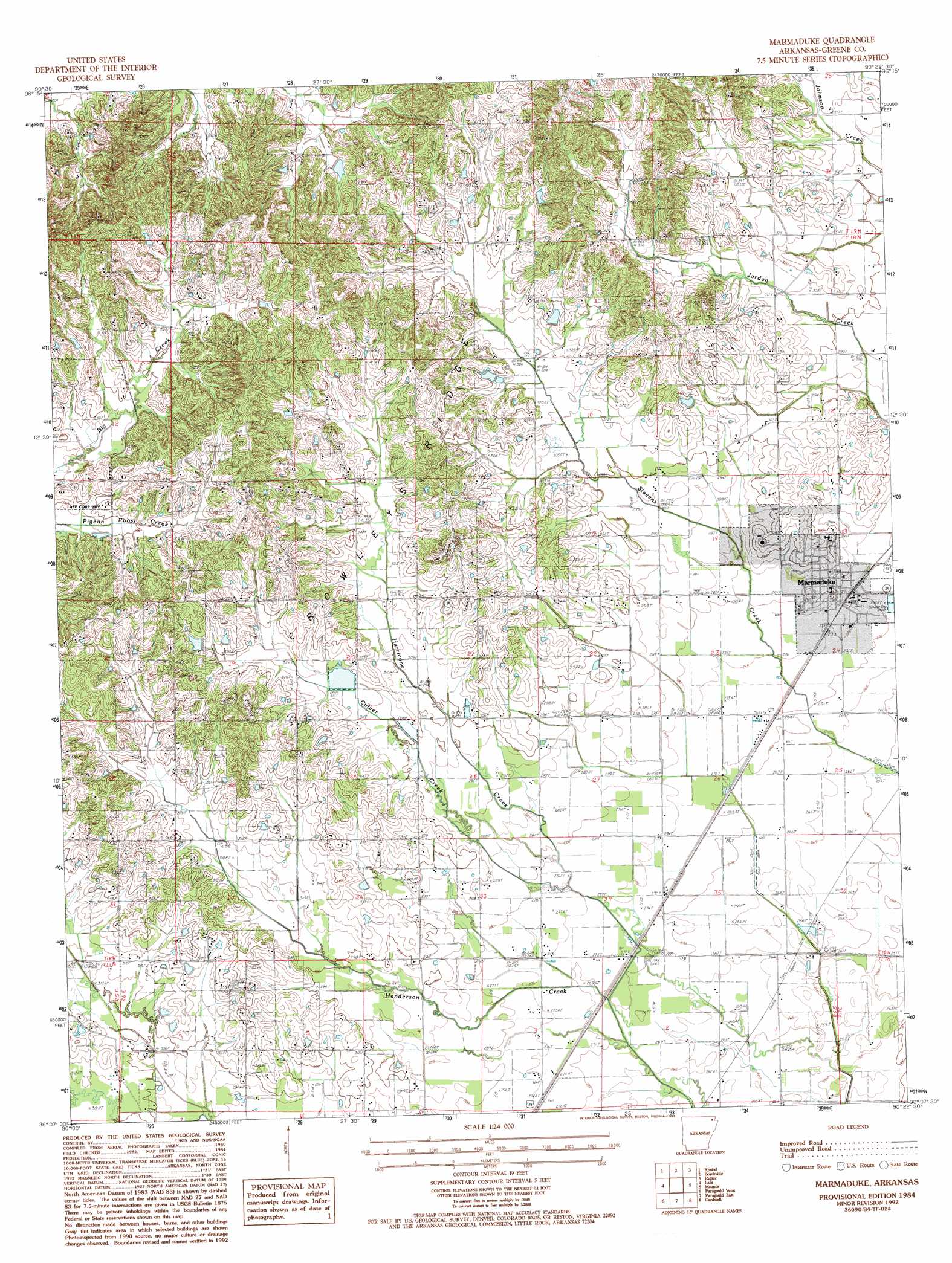
USGS Topo Quad 36090b4 - 1:24,000 scale
| Topo Map Name: | Marmaduke |
| USGS Topo Quad ID: | 36090b4 |
| Print Size: | ca. 21 1/4" wide x 27" high |
| Southeast Coordinates: | 36.125° N latitude / 90.375° W longitude |
| Map Center Coordinates: | 36.1875° N latitude / 90.4375° W longitude |
| U.S. State: | AR |
| Filename: | o36090b4.jpg |
| Download Map JPG Image: | Marmaduke topo map 1:24,000 scale |
| Map Type: | Topographic |
| Topo Series: | 7.5´ |
| Map Scale: | 1:24,000 |
| Source of Map Images: | United States Geological Survey (USGS) |
| Alternate Map Versions: |
Marmaduke AR 1984, updated 1984 Download PDF Buy paper map Marmaduke AR 1984, updated 1993 Download PDF Buy paper map Marmaduke AR 2011 Download PDF Buy paper map Marmaduke AR 2014 Download PDF Buy paper map |
1:24,000 Topo Quads surrounding Marmaduke
Datto |
Corning |
Mcdougal |
Pollard |
Peggott |
Peach Orchard |
Knobel |
Boydsville |
Rector |
Greenway |
Delaplaine |
Lafe |
Marmaduke |
Mounds |
Senath |
Walcott |
Paragould West |
Paragould East |
Cardwell |
Arbyrd |
Lorado |
Brookland |
Dixie |
Leachville |
Manila North |
> Back to 36090a1 at 1:100,000 scale
> Back to 36090a1 at 1:250,000 scale
> Back to U.S. Topo Maps home
Marmaduke topo map: Gazetteer
Marmaduke: Dams
Dickeys Lake Dam elevation 89m 291′Marmaduke: Populated Places
Marmaduke elevation 82m 269′Paris (historical) elevation 99m 324′
Marmaduke: Post Offices
Marmaduke Post Office elevation 85m 278′Marmaduke: Reservoirs
Dickeys Lake elevation 89m 291′Marmaduke: Streams
Culver Creek elevation 84m 275′Marmaduke digital topo map on disk
Buy this Marmaduke topo map showing relief, roads, GPS coordinates and other geographical features, as a high-resolution digital map file on DVD: