Lafe Topo Map Arkansas
To zoom in, hover over the map of Lafe
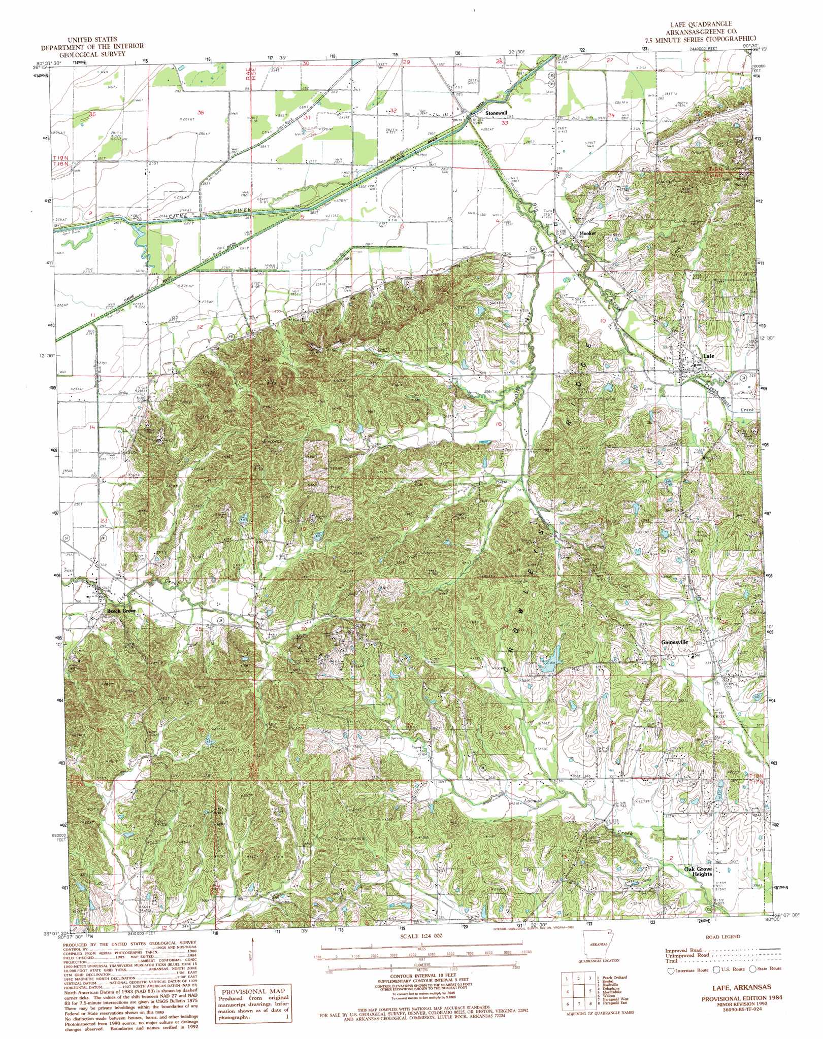
USGS Topo Quad 36090b5 - 1:24,000 scale
| Topo Map Name: | Lafe |
| USGS Topo Quad ID: | 36090b5 |
| Print Size: | ca. 21 1/4" wide x 27" high |
| Southeast Coordinates: | 36.125° N latitude / 90.5° W longitude |
| Map Center Coordinates: | 36.1875° N latitude / 90.5625° W longitude |
| U.S. State: | AR |
| Filename: | o36090b5.jpg |
| Download Map JPG Image: | Lafe topo map 1:24,000 scale |
| Map Type: | Topographic |
| Topo Series: | 7.5´ |
| Map Scale: | 1:24,000 |
| Source of Map Images: | United States Geological Survey (USGS) |
| Alternate Map Versions: |
Lafe AR 1984, updated 1984 Download PDF Buy paper map Lafe AR 1984, updated 1993 Download PDF Buy paper map Lafe AR 2011 Download PDF Buy paper map Lafe AR 2014 Download PDF Buy paper map |
1:24,000 Topo Quads surrounding Lafe
Supply |
Datto |
Corning |
Mcdougal |
Pollard |
Reyno |
Peach Orchard |
Knobel |
Boydsville |
Rector |
O'Kean |
Delaplaine |
Lafe |
Marmaduke |
Mounds |
Walnut Ridge Se |
Walcott |
Paragould West |
Paragould East |
Cardwell |
Bono |
Lorado |
Brookland |
Dixie |
Leachville |
> Back to 36090a1 at 1:100,000 scale
> Back to 36090a1 at 1:250,000 scale
> Back to U.S. Topo Maps home
Lafe topo map: Gazetteer
Lafe: Canals
Lateral Number 1 elevation 82m 269′Lateral Number 13 elevation 82m 269′
Lateral Number 2 elevation 82m 269′
Lafe: Dams
W H Spence Lake Dam elevation 108m 354′Lafe: Guts
Gum Slough elevation 81m 265′Lafe: Populated Places
Beech Grove elevation 91m 298′Gainesville elevation 101m 331′
Hillside (historical) elevation 113m 370′
Hooker elevation 90m 295′
Lafe elevation 95m 311′
Stonewall elevation 83m 272′
Lafe: Post Offices
Beech Grove Post Office elevation 93m 305′Stonewall Post Office elevation 82m 269′
Lafe: Reservoirs
W H Spence Lake elevation 108m 354′Lafe: Ridges
Crowleys Ridge elevation 157m 515′Crowleys Ridge elevation 157m 515′
Lafe: Streams
Big Creek elevation 81m 265′Pigeon Roost Creek elevation 95m 311′
Scatter Creek elevation 81m 265′
Lafe digital topo map on disk
Buy this Lafe topo map showing relief, roads, GPS coordinates and other geographical features, as a high-resolution digital map file on DVD: