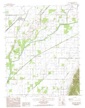
Delaplaine Topo Map Arkansas
To zoom in, hover over the map of Delaplaine
USGS Topo Quad 36090b6 - 1:24,000 scale
| Topo Map Name: | Delaplaine |
| USGS Topo Quad ID: | 36090b6 |
| Print Size: | ca. 21 1/4" wide x 27" high |
| Southeast Coordinates: | 36.125° N latitude / 90.625° W longitude |
| Map Center Coordinates: | 36.1875° N latitude / 90.6875° W longitude |
| U.S. State: | AR |
| Filename: | o36090b6.jpg |
| Download Map JPG Image: | Delaplaine topo map 1:24,000 scale |
| Map Type: | Topographic |
| Topo Series: | 7.5´ |
| Map Scale: | 1:24,000 |
| Source of Map Images: | United States Geological Survey (USGS) |
| Alternate Map Versions: |
Delaplaine AR 1984, updated 1984 Download PDF Buy paper map Delaplaine AR 1984, updated 1993 Download PDF Buy paper map Delaplaine AR 2011 Download PDF Buy paper map Delaplaine AR 2014 Download PDF Buy paper map |
1:24,000 Topo Quads surrounding Delaplaine
> Back to 36090a1 at 1:100,000 scale
> Back to 36090a1 at 1:250,000 scale
> Back to U.S. Topo Maps home
Delaplaine topo map: Gazetteer
Delaplaine: Canals
Big Gum Lateral elevation 80m 262′Lateral 4A elevation 81m 265′
Lateral 6 A elevation 80m 262′
Lateral 6 B elevation 80m 262′
Lateral Number 1 elevation 84m 275′
Lateral Number 10 elevation 81m 265′
Lateral Number 11 elevation 81m 265′
Lateral Number 12 elevation 82m 269′
Lateral Number 15 elevation 83m 272′
Lateral Number 16 elevation 80m 262′
Lateral Number 2 elevation 82m 269′
Lateral Number 3 elevation 79m 259′
Lateral Number 4 elevation 82m 269′
Lateral Number 5 elevation 80m 262′
Lateral Number 6 elevation 80m 262′
Lateral Number 7 elevation 81m 265′
Lateral Number 8 elevation 80m 262′
Lateral Number 9 elevation 80m 262′
Main Canal elevation 79m 259′
Swan Pond Ditch elevation 80m 262′
Swan Pond Lateral elevation 82m 269′
Delaplaine: Populated Places
Black Jack elevation 80m 262′Case (historical) elevation 81m 265′
Delaplaine elevation 82m 269′
Evening Star elevation 81m 265′
Delaplaine: Post Offices
Delaplaine Post Office elevation 81m 265′Delaplaine: Ridges
Jones Ridge elevation 88m 288′Delaplaine: Streams
Lick Creek elevation 83m 272′Delaplaine digital topo map on disk
Buy this Delaplaine topo map showing relief, roads, GPS coordinates and other geographical features, as a high-resolution digital map file on DVD:


