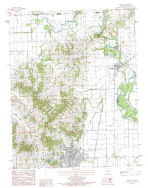
Peggott Topo Map Arkansas
To zoom in, hover over the map of Peggott
USGS Topo Quad 36090d2 - 1:24,000 scale
| Topo Map Name: | Peggott |
| USGS Topo Quad ID: | 36090d2 |
| Print Size: | ca. 21 1/4" wide x 27" high |
| Southeast Coordinates: | 36.375° N latitude / 90.125° W longitude |
| Map Center Coordinates: | 36.4375° N latitude / 90.1875° W longitude |
| U.S. States: | AR, MO |
| Filename: | o36090d2.jpg |
| Download Map JPG Image: | Peggott topo map 1:24,000 scale |
| Map Type: | Topographic |
| Topo Series: | 7.5´ |
| Map Scale: | 1:24,000 |
| Source of Map Images: | United States Geological Survey (USGS) |
| Alternate Map Versions: |
Piggott AR 1984, updated 1984 Download PDF Buy paper map Piggott AR 2011 Download PDF Buy paper map Piggott AR 2014 Download PDF Buy paper map |
1:24,000 Topo Quads surrounding Peggott
> Back to 36090a1 at 1:100,000 scale
> Back to 36090a1 at 1:250,000 scale
> Back to U.S. Topo Maps home
Peggott topo map: Gazetteer
Peggott: Airports
Piggott Community Hospital Heliport elevation 98m 321′Piggott Municipal Airport elevation 80m 262′
Peggott: Canals
Whitaker Cut-off elevation 85m 278′Peggott: Cliffs
Chalk Bluff elevation 101m 331′Peggott: Dams
Cole Lake Dam elevation 135m 442′Hughes Lake Dam elevation 101m 331′
Moore Lake Dam elevation 123m 403′
Peggott: Islands
Bass Island elevation 88m 288′Peggott: Lakes
Beaver Pond elevation 90m 295′Old River elevation 88m 288′
Peggott: Populated Places
Piggott elevation 89m 291′Saint Francis elevation 92m 301′
Trinnon elevation 83m 272′
Whitaker Place elevation 90m 295′
Peggott: Post Offices
Piggott Post Office elevation 89m 291′Peggott: Reservoirs
Cole Lake elevation 135m 442′Hughes Lake elevation 101m 331′
Moore Lake elevation 123m 403′
Peggott: Ridges
Crowleys Ridge elevation 95m 311′Peggott: Streams
Horse Creek elevation 133m 436′McNie Creek elevation 87m 285′
Old River elevation 89m 291′
Old River elevation 89m 291′
Pomp Creek elevation 89m 291′
Poplar Creek elevation 90m 295′
Sugar Creek elevation 85m 278′
Peggott digital topo map on disk
Buy this Peggott topo map showing relief, roads, GPS coordinates and other geographical features, as a high-resolution digital map file on DVD:


