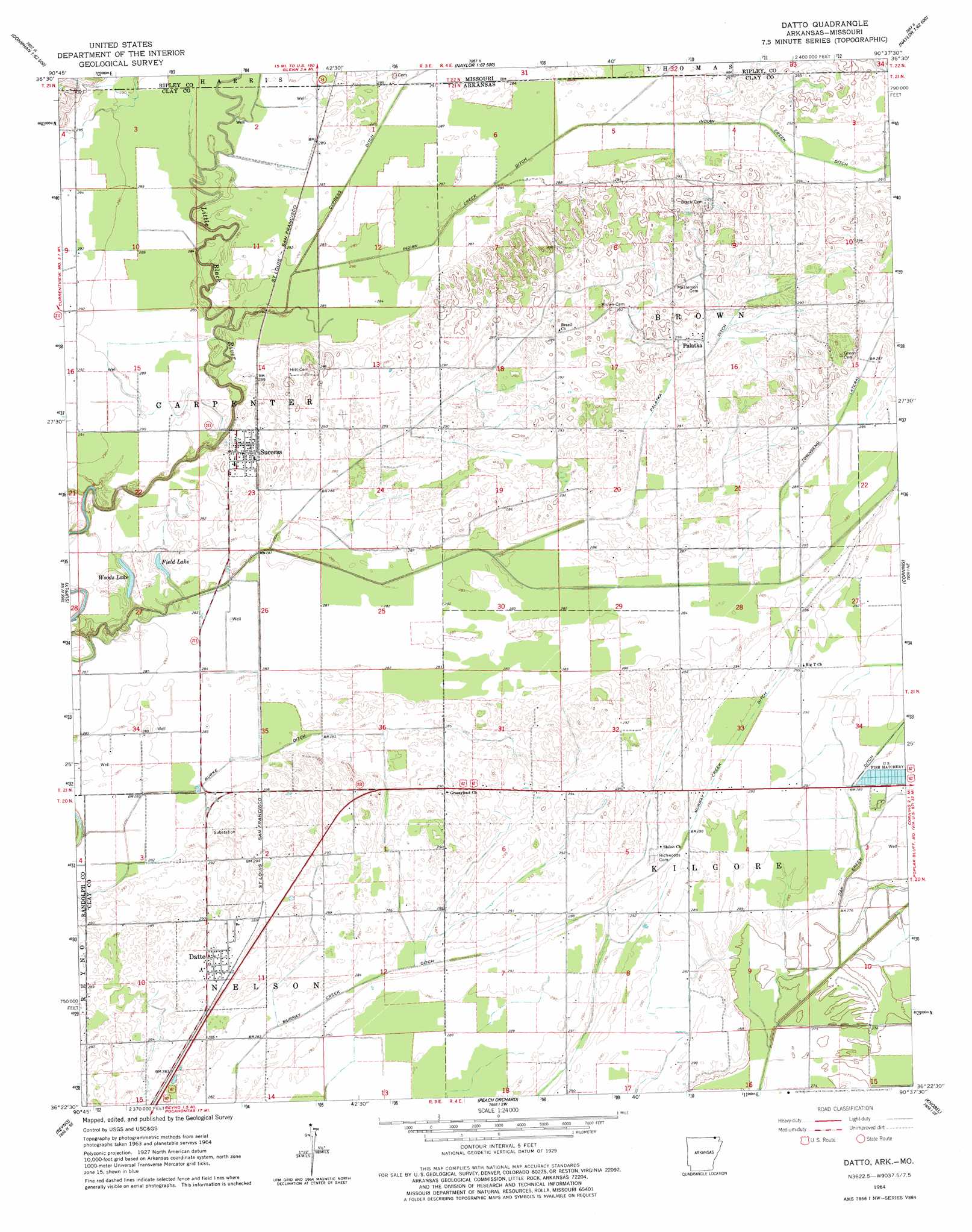
Datto Topo Map Arkansas
To zoom in, hover over the map of Datto
USGS Topo Quad 36090d6 - 1:24,000 scale
| Topo Map Name: | Datto |
| USGS Topo Quad ID: | 36090d6 |
| Print Size: | ca. 21 1/4" wide x 27" high |
| Southeast Coordinates: | 36.375° N latitude / 90.625° W longitude |
| Map Center Coordinates: | 36.4375° N latitude / 90.6875° W longitude |
| U.S. States: | AR, MO |
| Filename: | o36090d6.jpg |
| Download Map JPG Image: | Datto topo map 1:24,000 scale |
| Map Type: | Topographic |
| Topo Series: | 7.5´ |
| Map Scale: | 1:24,000 |
| Source of Map Images: | United States Geological Survey (USGS) |
| Alternate Map Versions: |
Datto AR 1964, updated 1965 Download PDF Buy paper map Datto AR 1964, updated 1977 Download PDF Buy paper map Datto AR 2011 Download PDF Buy paper map Datto AR 2014 Download PDF Buy paper map |
1:24,000 Topo Quads surrounding Datto
Briar |
Doniphan North |
Flatwoods |
Fairdealing |
Harviell |
Poynor |
Doniphan South |
Oxly |
Naylor |
Vastus |
Maynard |
Supply |
Datto |
Corning |
Mcdougal |
Pocahontas |
Reyno |
Peach Orchard |
Knobel |
Boydsville |
Manson |
O'Kean |
Delaplaine |
Lafe |
Marmaduke |
> Back to 36090a1 at 1:100,000 scale
> Back to 36090a1 at 1:250,000 scale
> Back to U.S. Topo Maps home
Datto topo map: Gazetteer
Datto: Airports
Corning Municipal Airport elevation 87m 285′Datto: Canals
Burke Ditch elevation 88m 288′Cypress Ditch elevation 88m 288′
Indian Creek Ditch elevation 87m 285′
Murray Creek Ditch elevation 86m 282′
Oak Creek Ditch elevation 87m 285′
Palatka Ditch elevation 88m 288′
Townsend Lateral elevation 88m 288′
Datto: Lakes
Field Lake elevation 86m 282′Woods Lake elevation 85m 278′
Datto: Populated Places
Datto elevation 85m 278′Palatka elevation 90m 295′
Pittman (historical) elevation 88m 288′
Success elevation 91m 298′
Twin Oaks elevation 88m 288′
Datto digital topo map on disk
Buy this Datto topo map showing relief, roads, GPS coordinates and other geographical features, as a high-resolution digital map file on DVD: