Supply Topo Map Arkansas
To zoom in, hover over the map of Supply
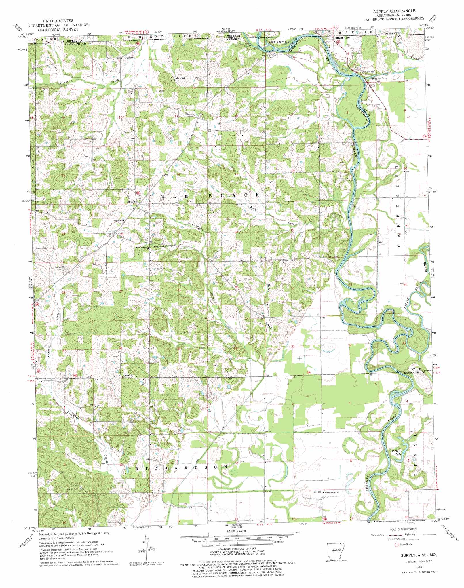
USGS Topo Quad 36090d7 - 1:24,000 scale
| Topo Map Name: | Supply |
| USGS Topo Quad ID: | 36090d7 |
| Print Size: | ca. 21 1/4" wide x 27" high |
| Southeast Coordinates: | 36.375° N latitude / 90.75° W longitude |
| Map Center Coordinates: | 36.4375° N latitude / 90.8125° W longitude |
| U.S. States: | AR, MO |
| Filename: | o36090d7.jpg |
| Download Map JPG Image: | Supply topo map 1:24,000 scale |
| Map Type: | Topographic |
| Topo Series: | 7.5´ |
| Map Scale: | 1:24,000 |
| Source of Map Images: | United States Geological Survey (USGS) |
| Alternate Map Versions: |
Supply AR 1968, updated 1969 Download PDF Buy paper map Supply AR 1968, updated 1978 Download PDF Buy paper map Supply AR 2011 Download PDF Buy paper map Supply AR 2014 Download PDF Buy paper map |
1:24,000 Topo Quads surrounding Supply
Bardley |
Briar |
Doniphan North |
Flatwoods |
Fairdealing |
Gatewood |
Poynor |
Doniphan South |
Oxly |
Naylor |
Warm Springs |
Maynard |
Supply |
Datto |
Corning |
Ravenden Springs Se |
Pocahontas |
Reyno |
Peach Orchard |
Knobel |
Noland |
Manson |
O'Kean |
Delaplaine |
Lafe |
> Back to 36090a1 at 1:100,000 scale
> Back to 36090a1 at 1:250,000 scale
> Back to U.S. Topo Maps home
Supply topo map: Gazetteer
Supply: Canals
Lateral Number 1 elevation 83m 272′Lateral Number 2 elevation 85m 278′
Supply: Crossings
Cochrum Ferry (historical) elevation 85m 278′Finley Ferry (historical) elevation 84m 275′
Pitmans Ferry (historical) elevation 87m 285′
Supply: Dams
R J Barnett Lake Dam elevation 98m 321′Supply: Lakes
McGuire Lake elevation 80m 262′Peoples Lake elevation 93m 305′
Supply: Populated Places
Current View elevation 102m 334′Current View elevation 102m 334′
Minorca elevation 108m 354′
Pitman elevation 128m 419′
Supply elevation 130m 426′
Supply: Reservoirs
R J Barnett Lake elevation 98m 321′Supply: Streams
Briar Creek elevation 87m 285′Glaze Creek elevation 87m 285′
Ingram Creek elevation 90m 295′
Lemmons Creek elevation 83m 272′
Little Black River elevation 80m 262′
Rock Creek elevation 85m 278′
Winningham Creek elevation 85m 278′
Supply: Summits
Grindstone Hill elevation 135m 442′Supply digital topo map on disk
Buy this Supply topo map showing relief, roads, GPS coordinates and other geographical features, as a high-resolution digital map file on DVD: