Maynard Topo Map Arkansas
To zoom in, hover over the map of Maynard
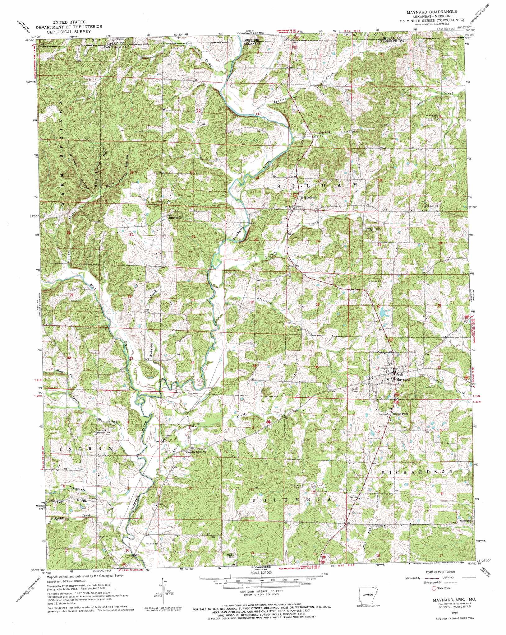
USGS Topo Quad 36090d8 - 1:24,000 scale
| Topo Map Name: | Maynard |
| USGS Topo Quad ID: | 36090d8 |
| Print Size: | ca. 21 1/4" wide x 27" high |
| Southeast Coordinates: | 36.375° N latitude / 90.875° W longitude |
| Map Center Coordinates: | 36.4375° N latitude / 90.9375° W longitude |
| U.S. States: | AR, MO |
| Filename: | o36090d8.jpg |
| Download Map JPG Image: | Maynard topo map 1:24,000 scale |
| Map Type: | Topographic |
| Topo Series: | 7.5´ |
| Map Scale: | 1:24,000 |
| Source of Map Images: | United States Geological Survey (USGS) |
| Alternate Map Versions: |
Maynard AR 1968, updated 1969 Download PDF Buy paper map Maynard AR 2011 Download PDF Buy paper map Maynard AR 2014 Download PDF Buy paper map |
1:24,000 Topo Quads surrounding Maynard
Riverton |
Bardley |
Briar |
Doniphan North |
Flatwoods |
Billmore |
Gatewood |
Poynor |
Doniphan South |
Oxly |
Dalton |
Warm Springs |
Maynard |
Supply |
Datto |
Ravenden Springs |
Ravenden Springs Se |
Pocahontas |
Reyno |
Peach Orchard |
Imboden |
Noland |
Manson |
O'Kean |
Delaplaine |
> Back to 36090a1 at 1:100,000 scale
> Back to 36090a1 at 1:250,000 scale
> Back to U.S. Topo Maps home
Maynard topo map: Gazetteer
Maynard: Populated Places
Brakebill elevation 146m 479′Elkins Park elevation 141m 462′
Glaze Creek elevation 135m 442′
Jerrett elevation 94m 308′
Maynard elevation 118m 387′
Middlebrook elevation 123m 403′
Mock (historical) elevation 129m 423′
Old Siloam elevation 128m 419′
Washington elevation 100m 328′
Maynard: Streams
Albritten Creek elevation 92m 301′Camp Creek elevation 89m 291′
Dry Creek elevation 102m 334′
Hagood Creek elevation 93m 305′
Lewis Creek elevation 86m 282′
Mud Creek elevation 89m 291′
Shaver Creek elevation 99m 324′
Spencer Creek elevation 100m 328′
Spencer Creek elevation 98m 321′
Spring Creek elevation 97m 318′
Tattle Creek elevation 87m 285′
Tennessee Creek elevation 88m 288′
Waldron Creek elevation 91m 298′
Wright Creek elevation 96m 314′
Maynard: Valleys
Blue Spring Hollow elevation 112m 367′Niccum Hollow elevation 111m 364′
Rock Spring Hollow elevation 115m 377′
Maynard digital topo map on disk
Buy this Maynard topo map showing relief, roads, GPS coordinates and other geographical features, as a high-resolution digital map file on DVD: