Vastus Topo Map Missouri
To zoom in, hover over the map of Vastus
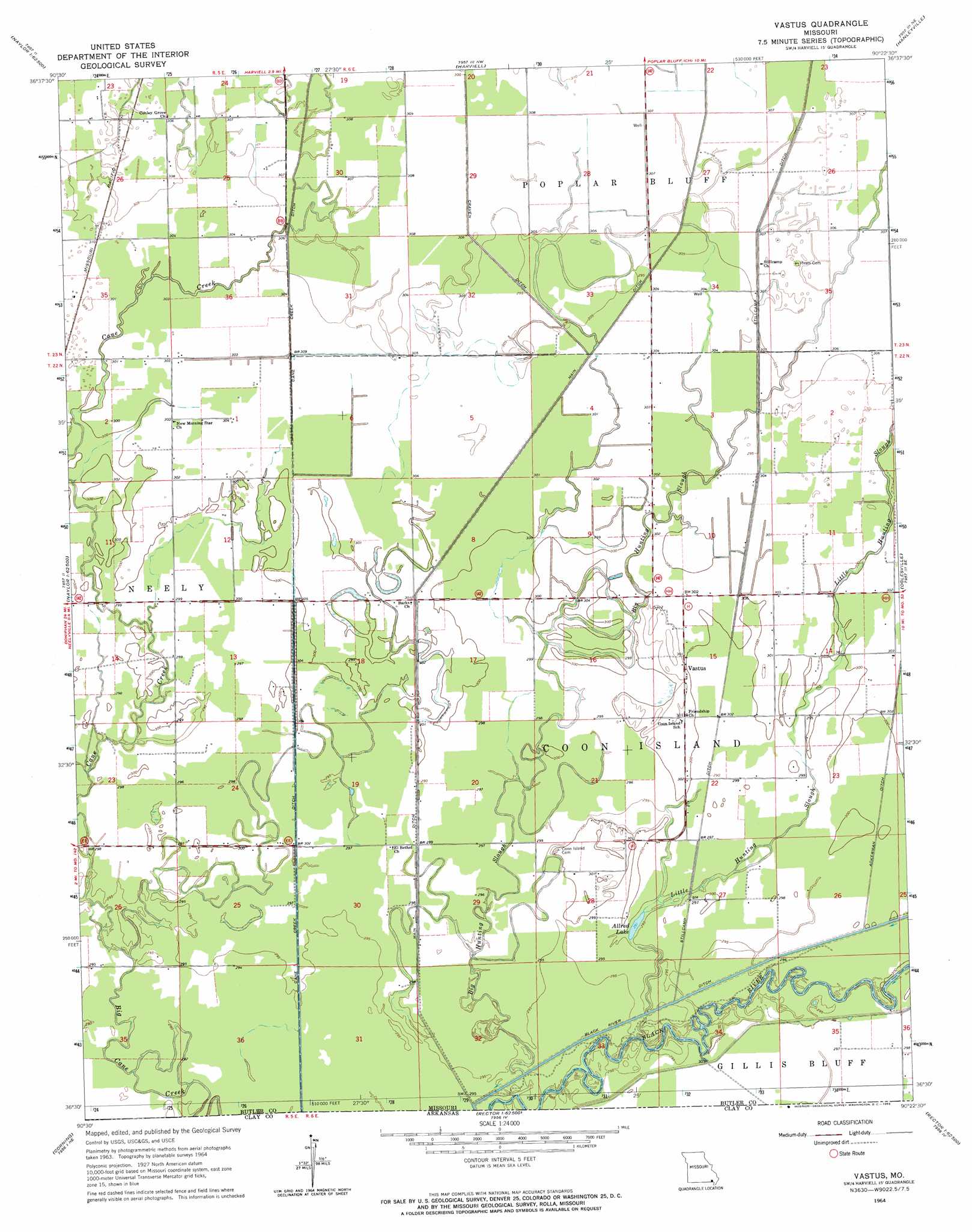
USGS Topo Quad 36090e4 - 1:24,000 scale
| Topo Map Name: | Vastus |
| USGS Topo Quad ID: | 36090e4 |
| Print Size: | ca. 21 1/4" wide x 27" high |
| Southeast Coordinates: | 36.5° N latitude / 90.375° W longitude |
| Map Center Coordinates: | 36.5625° N latitude / 90.4375° W longitude |
| U.S. State: | MO |
| Filename: | o36090e4.jpg |
| Download Map JPG Image: | Vastus topo map 1:24,000 scale |
| Map Type: | Topographic |
| Topo Series: | 7.5´ |
| Map Scale: | 1:24,000 |
| Source of Map Images: | United States Geological Survey (USGS) |
| Alternate Map Versions: |
Vastus MO 1964, updated 1965 Download PDF Buy paper map Vastus MO 2011 Download PDF Buy paper map Vastus MO 2015 Download PDF Buy paper map |
1:24,000 Topo Quads surrounding Vastus
Hogan Hollow |
Stringtown |
Poplar Bluff |
Rombauer |
Fisk |
Flatwoods |
Fairdealing |
Harviell |
Hanleyville |
Broseley |
Oxly |
Naylor |
Vastus |
Oglesville |
Glennonville |
Datto |
Corning |
Mcdougal |
Pollard |
Peggott |
Peach Orchard |
Knobel |
Boydsville |
Rector |
Greenway |
> Back to 36090e1 at 1:100,000 scale
> Back to 36090a1 at 1:250,000 scale
> Back to U.S. Topo Maps home
Vastus topo map: Gazetteer
Vastus: Bends
Chester Bend elevation 90m 295′Factory Bend elevation 90m 295′
Vastus: Canals
Cane Creek Ditch elevation 91m 298′Stillcamp Ditch elevation 92m 301′
Vastus: Lakes
Allred Lake elevation 89m 291′Vastus: Populated Places
Vastus elevation 94m 308′Vastus: Streams
Big Hunting Slough elevation 88m 288′Cane Creek elevation 89m 291′
Little Cane Creek elevation 90m 295′
Little Hunting Slough elevation 89m 291′
Vastus digital topo map on disk
Buy this Vastus topo map showing relief, roads, GPS coordinates and other geographical features, as a high-resolution digital map file on DVD: