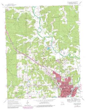
Poplar Bluff Topo Map Missouri
To zoom in, hover over the map of Poplar Bluff
USGS Topo Quad 36090g4 - 1:24,000 scale
| Topo Map Name: | Poplar Bluff |
| USGS Topo Quad ID: | 36090g4 |
| Print Size: | ca. 21 1/4" wide x 27" high |
| Southeast Coordinates: | 36.75° N latitude / 90.375° W longitude |
| Map Center Coordinates: | 36.8125° N latitude / 90.4375° W longitude |
| U.S. State: | MO |
| Filename: | o36090g4.jpg |
| Download Map JPG Image: | Poplar Bluff topo map 1:24,000 scale |
| Map Type: | Topographic |
| Topo Series: | 7.5´ |
| Map Scale: | 1:24,000 |
| Source of Map Images: | United States Geological Survey (USGS) |
| Alternate Map Versions: |
Poplar Bluff MO 1966, updated 1967 Download PDF Buy paper map Poplar Bluff MO 1966, updated 1979 Download PDF Buy paper map Poplar Bluff MO 1966, updated 1979 Download PDF Buy paper map Poplar Bluff MO 2011 Download PDF Buy paper map Poplar Bluff MO 2015 Download PDF Buy paper map |
| FStopo: | US Forest Service topo Poplar Bluff is available: Download FStopo PDF Download FStopo TIF |
1:24,000 Topo Quads surrounding Poplar Bluff
> Back to 36090e1 at 1:100,000 scale
> Back to 36090a1 at 1:250,000 scale
> Back to U.S. Topo Maps home
Poplar Bluff topo map: Gazetteer
Poplar Bluff: Airports
Lucy Lee Hospital Heliport elevation 140m 459′Poplar Bluff: Bridges
Mengo Bridge elevation 104m 341′Poplar Bluff: Dams
Chamberlain Dam elevation 131m 429′Hewlett Lake Dam elevation 124m 406′
Kelley Lake Dam elevation 130m 426′
Lake Lockloma Dam elevation 111m 364′
Lake Shore Acres Dam elevation 125m 410′
Mason Memorial Dam elevation 140m 459′
Mononame 646 Dam elevation 121m 396′
Mononame 667 Dam elevation 143m 469′
Oak Brier Estates Dam elevation 127m 416′
Rolling Hills Estates Lake Dam elevation 114m 374′
Tamaro Oaks Dam elevation 107m 351′
Wren Lake Dam elevation 107m 351′
Poplar Bluff: Guts
Mengo Slough elevation 104m 341′Poplar Bluff: Lakes
Carpenter Lake elevation 104m 341′Poplar Bluff: Parks
Bacon Memorial Park elevation 107m 351′Hillcrest Park elevation 104m 341′
Line Park elevation 100m 328′
Poplar Bluff: Populated Places
Cedar Valley elevation 125m 410′Green Forest elevation 142m 465′
Hilliard elevation 110m 360′
Kelly Town elevation 109m 357′
Loma Linda elevation 135m 442′
Poplar Bluff elevation 110m 360′
Shady Dell elevation 110m 360′
Wilby elevation 110m 360′
Poplar Bluff: Reservoirs
Big Lake elevation 107m 351′Chamberlain Lake elevation 131m 429′
Hon-Dah Reservoir elevation 140m 459′
Kelley Lake elevation 130m 426′
Lake Lockloma elevation 111m 364′
Rolling Hills Estates Lake elevation 114m 374′
Shore Acres Lake elevation 125m 410′
Wren Lake elevation 107m 351′
Poplar Bluff: Streams
Agee Creek elevation 104m 341′Aldridge Creek elevation 108m 354′
Buck Creek elevation 104m 341′
Dobbs Creek elevation 110m 360′
Hartman Creek elevation 109m 357′
Harwell Creek elevation 104m 341′
Hickory Creek elevation 104m 341′
Hoedapp Creek elevation 105m 344′
Indian Creek elevation 103m 337′
Lewis Creek elevation 114m 374′
Mill Creek elevation 104m 341′
Widow Creek elevation 104m 341′
Poplar Bluff digital topo map on disk
Buy this Poplar Bluff topo map showing relief, roads, GPS coordinates and other geographical features, as a high-resolution digital map file on DVD:


