Acorn Ridge Topo Map Missouri
To zoom in, hover over the map of Acorn Ridge
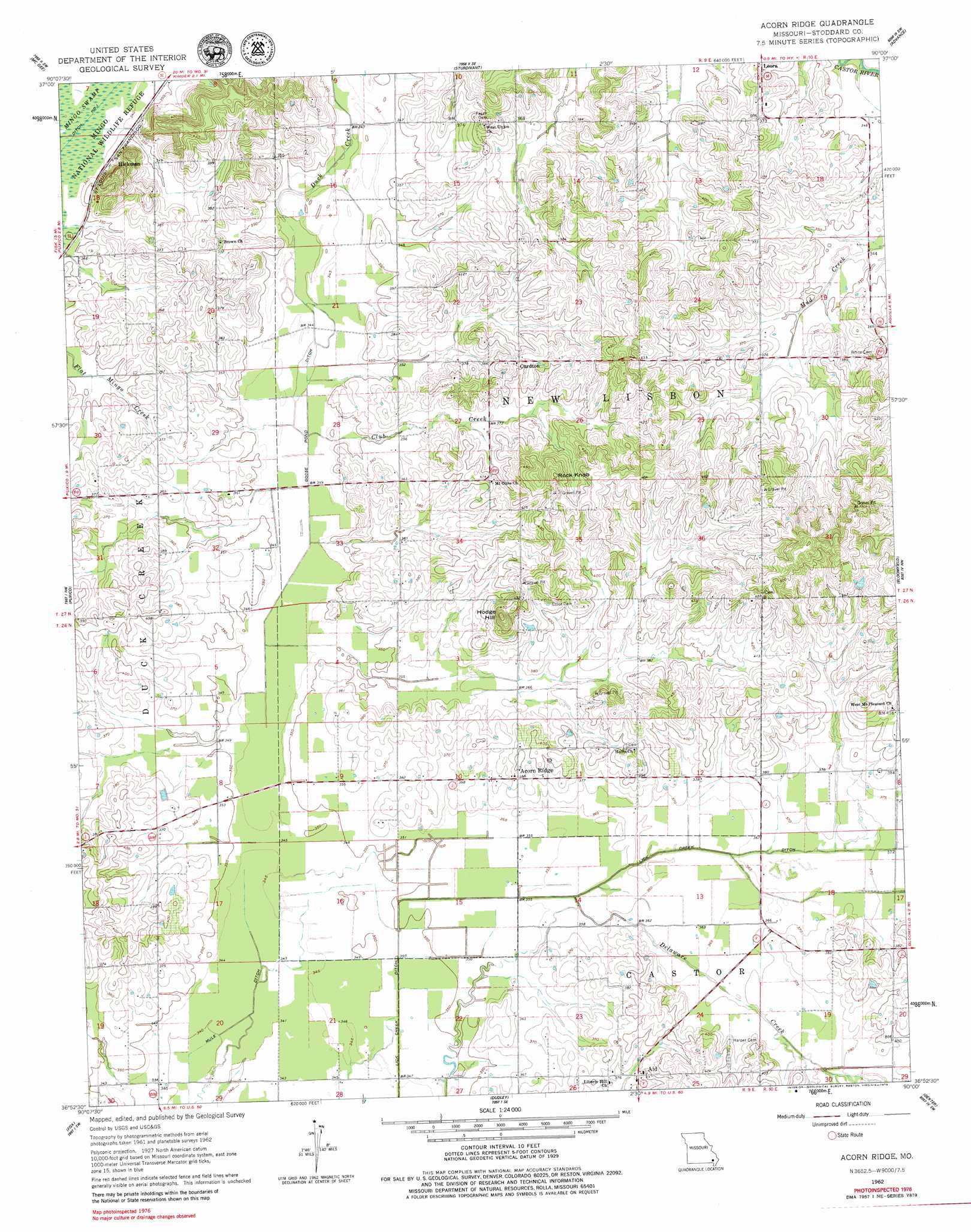
USGS Topo Quad 36090h1 - 1:24,000 scale
| Topo Map Name: | Acorn Ridge |
| USGS Topo Quad ID: | 36090h1 |
| Print Size: | ca. 21 1/4" wide x 27" high |
| Southeast Coordinates: | 36.875° N latitude / 90° W longitude |
| Map Center Coordinates: | 36.9375° N latitude / 90.0625° W longitude |
| U.S. State: | MO |
| Filename: | o36090h1.jpg |
| Download Map JPG Image: | Acorn Ridge topo map 1:24,000 scale |
| Map Type: | Topographic |
| Topo Series: | 7.5´ |
| Map Scale: | 1:24,000 |
| Source of Map Images: | United States Geological Survey (USGS) |
| Alternate Map Versions: |
Acorn Ridge MO 1962, updated 1963 Download PDF Buy paper map Acorn Ridge MO 1962, updated 1979 Download PDF Buy paper map Acorn Ridge MO 2012 Download PDF Buy paper map Acorn Ridge MO 2015 Download PDF Buy paper map |
1:24,000 Topo Quads surrounding Acorn Ridge
Lowndes |
Gipsy |
Zalma |
Dongola |
Whitewater |
Shook |
Mcgee |
Sturdivant |
Advance |
Bell City |
Wappapello |
Puxico |
Acorn Ridge |
Bloomfield |
Clines Island |
Rombauer |
Fisk |
Dudley |
Dexter |
Essex |
Hanleyville |
Broseley |
Powe |
Bernie |
Hills Store |
> Back to 36090e1 at 1:100,000 scale
> Back to 36090a1 at 1:250,000 scale
> Back to U.S. Topo Maps home
Acorn Ridge topo map: Gazetteer
Acorn Ridge: Canals
Goose Pond Ditch elevation 104m 341′Lick Creek Ditch elevation 104m 341′
Acorn Ridge: Populated Places
Acorn Ridge elevation 118m 387′Aid elevation 118m 387′
Castorville (historical) elevation 107m 351′
Curdton elevation 126m 413′
Hickman elevation 107m 351′
Acorn Ridge: Streams
Club Creek elevation 104m 341′Delaware Creek elevation 103m 337′
Acorn Ridge: Summits
Hodge Hill elevation 154m 505′Rock Knob elevation 145m 475′
Acorn Ridge digital topo map on disk
Buy this Acorn Ridge topo map showing relief, roads, GPS coordinates and other geographical features, as a high-resolution digital map file on DVD: