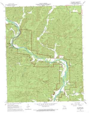
Big Spring Topo Map Missouri
To zoom in, hover over the map of Big Spring
USGS Topo Quad 36090h8 - 1:24,000 scale
| Topo Map Name: | Big Spring |
| USGS Topo Quad ID: | 36090h8 |
| Print Size: | ca. 21 1/4" wide x 27" high |
| Southeast Coordinates: | 36.875° N latitude / 90.875° W longitude |
| Map Center Coordinates: | 36.9375° N latitude / 90.9375° W longitude |
| U.S. State: | MO |
| Filename: | o36090h8.jpg |
| Download Map JPG Image: | Big Spring topo map 1:24,000 scale |
| Map Type: | Topographic |
| Topo Series: | 7.5´ |
| Map Scale: | 1:24,000 |
| Source of Map Images: | United States Geological Survey (USGS) |
| Alternate Map Versions: |
Big Spring MO 1968, updated 1969 Download PDF Buy paper map Big Spring MO 1968, updated 1980 Download PDF Buy paper map Big Spring MO 1968, updated 1980 Download PDF Buy paper map Big Spring MO 2011 Download PDF Buy paper map Big Spring MO 2015 Download PDF Buy paper map |
1:24,000 Topo Quads surrounding Big Spring
> Back to 36090e1 at 1:100,000 scale
> Back to 36090a1 at 1:250,000 scale
> Back to U.S. Topo Maps home
Big Spring topo map: Gazetteer
Big Spring: Channels
Colemans Failure Chute elevation 128m 419′Big Spring: Guts
Long Bay elevation 130m 426′Big Spring: Parks
Big Spring Campgrounds elevation 153m 501′Big Spring State Park elevation 182m 597′
Ozark National Scenic Riverways elevation 130m 426′
Big Spring: Populated Places
Chilton elevation 133m 436′Big Spring: Ridges
Bee Gum Ridge elevation 244m 800′Big Spring: Springs
Big Spring elevation 143m 469′Cave Spring elevation 131m 429′
Big Spring: Streams
Carter Creek elevation 135m 442′Chilton Creek elevation 128m 419′
Big Spring: Summits
Cataract Hill elevation 202m 662′Big Spring: Valleys
Aldrich Valley elevation 128m 419′Beaver Pond Hollow elevation 134m 439′
Big Grassy Valley elevation 128m 419′
Brown Hollow elevation 140m 459′
Chalk Bank Hollow elevation 128m 419′
Chub Hollow elevation 134m 439′
Clay Hollow elevation 206m 675′
Clay Hollow elevation 135m 442′
Copper Mine Hollow elevation 127m 416′
Elm Spring Hollow elevation 128m 419′
Hickory Hollow elevation 127m 416′
Kinnard Hollow elevation 163m 534′
Latty Valley elevation 149m 488′
Lick Log Hollow elevation 128m 419′
Log Hollow elevation 132m 433′
Long Bay Hollow elevation 128m 419′
McSpadden Hollow elevation 157m 515′
Possum Hollow elevation 127m 416′
Round Pond Hollow elevation 124m 406′
Shelton Hollow elevation 140m 459′
Spring Valley elevation 137m 449′
Sweezie Hollow elevation 138m 452′
Van Buren Hollow elevation 150m 492′
Water Hollow elevation 140m 459′
Water Hollow elevation 141m 462′
Big Spring digital topo map on disk
Buy this Big Spring topo map showing relief, roads, GPS coordinates and other geographical features, as a high-resolution digital map file on DVD:


