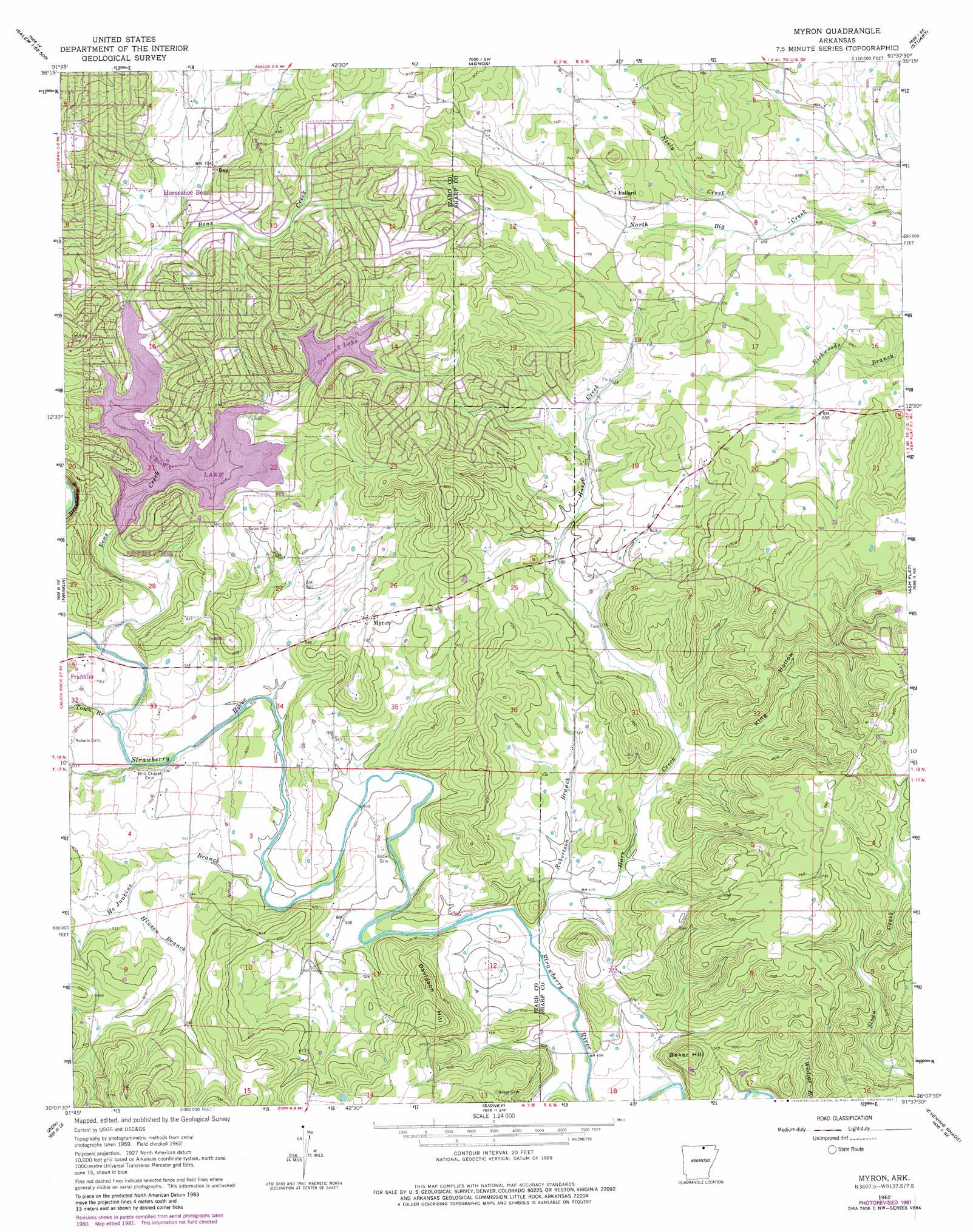
Myron Topo Map Arkansas
To zoom in, hover over the map of Myron
USGS Topo Quad 36091b6 - 1:24,000 scale
| Topo Map Name: | Myron |
| USGS Topo Quad ID: | 36091b6 |
| Print Size: | ca. 21 1/4" wide x 27" high |
| Southeast Coordinates: | 36.125° N latitude / 91.625° W longitude |
| Map Center Coordinates: | 36.1875° N latitude / 91.6875° W longitude |
| U.S. State: | AR |
| Filename: | o36091b6.jpg |
| Download Map JPG Image: | Myron topo map 1:24,000 scale |
| Map Type: | Topographic |
| Topo Series: | 7.5´ |
| Map Scale: | 1:24,000 |
| Source of Map Images: | United States Geological Survey (USGS) |
| Alternate Map Versions: |
Myron AR 1962, updated 1963 Download PDF Buy paper map Myron AR 1962, updated 1976 Download PDF Buy paper map Myron AR 1962, updated 1982 Download PDF Buy paper map Myron AR 2011 Download PDF Buy paper map Myron AR 2014 Download PDF Buy paper map |
1:24,000 Topo Quads surrounding Myron
Viola |
Salem Knob |
Camp |
Mammoth Spring |
Wirth |
Byron |
Salem |
Agnos |
Stuart |
Hardy |
Oxford |
Franklin |
Myron |
Ash Flat |
Sitka |
Melbourne |
Zion |
Sidney |
Evening Shade |
Poughkeepsie |
Guion |
Mount Pleasant |
Sandtown |
Cave City |
Grange |
> Back to 36091a1 at 1:100,000 scale
> Back to 36090a1 at 1:250,000 scale
> Back to U.S. Topo Maps home
Myron topo map: Gazetteer
Myron: Dams
Crown Lake Dam elevation 207m 679′Diamond Lake Dam elevation 197m 646′
Myron: Populated Places
Ballard elevation 215m 705′Day elevation 215m 705′
Love (historical) elevation 152m 498′
Myron elevation 188m 616′
Myron: Reservoirs
Crown Lake elevation 207m 679′Diamond Lake elevation 197m 646′
Myron: Streams
Bens Creek elevation 155m 508′Hars Creek elevation 144m 472′
Hinson Branch elevation 160m 524′
McJunkins Branch elevation 148m 485′
Neely Creek elevation 193m 633′
Robertson Branch elevation 147m 482′
Town Branch elevation 155m 508′
Myron: Summits
Baker Hill elevation 203m 666′Davidson Hill elevation 227m 744′
Myron: Valleys
King Hollow elevation 156m 511′Myron digital topo map on disk
Buy this Myron topo map showing relief, roads, GPS coordinates and other geographical features, as a high-resolution digital map file on DVD: