Oxford Topo Map Arkansas
To zoom in, hover over the map of Oxford
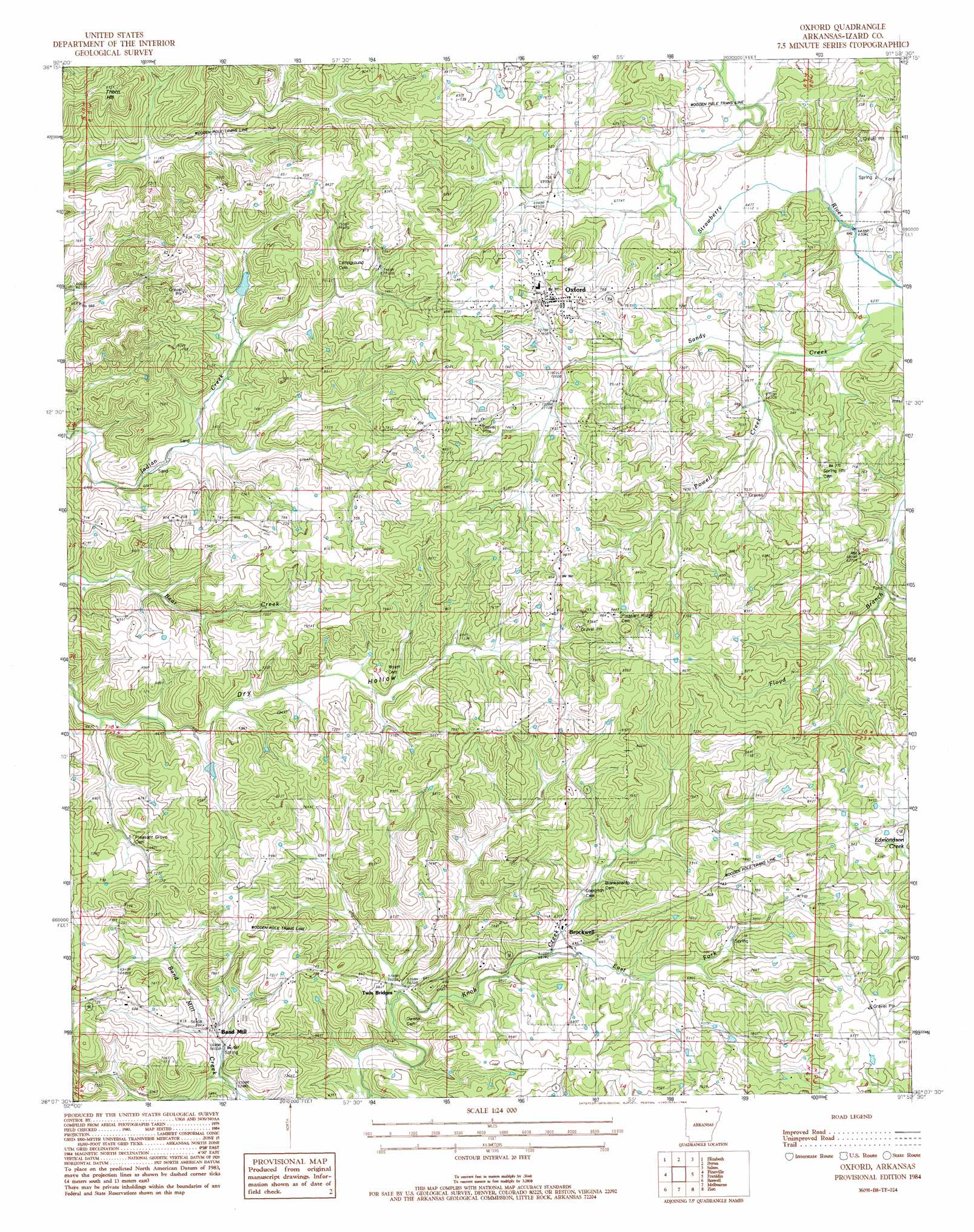
USGS Topo Quad 36091b8 - 1:24,000 scale
| Topo Map Name: | Oxford |
| USGS Topo Quad ID: | 36091b8 |
| Print Size: | ca. 21 1/4" wide x 27" high |
| Southeast Coordinates: | 36.125° N latitude / 91.875° W longitude |
| Map Center Coordinates: | 36.1875° N latitude / 91.9375° W longitude |
| U.S. State: | AR |
| Filename: | o36091b8.jpg |
| Download Map JPG Image: | Oxford topo map 1:24,000 scale |
| Map Type: | Topographic |
| Topo Series: | 7.5´ |
| Map Scale: | 1:24,000 |
| Source of Map Images: | United States Geological Survey (USGS) |
| Alternate Map Versions: |
Melbourne NW AR 1976, updated 1977 Download PDF Buy paper map Oxford AR 1984, updated 1984 Download PDF Buy paper map Oxford AR 2011 Download PDF Buy paper map Oxford AR 2014 Download PDF Buy paper map |
1:24,000 Topo Quads surrounding Oxford
Gamaliel |
Gepp |
Viola |
Salem Knob |
Camp |
Norfork Dam North |
Elizabeth |
Byron |
Salem |
Agnos |
Norfork Dam South |
Pineville |
Oxford |
Franklin |
Myron |
Calico Rock |
Boswell |
Melbourne |
Zion |
Sidney |
Fiftysix |
Sylamore |
Guion |
Mount Pleasant |
Sandtown |
> Back to 36091a1 at 1:100,000 scale
> Back to 36090a1 at 1:250,000 scale
> Back to U.S. Topo Maps home
Oxford topo map: Gazetteer
Oxford: Populated Places
Band Mill elevation 182m 597′Brockwell elevation 185m 606′
Jett (historical) elevation 238m 780′
Oxford elevation 240m 787′
Twin Bridges elevation 172m 564′
Oxford: Post Offices
Brockwell Post Office elevation 191m 626′Oxford: Streams
Powell Creek elevation 199m 652′Oxford: Summits
Thorn Hill elevation 262m 859′Oxford digital topo map on disk
Buy this Oxford topo map showing relief, roads, GPS coordinates and other geographical features, as a high-resolution digital map file on DVD: