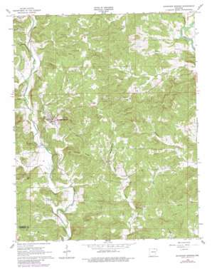
Ravenden Springs Topo Map Arkansas
To zoom in, hover over the map of Ravenden Springs
USGS Topo Quad 36091c2 - 1:24,000 scale
| Topo Map Name: | Ravenden Springs |
| USGS Topo Quad ID: | 36091c2 |
| Print Size: | ca. 21 1/4" wide x 27" high |
| Southeast Coordinates: | 36.25° N latitude / 91.125° W longitude |
| Map Center Coordinates: | 36.3125° N latitude / 91.1875° W longitude |
| U.S. State: | AR |
| Filename: | o36091c2.jpg |
| Download Map JPG Image: | Ravenden Springs topo map 1:24,000 scale |
| Map Type: | Topographic |
| Topo Series: | 7.5´ |
| Map Scale: | 1:24,000 |
| Source of Map Images: | United States Geological Survey (USGS) |
| Alternate Map Versions: |
Ravenden Springs AR 1966, updated 1967 Download PDF Buy paper map Ravenden Springs AR 1966, updated 1982 Download PDF Buy paper map Ravenden Springs AR 2011 Download PDF Buy paper map Ravenden Springs AR 2014 Download PDF Buy paper map |
1:24,000 Topo Quads surrounding Ravenden Springs
> Back to 36091a1 at 1:100,000 scale
> Back to 36090a1 at 1:250,000 scale
> Back to U.S. Topo Maps home
Ravenden Springs topo map: Gazetteer
Ravenden Springs: Cliffs
Baker Bluff elevation 163m 534′Ravenden Springs: Populated Places
Elevenpoint elevation 100m 328′Kingsville (historical) elevation 122m 400′
Ravenden Springs elevation 135m 442′
Watervalley (historical) elevation 109m 357′
Yadkin (historical) elevation 139m 456′
Ravenden Springs: Ridges
Locust Ridge elevation 194m 636′Ravenden Springs: Springs
Middle Spring elevation 131m 429′Ravenden Springs: Streams
Ferguson Creek elevation 97m 318′Glory Branch elevation 118m 387′
Hall Creek elevation 103m 337′
Hincha Creek elevation 91m 298′
Jenny Branch elevation 108m 354′
Joe Branch elevation 109m 357′
Johns Creek elevation 95m 311′
McAfee Creek elevation 111m 364′
Price Branch elevation 117m 383′
Rickman Creek elevation 91m 298′
Ravenden Springs: Summits
Oaks Hill elevation 175m 574′Ravenden Springs: Valleys
Byrd Hollow elevation 119m 390′Ravenden Springs digital topo map on disk
Buy this Ravenden Springs topo map showing relief, roads, GPS coordinates and other geographical features, as a high-resolution digital map file on DVD:


