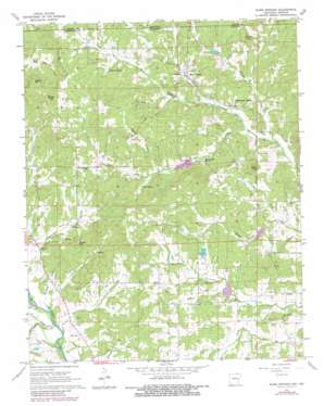
Warm Springs Topo Map Arkansas
To zoom in, hover over the map of Warm Springs
USGS Topo Quad 36091d1 - 1:24,000 scale
| Topo Map Name: | Warm Springs |
| USGS Topo Quad ID: | 36091d1 |
| Print Size: | ca. 21 1/4" wide x 27" high |
| Southeast Coordinates: | 36.375° N latitude / 91° W longitude |
| Map Center Coordinates: | 36.4375° N latitude / 91.0625° W longitude |
| U.S. States: | AR, MO |
| Filename: | o36091d1.jpg |
| Download Map JPG Image: | Warm Springs topo map 1:24,000 scale |
| Map Type: | Topographic |
| Topo Series: | 7.5´ |
| Map Scale: | 1:24,000 |
| Source of Map Images: | United States Geological Survey (USGS) |
| Alternate Map Versions: |
Warm Springs AR 1967, updated 1969 Download PDF Buy paper map Warm Springs AR 1967, updated 1982 Download PDF Buy paper map Warm Springs AR 2011 Download PDF Buy paper map Warm Springs AR 2014 Download PDF Buy paper map |
| FStopo: | US Forest Service topo Warm Springs is available: Download FStopo PDF Download FStopo TIF |
1:24,000 Topo Quads surrounding Warm Springs
> Back to 36091a1 at 1:100,000 scale
> Back to 36090a1 at 1:250,000 scale
> Back to U.S. Topo Maps home
Warm Springs topo map: Gazetteer
Warm Springs: Dams
Fourche Creek Site 16 Dam elevation 142m 465′Fourche Creek Site 17 Dam elevation 115m 377′
Fourche Creek Site 18 Dam elevation 106m 347′
Meadows Lake Dam elevation 136m 446′
Wallace Lake Dam elevation 126m 413′
Warm Springs: Populated Places
Antioch elevation 128m 419′Hamil elevation 131m 429′
Ingram elevation 113m 370′
Palestine elevation 131m 429′
Warm Springs elevation 129m 423′
Warm Springs: Post Offices
Warm Springs Post Office (historical) elevation 131m 429′Warm Springs: Reservoirs
Fourche Creek Site 16 Reservoir elevation 142m 465′Fourche Creek Site 17 Reservoir elevation 115m 377′
Fourche Creek Site 18 Reservoir elevation 106m 347′
Meadows Lake elevation 136m 446′
Wallace Lake elevation 126m 413′
Warm Springs: Ridges
Tyer Ridge elevation 123m 403′Warm Springs: Springs
Catto Spring elevation 140m 459′Cowden Spring elevation 145m 475′
Whittenberg Spring elevation 124m 406′
Wooldridge Spring elevation 117m 383′
Warm Springs: Streams
Barum Branch elevation 128m 419′Dry Creek elevation 95m 311′
Green Fork Creek elevation 112m 367′
Higgens Creek elevation 98m 321′
Hurricane Creek elevation 98m 321′
Jones Creek elevation 97m 318′
Midway Creek elevation 95m 311′
Turner Creek elevation 100m 328′
Warm Springs Creek elevation 100m 328′
Warm Springs: Summits
Bald Knob elevation 192m 629′Bellah Hills elevation 225m 738′
Gentry Hill elevation 221m 725′
Phillips Knob elevation 206m 675′
Stone Hill elevation 187m 613′
Warm Springs digital topo map on disk
Buy this Warm Springs topo map showing relief, roads, GPS coordinates and other geographical features, as a high-resolution digital map file on DVD:


