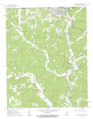
Mammoth Spring Topo Map Arkansas
To zoom in, hover over the map of Mammoth Spring
USGS Topo Quad 36091d5 - 1:24,000 scale
| Topo Map Name: | Mammoth Spring |
| USGS Topo Quad ID: | 36091d5 |
| Print Size: | ca. 21 1/4" wide x 27" high |
| Southeast Coordinates: | 36.375° N latitude / 91.5° W longitude |
| Map Center Coordinates: | 36.4375° N latitude / 91.5625° W longitude |
| U.S. States: | AR, MO |
| Filename: | o36091d5.jpg |
| Download Map JPG Image: | Mammoth Spring topo map 1:24,000 scale |
| Map Type: | Topographic |
| Topo Series: | 7.5´ |
| Map Scale: | 1:24,000 |
| Source of Map Images: | United States Geological Survey (USGS) |
| Alternate Map Versions: |
Mammoth Spring AR 1962, updated 1963 Download PDF Buy paper map Mammoth Spring AR 2011 Download PDF Buy paper map Mammoth Spring AR 2014 Download PDF Buy paper map |
1:24,000 Topo Quads surrounding Mammoth Spring
> Back to 36091a1 at 1:100,000 scale
> Back to 36090a1 at 1:250,000 scale
> Back to U.S. Topo Maps home
Mammoth Spring topo map: Gazetteer
Mammoth Spring: Bends
Horseshoe Bend elevation 136m 446′Mammoth Spring: Crossings
Oxford Ford elevation 160m 524′Mammoth Spring: Dams
Cecil Lake Dam elevation 143m 469′Mammoth Spring: Falls
Cottonwood Falls elevation 127m 416′Saddler Falls elevation 125m 410′
Mammoth Spring: Gaps
Needles Eye elevation 131m 429′Mammoth Spring: Populated Places
Baker Ford elevation 133m 436′Frickenger (historical) elevation 167m 547′
King elevation 132m 433′
Mammoth Spring elevation 159m 521′
Many Islands elevation 130m 426′
Peach (historical) elevation 144m 472′
Mammoth Spring: Reservoirs
Lake Cecil elevation 143m 469′Mammoth Spring: Springs
Cold Spring elevation 145m 475′Mammoth Spring elevation 154m 505′
Mammoth Spring: Streams
Big Creek elevation 131m 429′Brush Creek elevation 132m 433′
English Creek elevation 127m 416′
Field Creek elevation 136m 446′
Little Gut Creek elevation 129m 423′
Sycamore Creek elevation 139m 456′
Trace Creek elevation 143m 469′
Tunstil Branch elevation 146m 479′
Warm Fork elevation 152m 498′
Warm Fork Spring River elevation 145m 475′
Water Fork Branch elevation 185m 606′
Water Fork Branch elevation 161m 528′
Mammoth Spring: Valleys
Big Cottonwood Hollow elevation 128m 419′Blue Spring Hollow elevation 132m 433′
Cottonwood Hollow elevation 130m 426′
Ellis Hollow elevation 152m 498′
Hatfield Hollow elevation 136m 446′
Long Run Hollow elevation 144m 472′
Williams Hollow elevation 162m 531′
Mammoth Spring digital topo map on disk
Buy this Mammoth Spring topo map showing relief, roads, GPS coordinates and other geographical features, as a high-resolution digital map file on DVD:


