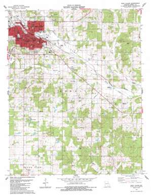
West Plains Topo Map Missouri
To zoom in, hover over the map of West Plains
USGS Topo Quad 36091f7 - 1:24,000 scale
| Topo Map Name: | West Plains |
| USGS Topo Quad ID: | 36091f7 |
| Print Size: | ca. 21 1/4" wide x 27" high |
| Southeast Coordinates: | 36.625° N latitude / 91.75° W longitude |
| Map Center Coordinates: | 36.6875° N latitude / 91.8125° W longitude |
| U.S. State: | MO |
| Filename: | o36091f7.jpg |
| Download Map JPG Image: | West Plains topo map 1:24,000 scale |
| Map Type: | Topographic |
| Topo Series: | 7.5´ |
| Map Scale: | 1:24,000 |
| Source of Map Images: | United States Geological Survey (USGS) |
| Alternate Map Versions: |
West Plains MO 1938, updated 1954 Download PDF Buy paper map West Plains MO 1938, updated 1954 Download PDF Buy paper map West Plains MO 1940 Download PDF Buy paper map West Plains MO 1976, updated 1977 Download PDF Buy paper map West Plains MO 1983, updated 1984 Download PDF Buy paper map West Plains MO 2011 Download PDF Buy paper map West Plains MO 2015 Download PDF Buy paper map |
1:24,000 Topo Quads surrounding West Plains
> Back to 36091e1 at 1:100,000 scale
> Back to 36090a1 at 1:250,000 scale
> Back to U.S. Topo Maps home
West Plains topo map: Gazetteer
West Plains: Airports
Howell Valley Airport elevation 278m 912′West Plains Municipal Airport elevation 300m 984′
West Plains: Dams
Bratton Dam elevation 319m 1046′Kennedy Dam elevation 300m 984′
Martin Lake Dam elevation 307m 1007′
Mononame 772 Dam elevation 326m 1069′
West Plains: Lakes
Round Pond elevation 317m 1040′Twin Ponds elevation 316m 1036′
West Plains: Parks
American Legion Field elevation 291m 954′Butler Park elevation 311m 1020′
Lincoln Park elevation 320m 1049′
Peoples Park elevation 302m 990′
West Plains: Populated Places
Carson (historical) elevation 280m 918′Chapin elevation 271m 889′
Cottbus elevation 326m 1069′
Frankville elevation 296m 971′
Summers Addition elevation 327m 1072′
West Plains elevation 306m 1003′
West Plains: Post Offices
Cottbus Post Office elevation 326m 1069′West Plains: Streams
Big Greasy Creek elevation 295m 967′Burton Creek elevation 298m 977′
Chapin Branch elevation 269m 882′
Little Greasy Creek elevation 265m 869′
Mustion Creek elevation 271m 889′
North Fork Howell Creek elevation 290m 951′
South Fork Howell Creek elevation 290m 951′
Spradlin Creek elevation 281m 921′
West Plains: Summits
Hines Hill elevation 336m 1102′West Plains: Valleys
Mustion Hollow elevation 279m 915′West Plains digital topo map on disk
Buy this West Plains topo map showing relief, roads, GPS coordinates and other geographical features, as a high-resolution digital map file on DVD:


