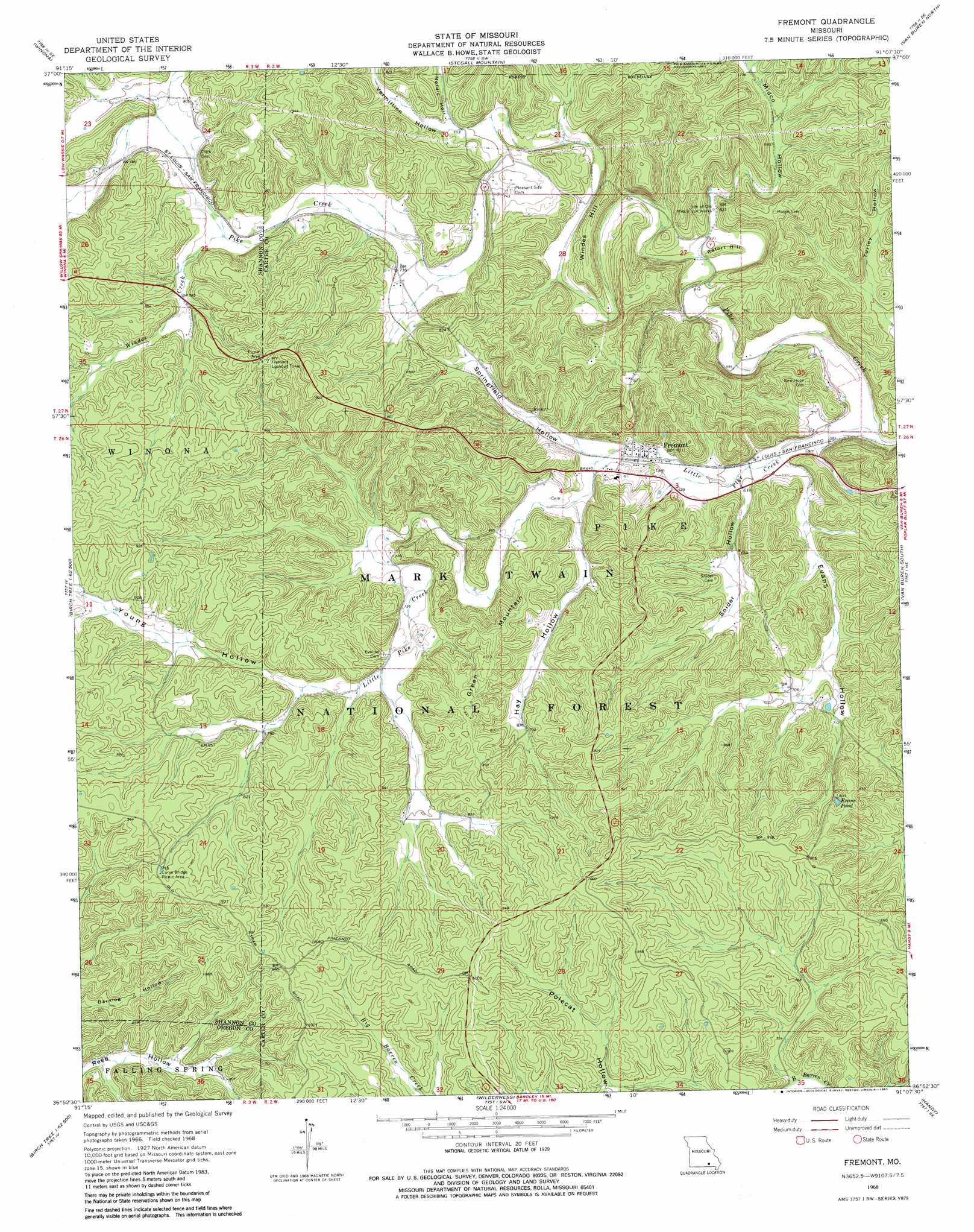
Fremont Topo Map Missouri
To zoom in, hover over the map of Fremont
USGS Topo Quad 36091h2 - 1:24,000 scale
| Topo Map Name: | Fremont |
| USGS Topo Quad ID: | 36091h2 |
| Print Size: | ca. 21 1/4" wide x 27" high |
| Southeast Coordinates: | 36.875° N latitude / 91.125° W longitude |
| Map Center Coordinates: | 36.9375° N latitude / 91.1875° W longitude |
| U.S. State: | MO |
| Filename: | o36091h2.jpg |
| Download Map JPG Image: | Fremont topo map 1:24,000 scale |
| Map Type: | Topographic |
| Topo Series: | 7.5´ |
| Map Scale: | 1:24,000 |
| Source of Map Images: | United States Geological Survey (USGS) |
| Alternate Map Versions: |
Fremont MO 1968, updated 1969 Download PDF Buy paper map Fremont MO 1968, updated 1983 Download PDF Buy paper map Fremont MO 1997, updated 1999 Download PDF Buy paper map Fremont MO 2011 Download PDF Buy paper map Fremont MO 2015 Download PDF Buy paper map |
| FStopo: | US Forest Service topo Fremont is available: Download FStopo PDF Download FStopo TIF |
1:24,000 Topo Quads surrounding Fremont
Alley Spring |
Eminence |
Powder Mill Ferry |
Exchange |
Ellington |
Bartlett |
Winona |
Stegall Mountain |
Van Buren North |
Garwood |
Birch Tree |
Low Wassie |
Fremont |
Van Buren South |
Big Spring |
Peidmont Hollow |
Greer |
Wilderness |
Handy |
Grandin Sw |
Alton |
Many Springs |
Riverton |
Bardley |
Briar |
> Back to 36091e1 at 1:100,000 scale
> Back to 36090a1 at 1:250,000 scale
> Back to U.S. Topo Maps home
Fremont topo map: Gazetteer
Fremont: Lakes
Evans Pond elevation 244m 800′Fremont: Parks
Curve Bridge Picnic Area elevation 279m 915′Fremont: Populated Places
Fremont elevation 190m 623′Fremont: Streams
Little Pike Creek elevation 176m 577′Windes Creek elevation 229m 751′
Fremont: Summits
Green Mountain elevation 275m 902′Retort Hill elevation 193m 633′
Windes Hill elevation 231m 757′
Fremont: Valleys
Evans Hollow elevation 180m 590′Hay Hollow elevation 195m 639′
Midco Hollow elevation 190m 623′
Nordic Hollow elevation 217m 711′
Snider Hollow elevation 185m 606′
Springfield Hollow elevation 192m 629′
Turley Hollow elevation 177m 580′
Vermillion Hollow elevation 214m 702′
Young Hollow elevation 234m 767′
Fremont digital topo map on disk
Buy this Fremont topo map showing relief, roads, GPS coordinates and other geographical features, as a high-resolution digital map file on DVD: