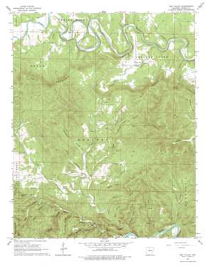
Rea Valley Topo Map Arkansas
To zoom in, hover over the map of Rea Valley
USGS Topo Quad 36092b5 - 1:24,000 scale
| Topo Map Name: | Rea Valley |
| USGS Topo Quad ID: | 36092b5 |
| Print Size: | ca. 21 1/4" wide x 27" high |
| Southeast Coordinates: | 36.125° N latitude / 92.5° W longitude |
| Map Center Coordinates: | 36.1875° N latitude / 92.5625° W longitude |
| U.S. State: | AR |
| Filename: | o36092b5.jpg |
| Download Map JPG Image: | Rea Valley topo map 1:24,000 scale |
| Map Type: | Topographic |
| Topo Series: | 7.5´ |
| Map Scale: | 1:24,000 |
| Source of Map Images: | United States Geological Survey (USGS) |
| Alternate Map Versions: |
Rea Valley AR 1966, updated 1967 Download PDF Buy paper map Rea Valley AR 1966, updated 1978 Download PDF Buy paper map Rea Valley AR 1966, updated 1978 Download PDF Buy paper map Rea Valley AR 2011 Download PDF Buy paper map Rea Valley AR 2014 Download PDF Buy paper map |
1:24,000 Topo Quads surrounding Rea Valley
> Back to 36092a1 at 1:100,000 scale
> Back to 36092a1 at 1:250,000 scale
> Back to U.S. Topo Maps home
Rea Valley topo map: Gazetteer
Rea Valley: Bars
Clabber Creek Shoal elevation 137m 449′Rea Valley: Channels
Blind Chute elevation 134m 439′Rea Valley: Cliffs
Poison Point elevation 295m 967′Rea Valley: Parks
Rush Historic District elevation 159m 521′Rea Valley: Populated Places
Rea Valley elevation 184m 603′Rush elevation 155m 508′
Rea Valley: Streams
Blue John Creek elevation 169m 554′Boat Creek elevation 134m 439′
Cabin Creek elevation 134m 439′
Cedar Creek elevation 136m 446′
Clabber Creek elevation 137m 449′
Ingram Creek elevation 181m 593′
Little Rush Creek elevation 188m 616′
Valley Branch elevation 130m 426′
Williams Branch elevation 156m 511′
Rea Valley: Summits
Hall Mountain elevation 397m 1302′Rea Valley: Valleys
Barney Hollow elevation 173m 567′Bear Hollow elevation 147m 482′
Campbell Hollow elevation 193m 633′
Cold Spring Hollow elevation 156m 511′
Coldwater Hollow elevation 226m 741′
Elbow Hollow elevation 126m 413′
Elbow Hollow elevation 196m 643′
Flat Hollow elevation 152m 498′
George Treat Hollow elevation 233m 764′
John Treat Hollow elevation 150m 492′
Leader Hollow elevation 137m 449′
Pine Hollow elevation 133m 436′
Pine Hollow elevation 159m 521′
Shop Hollow elevation 183m 600′
Wilson Hollow elevation 165m 541′
Rea Valley digital topo map on disk
Buy this Rea Valley topo map showing relief, roads, GPS coordinates and other geographical features, as a high-resolution digital map file on DVD:


