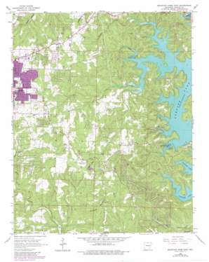
Mountain Home East Topo Map Arkansas
To zoom in, hover over the map of Mountain Home East
USGS Topo Quad 36092c3 - 1:24,000 scale
| Topo Map Name: | Mountain Home East |
| USGS Topo Quad ID: | 36092c3 |
| Print Size: | ca. 21 1/4" wide x 27" high |
| Southeast Coordinates: | 36.25° N latitude / 92.25° W longitude |
| Map Center Coordinates: | 36.3125° N latitude / 92.3125° W longitude |
| U.S. State: | AR |
| Filename: | o36092c3.jpg |
| Download Map JPG Image: | Mountain Home East topo map 1:24,000 scale |
| Map Type: | Topographic |
| Topo Series: | 7.5´ |
| Map Scale: | 1:24,000 |
| Source of Map Images: | United States Geological Survey (USGS) |
| Alternate Map Versions: |
Mountain Home East AR 1966, updated 1967 Download PDF Buy paper map Mountain Home East AR 1966, updated 1982 Download PDF Buy paper map Mountain Home East AR 1979, updated 1981 Download PDF Buy paper map Mountain Home East AR 2011 Download PDF Buy paper map Mountain Home East AR 2014 Download PDF Buy paper map |
1:24,000 Topo Quads surrounding Mountain Home East
> Back to 36092a1 at 1:100,000 scale
> Back to 36092a1 at 1:250,000 scale
> Back to U.S. Topo Maps home
Mountain Home East topo map: Gazetteer
Mountain Home East: Crossings
Traceys Ferry (historical) elevation 162m 531′Traceys Ford (historical) elevation 162m 531′
Mountain Home East: Parks
Buzzard Roose Use Area elevation 175m 574′Panther Bay Public Use Area elevation 170m 557′
Tracy Use Area elevation 182m 597′
Mountain Home East: Populated Places
Briarcliff elevation 216m 708′Heritage Estates elevation 228m 748′
Sycamore Heights elevation 228m 748′
Mountain Home East: Streams
Fall Creek elevation 162m 531′Hicks Creek elevation 175m 574′
Panther Creek elevation 159m 521′
Panther Fork elevation 163m 534′
Shoal Creek elevation 161m 528′
Mountain Home East: Summits
Birdsong Mountain elevation 270m 885′Heart Bald elevation 293m 961′
Mountain Home East: Valleys
Smith Hollow elevation 134m 439′Mountain Home East digital topo map on disk
Buy this Mountain Home East topo map showing relief, roads, GPS coordinates and other geographical features, as a high-resolution digital map file on DVD:


