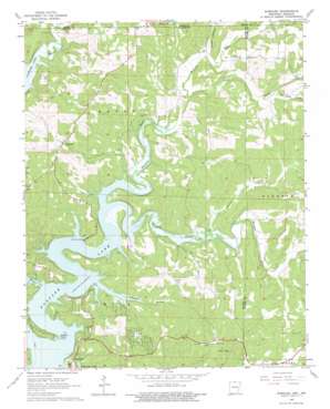
Gamaliel Topo Map Arkansas
To zoom in, hover over the map of Gamaliel
USGS Topo Quad 36092d2 - 1:24,000 scale
| Topo Map Name: | Gamaliel |
| USGS Topo Quad ID: | 36092d2 |
| Print Size: | ca. 21 1/4" wide x 27" high |
| Southeast Coordinates: | 36.375° N latitude / 92.125° W longitude |
| Map Center Coordinates: | 36.4375° N latitude / 92.1875° W longitude |
| U.S. States: | AR, MO |
| Filename: | o36092d2.jpg |
| Download Map JPG Image: | Gamaliel topo map 1:24,000 scale |
| Map Type: | Topographic |
| Topo Series: | 7.5´ |
| Map Scale: | 1:24,000 |
| Source of Map Images: | United States Geological Survey (USGS) |
| Alternate Map Versions: |
Gamaliel AR 1965, updated 1967 Download PDF Buy paper map Gamaliel AR 1965, updated 1975 Download PDF Buy paper map Gamaliel AR 1979, updated 1981 Download PDF Buy paper map Gamaliel AR 2011 Download PDF Buy paper map Gamaliel AR 2014 Download PDF Buy paper map |
1:24,000 Topo Quads surrounding Gamaliel
> Back to 36092a1 at 1:100,000 scale
> Back to 36092a1 at 1:250,000 scale
> Back to U.S. Topo Maps home
Gamaliel topo map: Gazetteer
Gamaliel: Bays
Howard Cove elevation 158m 518′Gamaliel: Capes
Bidwell Point elevation 161m 528′Gamaliel: Parks
Bidwell Point Use Area elevation 172m 564′Gamaliel Use Area elevation 187m 613′
Howard Cove Use Area elevation 167m 547′
Talbert Use Area elevation 174m 570′
Gamaliel: Populated Places
Bennetts (historical) elevation 181m 593′County Line elevation 240m 787′
Cumi elevation 239m 784′
Custer (historical) elevation 160m 524′
Gamaliel elevation 274m 898′
Henderson elevation 202m 662′
Norfork Lake Estates elevation 237m 777′
Gamaliel: Post Offices
Gamaliel Post Office elevation 272m 892′Gamaliel: Streams
Barren Creek elevation 164m 538′Bennetts Bayou elevation 162m 531′
Jenkins Branch elevation 170m 557′
Little Creek elevation 179m 587′
North Fork River elevation 166m 544′
Poor Hollow Branch elevation 195m 639′
Tanner Creek elevation 165m 541′
Walker Branch elevation 160m 524′
Gamaliel: Summits
Turkey Knob elevation 232m 761′Gamaliel: Valleys
Biven Hollow elevation 208m 682′Powell Hollow elevation 193m 633′
Walker Hollow elevation 158m 518′
Gamaliel digital topo map on disk
Buy this Gamaliel topo map showing relief, roads, GPS coordinates and other geographical features, as a high-resolution digital map file on DVD:


