Midway Topo Map Arkansas
To zoom in, hover over the map of Midway
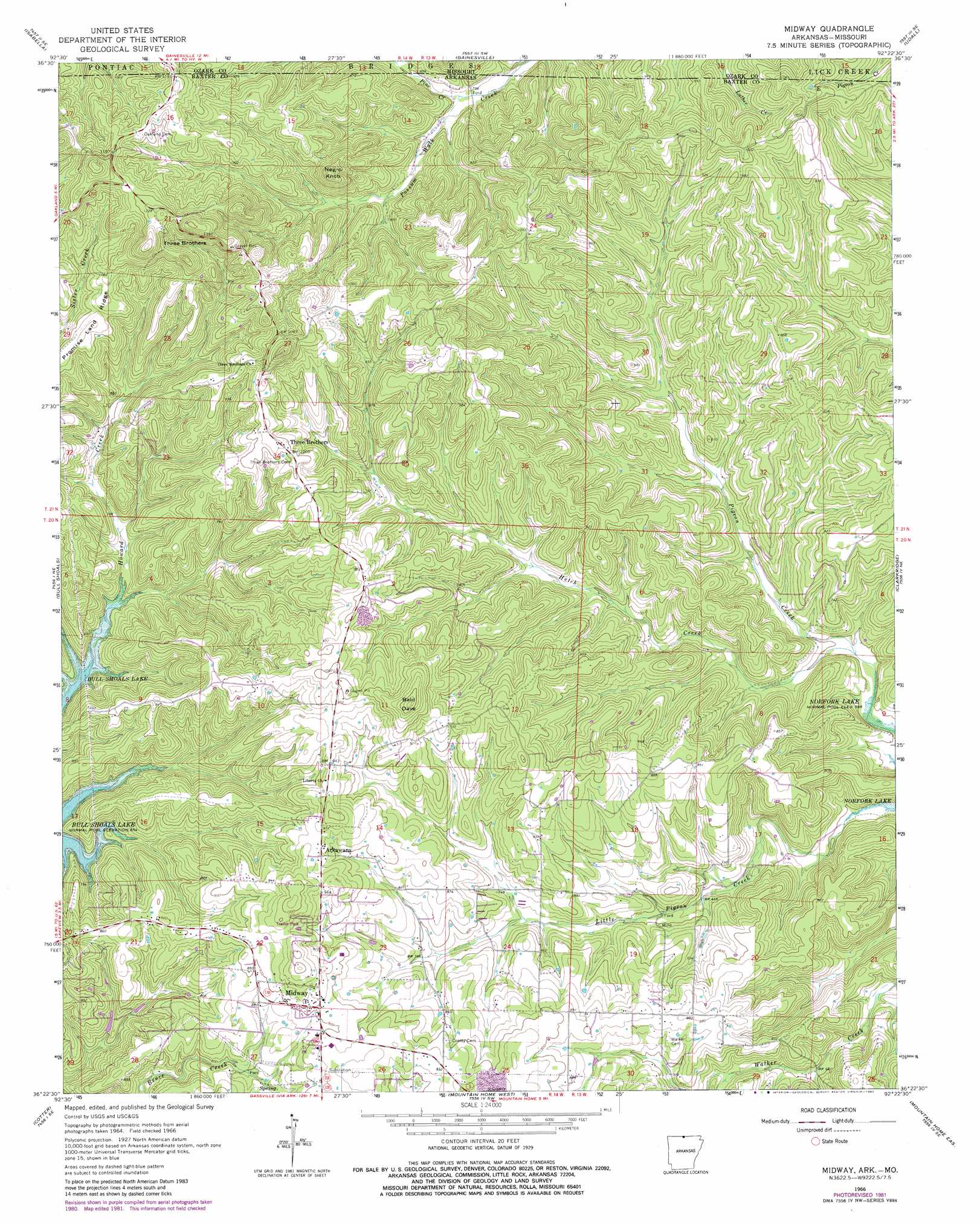
USGS Topo Quad 36092d4 - 1:24,000 scale
| Topo Map Name: | Midway |
| USGS Topo Quad ID: | 36092d4 |
| Print Size: | ca. 21 1/4" wide x 27" high |
| Southeast Coordinates: | 36.375° N latitude / 92.375° W longitude |
| Map Center Coordinates: | 36.4375° N latitude / 92.4375° W longitude |
| U.S. States: | AR, MO |
| Filename: | o36092d4.jpg |
| Download Map JPG Image: | Midway topo map 1:24,000 scale |
| Map Type: | Topographic |
| Topo Series: | 7.5´ |
| Map Scale: | 1:24,000 |
| Source of Map Images: | United States Geological Survey (USGS) |
| Alternate Map Versions: |
Midway AR 1966, updated 1967 Download PDF Buy paper map Midway AR 1966, updated 1976 Download PDF Buy paper map Midway AR 1966, updated 1982 Download PDF Buy paper map Midway AR 1979, updated 1981 Download PDF Buy paper map Midway AR 2011 Download PDF Buy paper map Midway AR 2014 Download PDF Buy paper map |
1:24,000 Topo Quads surrounding Midway
Thornfield |
Willhoit |
Gainesville Nw |
Sycamore |
Cureall Nw |
Theodosia |
Isabella |
Gainesville |
Udall |
Bakersfield |
Cotter Nw |
Bull Shoals |
Midway |
Clarkridge |
Gamaliel |
Cotter Sw |
Cotter |
Mountain Home West |
Mountain Home East |
Norfork Dam North |
Yellville |
Rea Valley |
Buffalo City |
Norfork |
Norfork Dam South |
> Back to 36092a1 at 1:100,000 scale
> Back to 36092a1 at 1:250,000 scale
> Back to U.S. Topo Maps home
Midway topo map: Gazetteer
Midway: Populated Places
Arkawana elevation 277m 908′Midway elevation 271m 889′
Three Brothers elevation 306m 1003′
Midway: Post Offices
Midway Post Office elevation 267m 875′Midway: Streams
Hutch Creek elevation 177m 580′Pine Creek elevation 235m 770′
Midway: Summits
Bald Dave elevation 343m 1125′Negro Knob elevation 358m 1174′
Three Brothers elevation 373m 1223′
Midway digital topo map on disk
Buy this Midway topo map showing relief, roads, GPS coordinates and other geographical features, as a high-resolution digital map file on DVD: