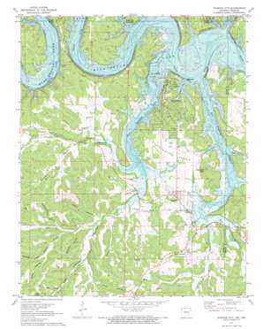
Diamond City Topo Map Arkansas
To zoom in, hover over the map of Diamond City
USGS Topo Quad 36092d8 - 1:24,000 scale
| Topo Map Name: | Diamond City |
| USGS Topo Quad ID: | 36092d8 |
| Print Size: | ca. 21 1/4" wide x 27" high |
| Southeast Coordinates: | 36.375° N latitude / 92.875° W longitude |
| Map Center Coordinates: | 36.4375° N latitude / 92.9375° W longitude |
| U.S. States: | AR, MO |
| Filename: | o36092d8.jpg |
| Download Map JPG Image: | Diamond City topo map 1:24,000 scale |
| Map Type: | Topographic |
| Topo Series: | 7.5´ |
| Map Scale: | 1:24,000 |
| Source of Map Images: | United States Geological Survey (USGS) |
| Alternate Map Versions: |
Diamond City AR 1972, updated 1973 Download PDF Buy paper map Diamond City AR 2011 Download PDF Buy paper map Diamond City AR 2014 Download PDF Buy paper map |
1:24,000 Topo Quads surrounding Diamond City
> Back to 36092a1 at 1:100,000 scale
> Back to 36092a1 at 1:250,000 scale
> Back to U.S. Topo Maps home
Diamond City topo map: Gazetteer
Diamond City: Bays
Coffman Cove elevation 195m 639′Deer Cove elevation 199m 652′
Deer Cove elevation 196m 643′
Moon Cove elevation 194m 636′
Nelson Cove elevation 193m 633′
State Line Cove elevation 198m 649′
Diamond City: Bends
Grays Bend elevation 196m 643′Hog Thief Bend elevation 196m 643′
Diamond City: Capes
Campbell Point elevation 200m 656′Diamond City: Cliffs
Buzzard Bluff elevation 216m 708′Goat Bluff elevation 195m 639′
Diamond City: Crossings
Longs Ferry (historical) elevation 196m 643′Sheafers Ferry (historical) elevation 194m 636′
Diamond City: Flats
Sugarloaf Prairie elevation 220m 721′Diamond City: Parks
Lead Hill Public Use Area elevation 202m 662′Diamond City: Populated Places
Diamond City elevation 243m 797′Lead Hill elevation 257m 843′
South Lead Hill elevation 251m 823′
Sycamore elevation 221m 725′
Willis elevation 275m 902′
Diamond City: Post Offices
Diamond City Post Office elevation 241m 790′Diamond City: Springs
Buckley Spring elevation 239m 784′Diamond City: Streams
Bailey Branch elevation 224m 734′Deshield Fork elevation 195m 639′
East Sugarloaf Creek elevation 196m 643′
Lead Mine Creek elevation 210m 688′
Locust Creek elevation 198m 649′
Trotter Branch elevation 209m 685′
West Sugarloaf Creek elevation 196m 643′
Willis Branch elevation 221m 725′
Diamond City: Summits
Sugarloaf Knob elevation 290m 951′Diamond City: Valleys
Buckley Hollow elevation 220m 721′Buzzard Roost Hollow elevation 234m 767′
Carrollton Hollow elevation 195m 639′
Curtis Hollow elevation 212m 695′
Dixon Hollow elevation 235m 770′
Four Spring Hollow elevation 199m 652′
Hunnicut Hollow elevation 247m 810′
Jones Hollow elevation 250m 820′
Monroe Hollow elevation 207m 679′
Russian Hollow elevation 226m 741′
Terrapin Hollow elevation 196m 643′
Diamond City digital topo map on disk
Buy this Diamond City topo map showing relief, roads, GPS coordinates and other geographical features, as a high-resolution digital map file on DVD:


